We chose to travel to New Mexico and Arizona in October because it is dry season and because the desert is beautiful in the autumn. We hoped to catch the fall colors in northern New Mexico and enjoy some less oppressive temperatures in Tucson. Only the first of these hopes was realized, but we had a wonderful time nonetheless.
Day 1 – Tucson
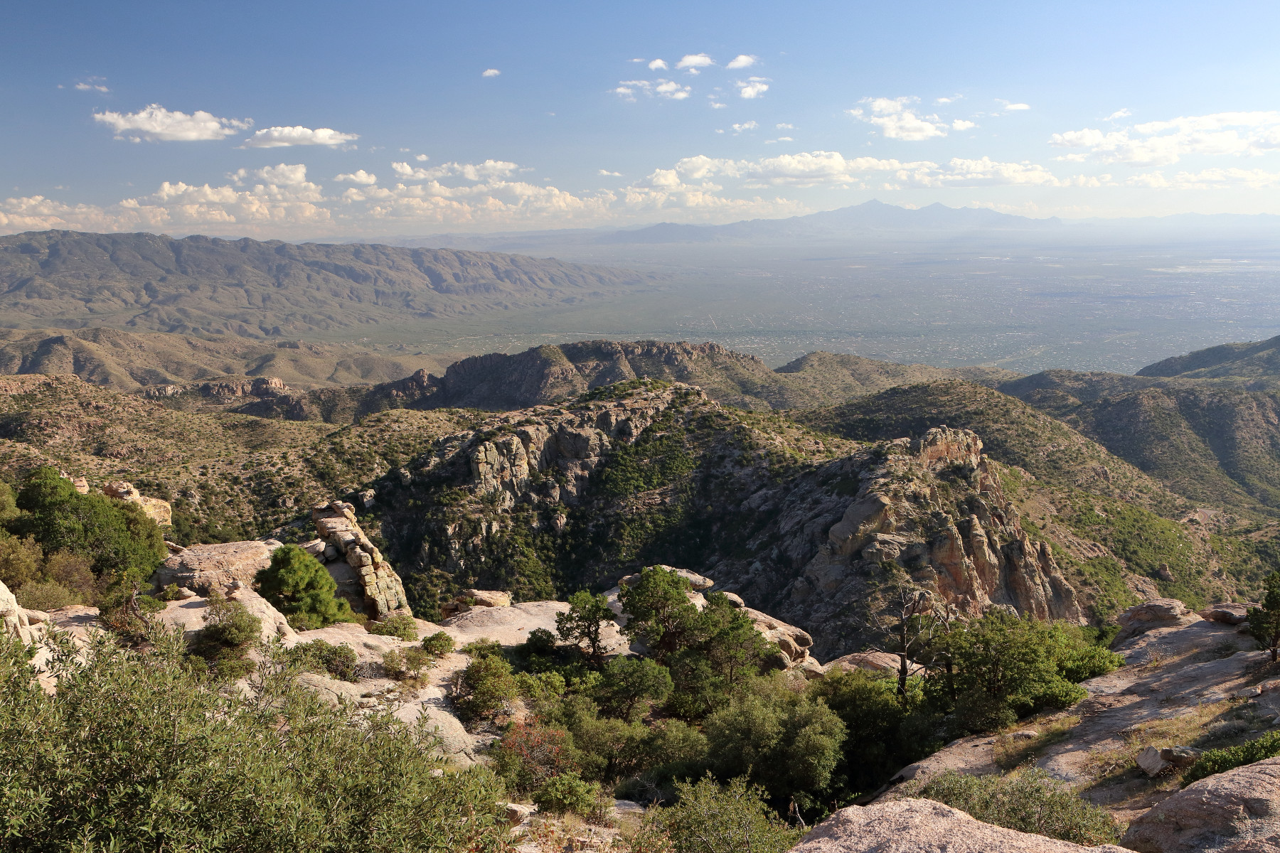
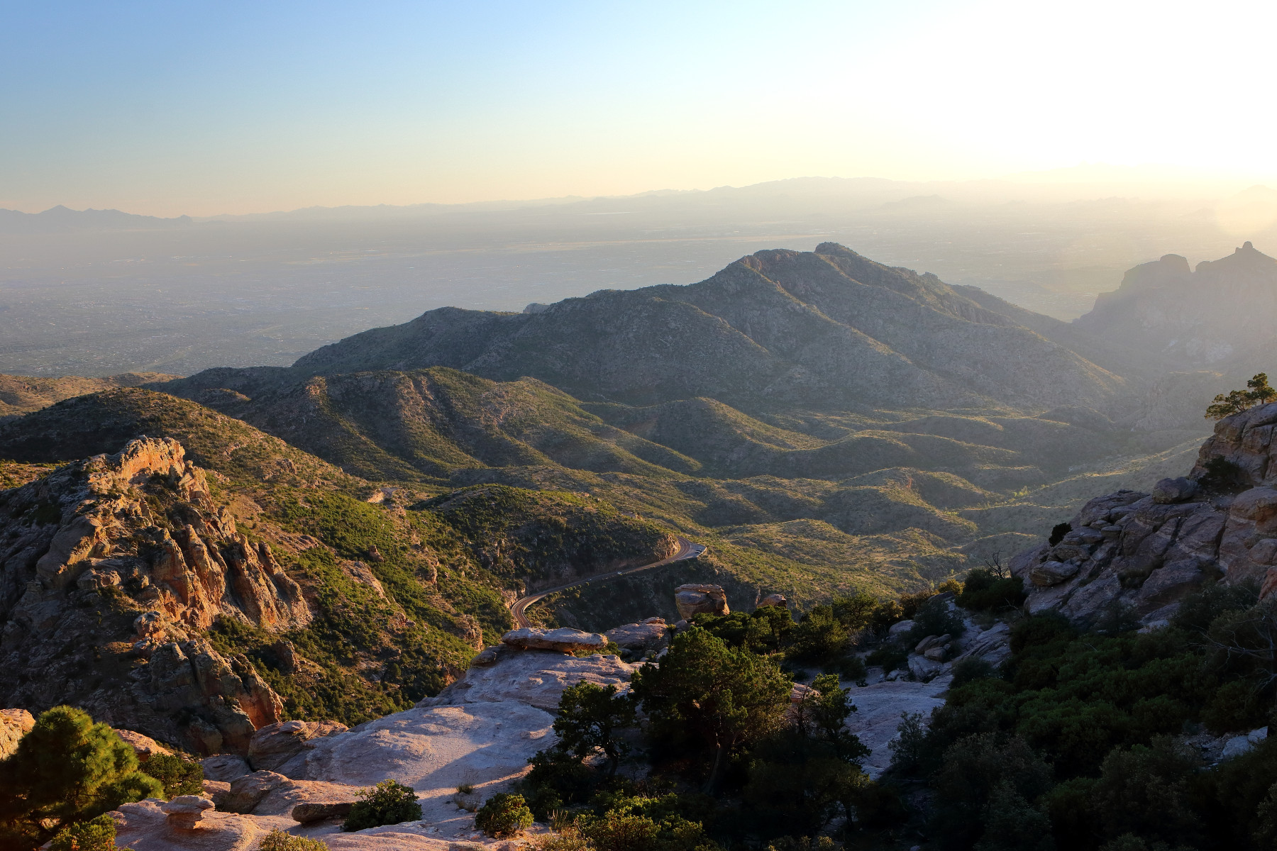
We flew into Tucson, arriving just after noon and after settling in with our host, we drove to Mount Lemmon, At 9,159 feet in elevation, the temperatures at the summit were nearly 30 degrees cooler than the 90 degree temperatures in the city. We enjoyed the evening light as we drove back into town for dinner.
Day 2 – Dripping Springs and White Sands
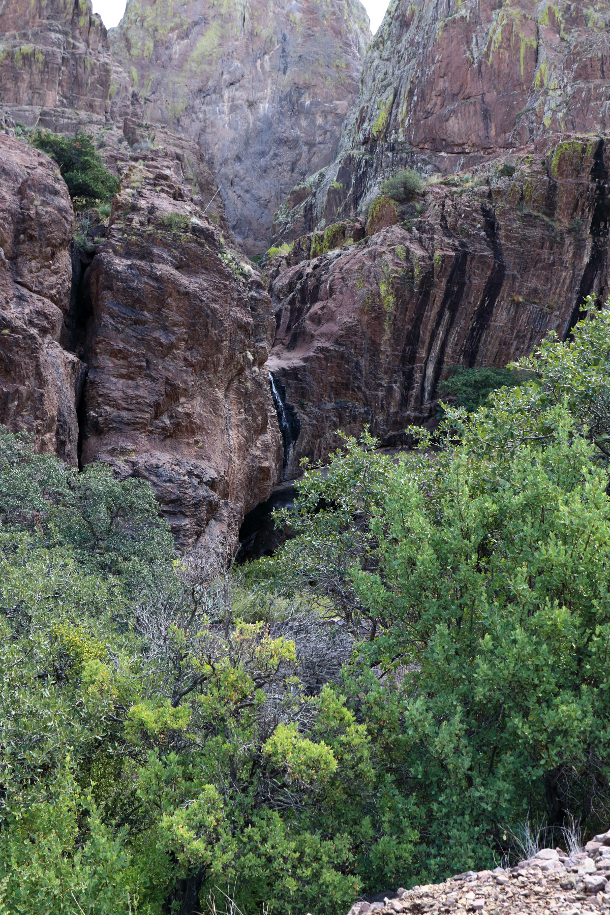
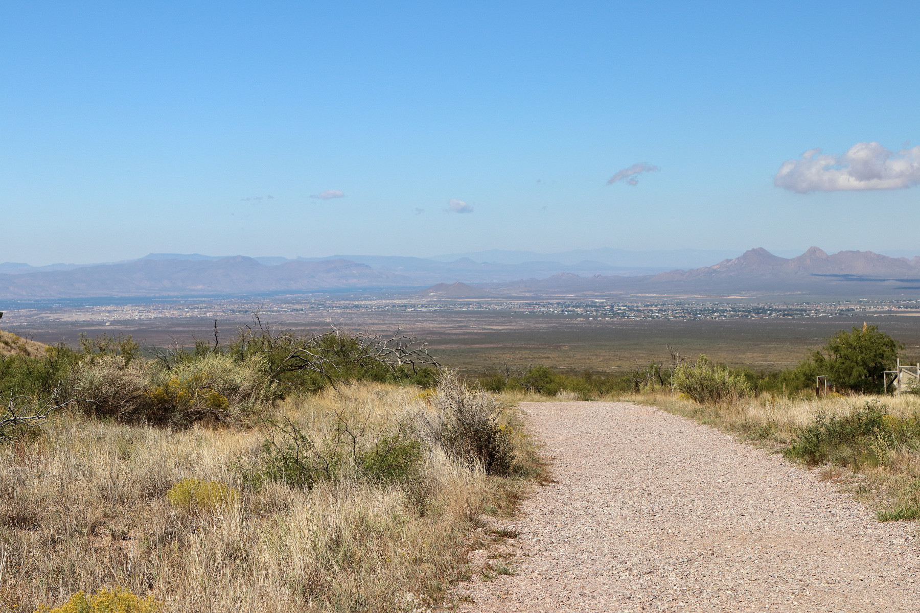
We set out from Tucson toward White Sands, New Mexico. On our way, we did a short hike to Dripping Springs, a small waterfall, and enjoyed an overlook of Las Cruces.
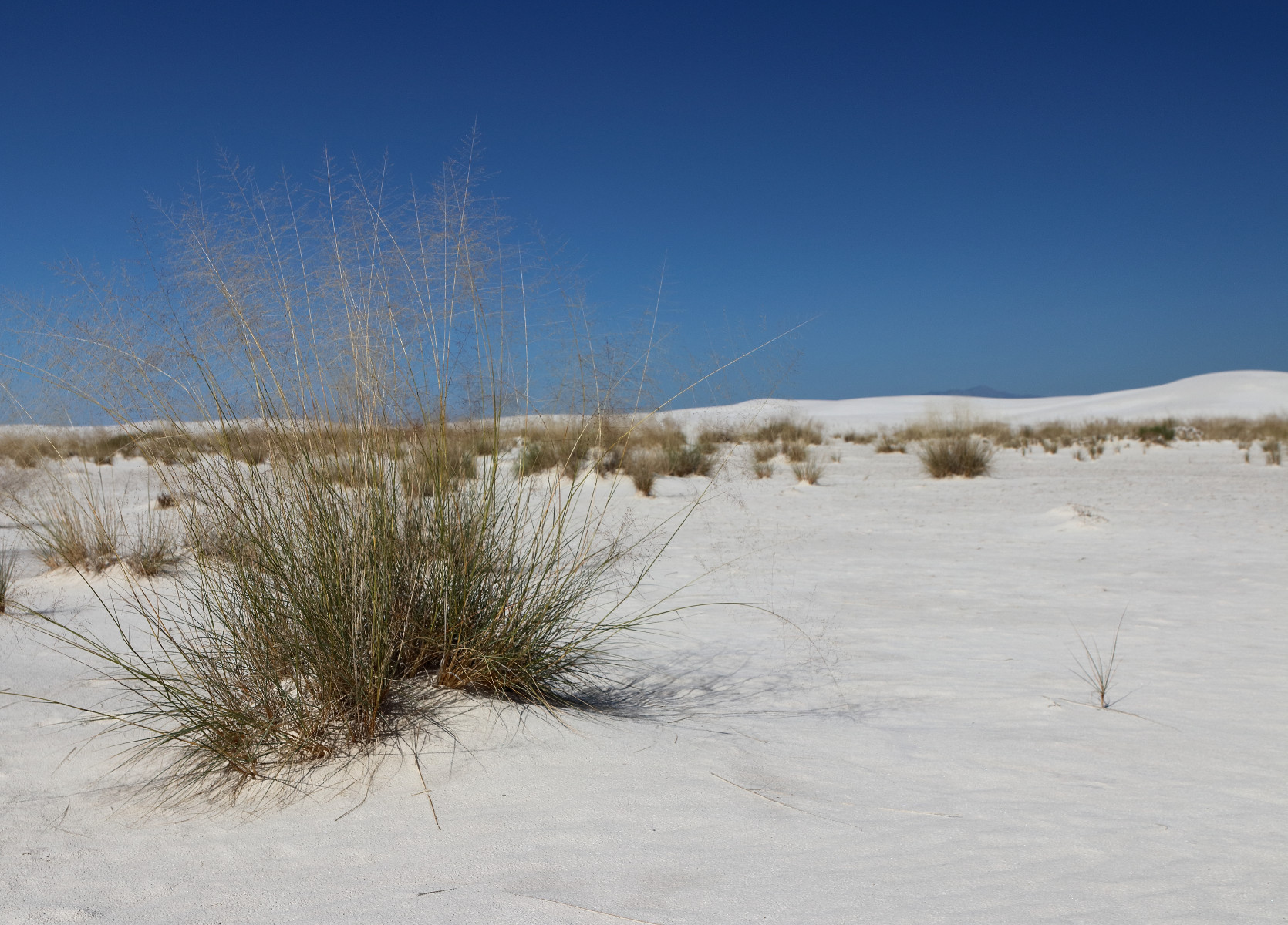
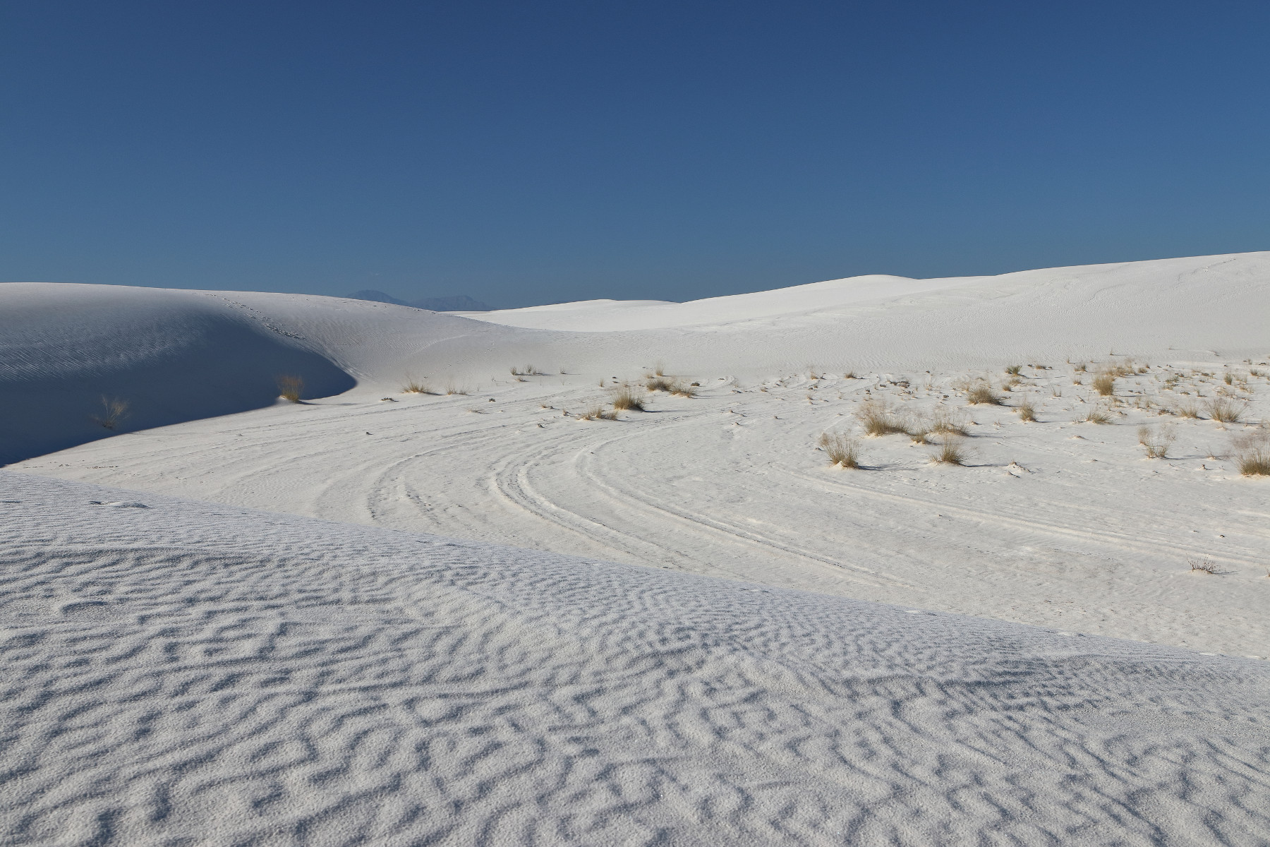
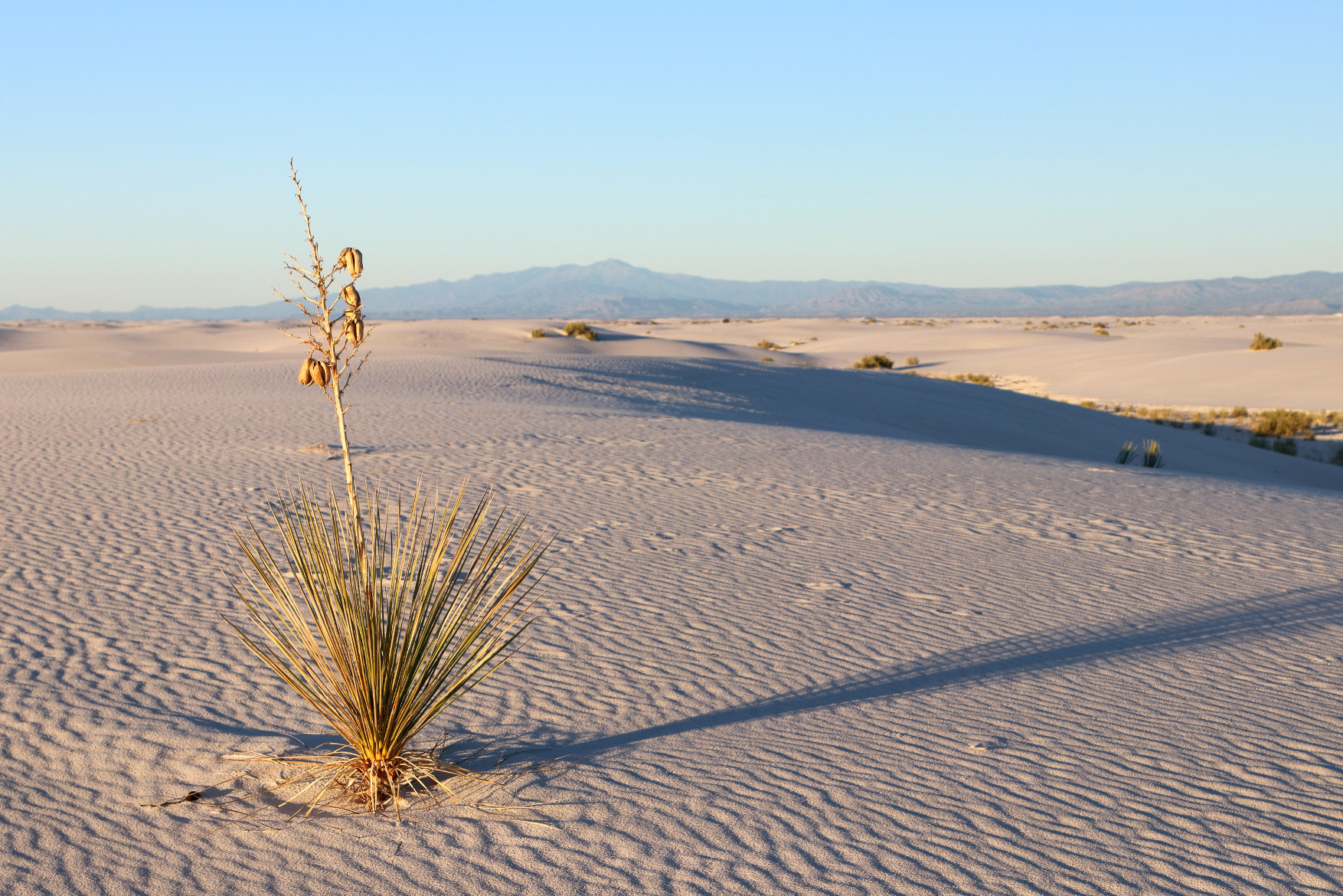
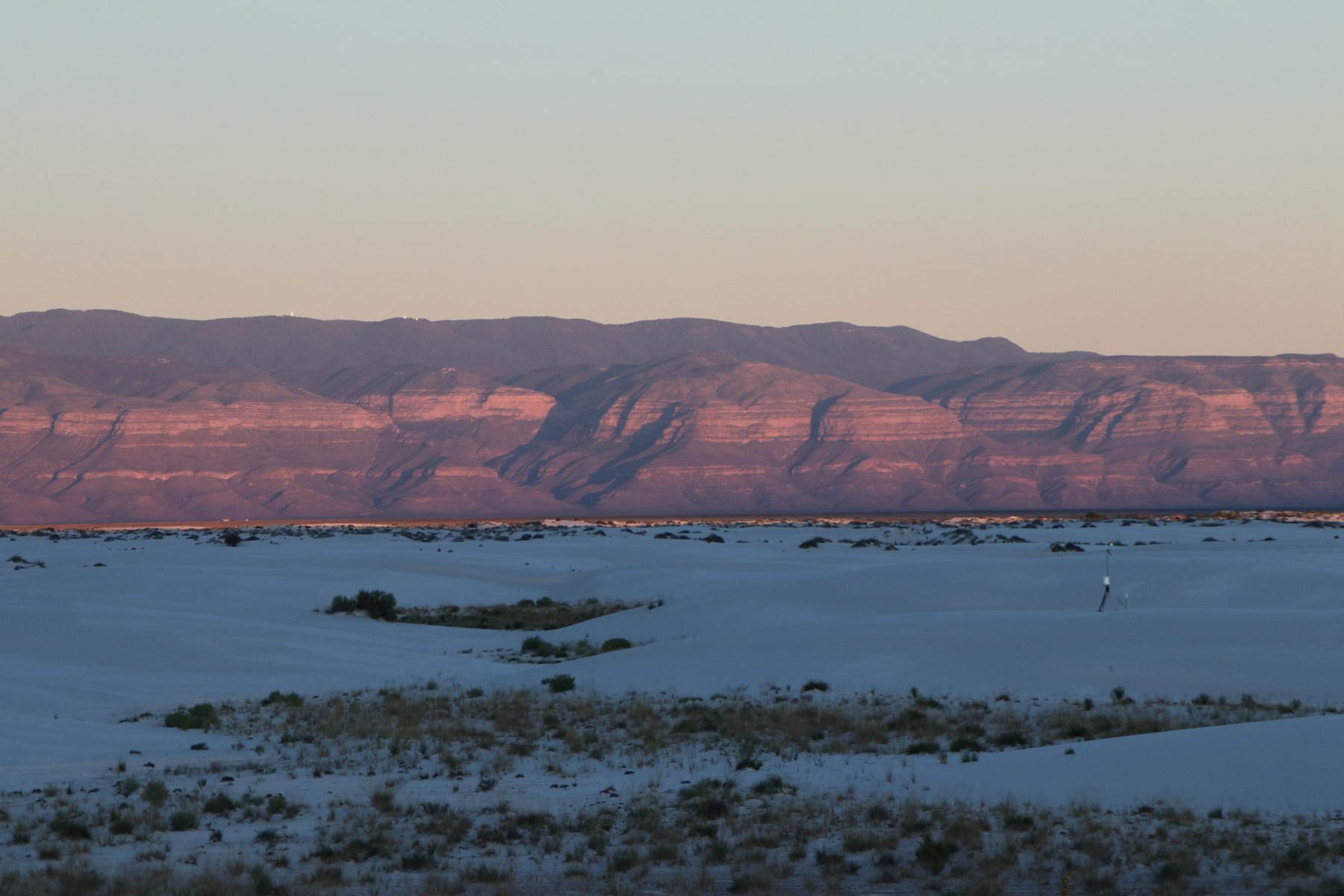
We arrived at White Sands, where we spent the afternoon and watched the sunset. Miles of gypsum dunes make White Sands a truly remarkable and unique place.
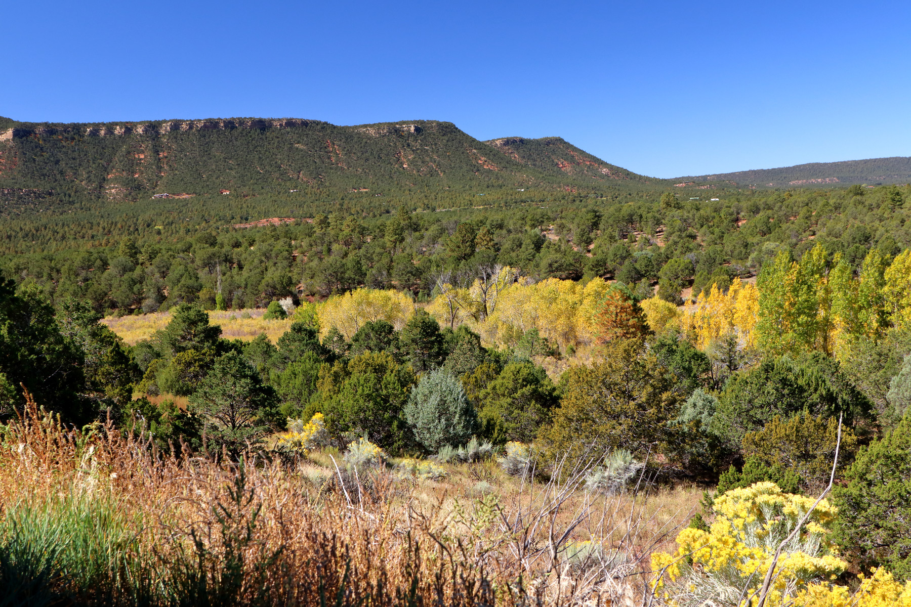
Day 3 – Pecos, Santa Fe, and Taos
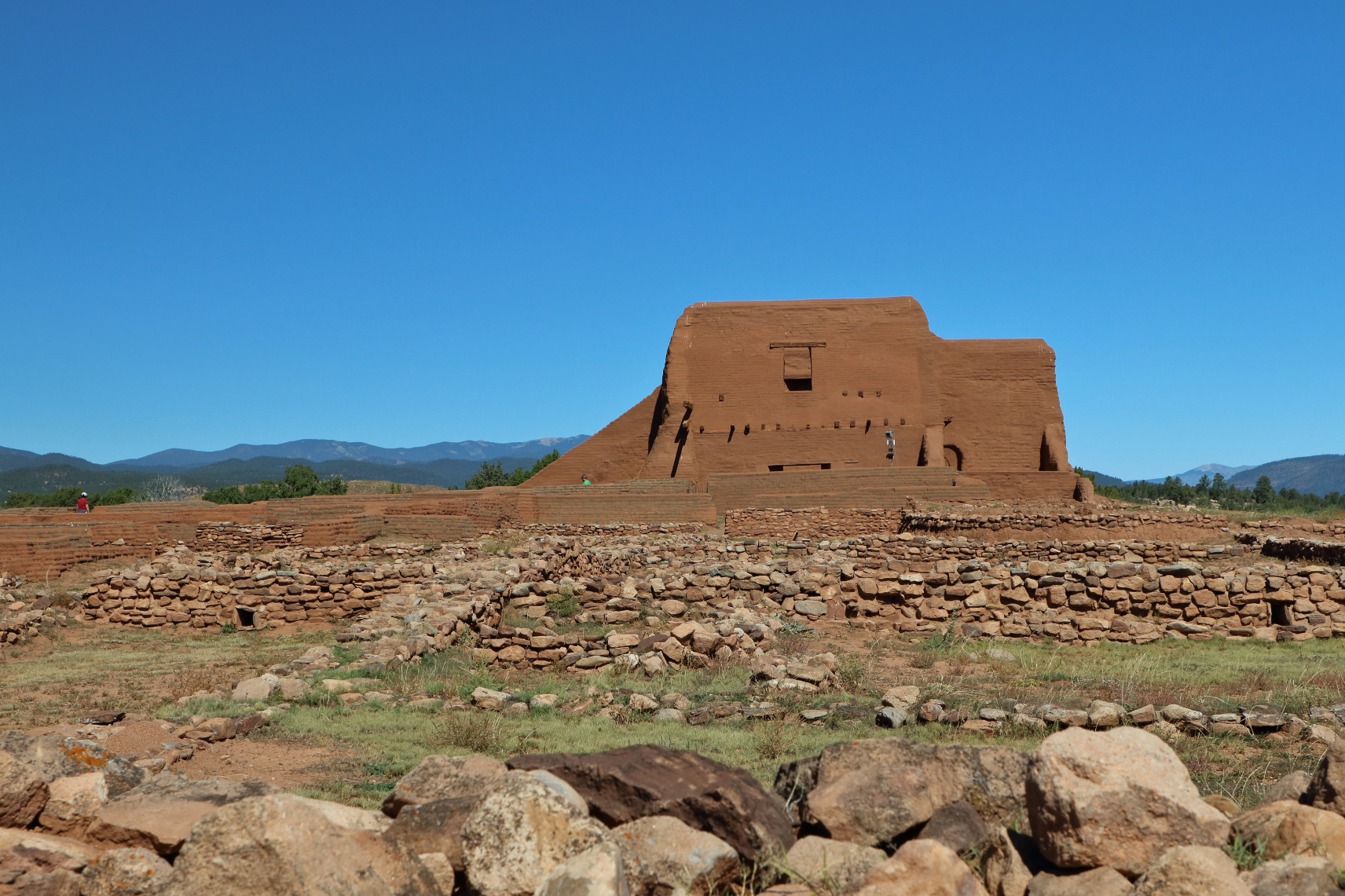
Pecos National Historical Park is the site of the Pecos Pueblo, inhabited between 1350 and 1838, and a church built during Spanish control of the pueblo.
From the historical site, there is a view of Glorieta Pass.
Being a civil war buff, I insisted on stopping by what has been preserved of the Glorieta Pass battlefield. Referred to as the “Gettysburg of the West,” Union forces destroyed a Confederate supply train, forcing retreat to Arizona and Texas.
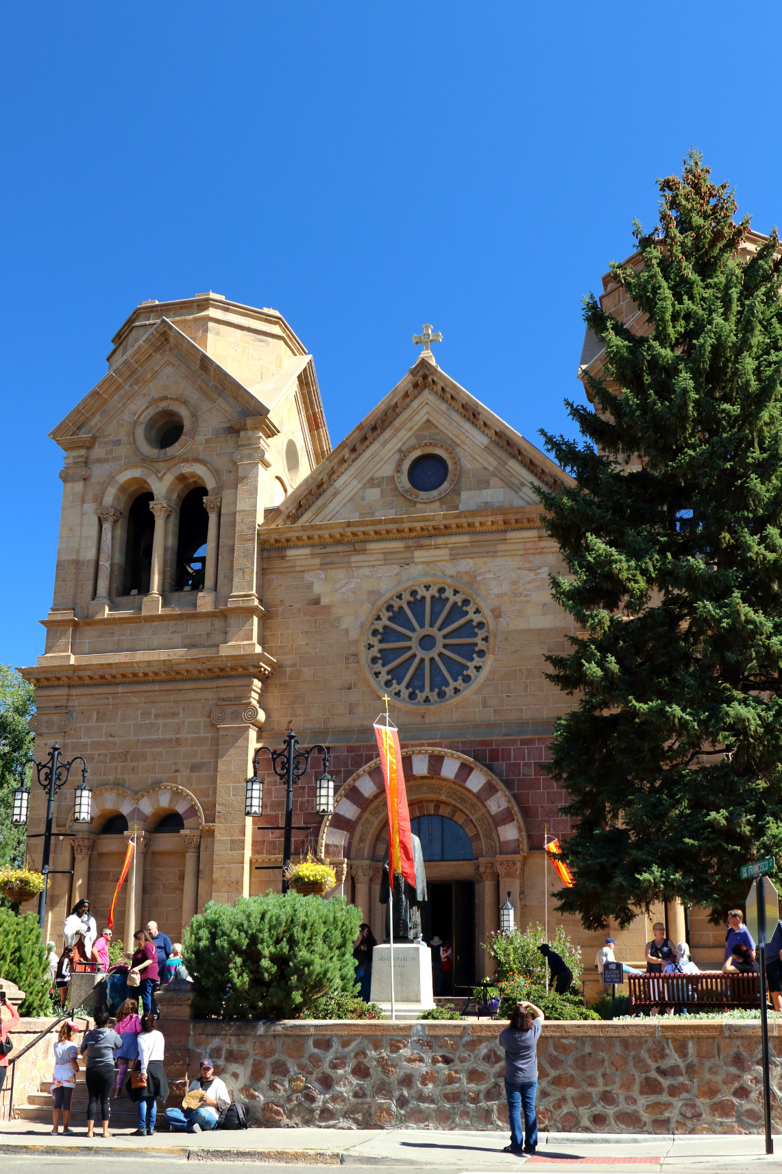
We stopped for lunch and walked around Santa Fe.
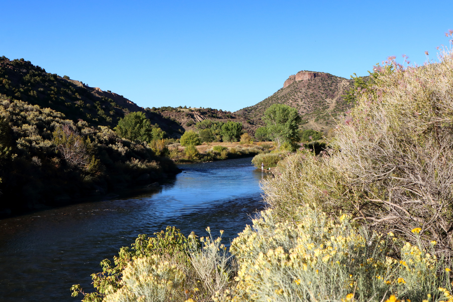
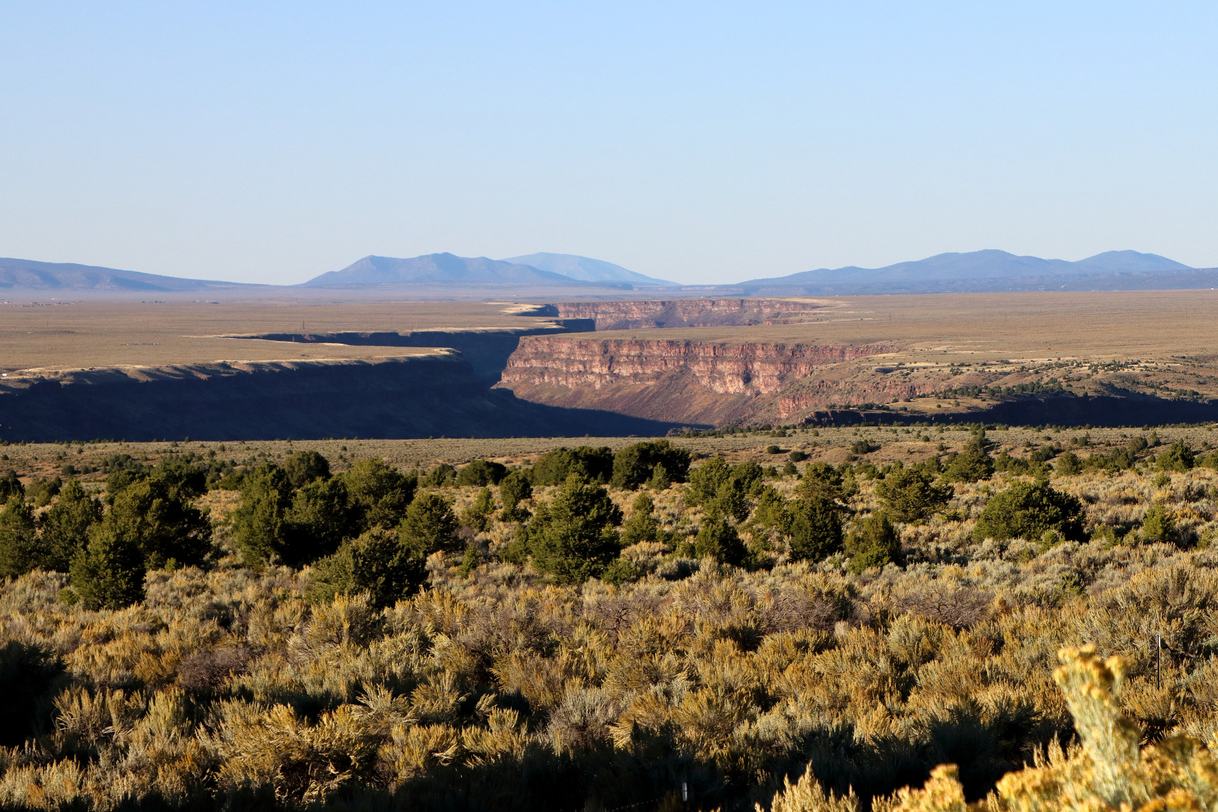
Then we continued to Taos, driving along the Rio Grande and catching a glimpse of the Rio Grande gorge.
Day 4 – Taos
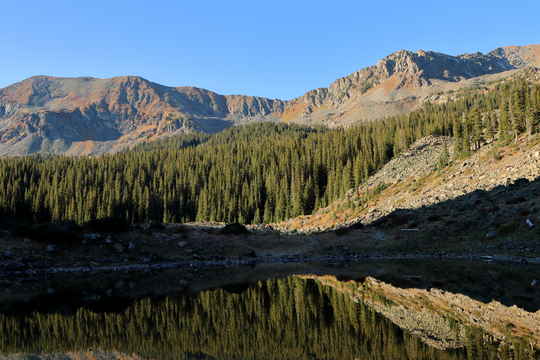
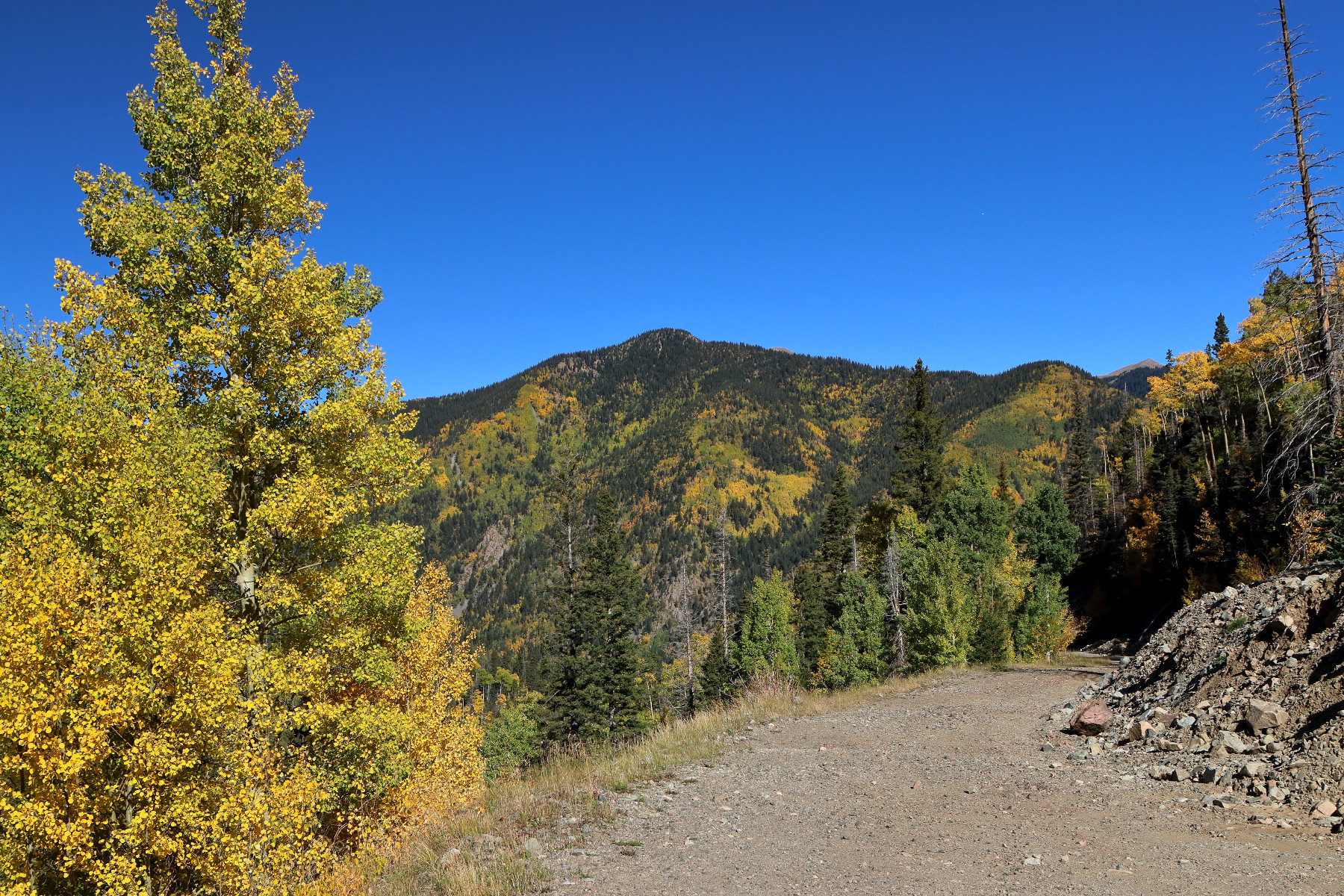
We started our day before dawn so we could catch morning light at Williams Lake (elevation 11,040 feet) near Taos Ski Valley. It was below 30 degrees when we started out, and it got colder as we gained in elevation. It was probably around 20 degrees when we reached the lake.
After our hike, we walked along a gravel road at the ski resort to photograph the stunning views of the aspens, which had changed from green to brilliant yellow. Fall was near peak in northern New Mexico, just as we had hoped.
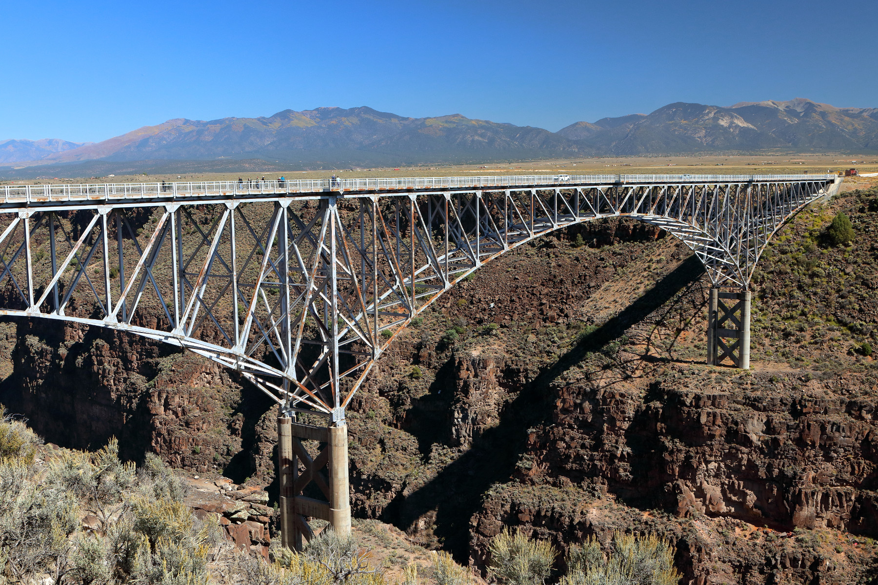
We spent early afternoon at the Rio Grande Gorge Bridge…
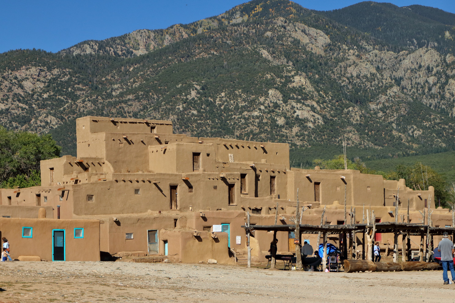
…and late afternoon at the Taos Pueblo.
Day 5 – Albuquerque and Los Alamos
Our trip coincided with the Albuquerque International Balloon Fiesta, an annual gathering of balloon enthusiasts. We awoke around 3am to drive from Taos to Albuquerque in time to see the morning ascent.


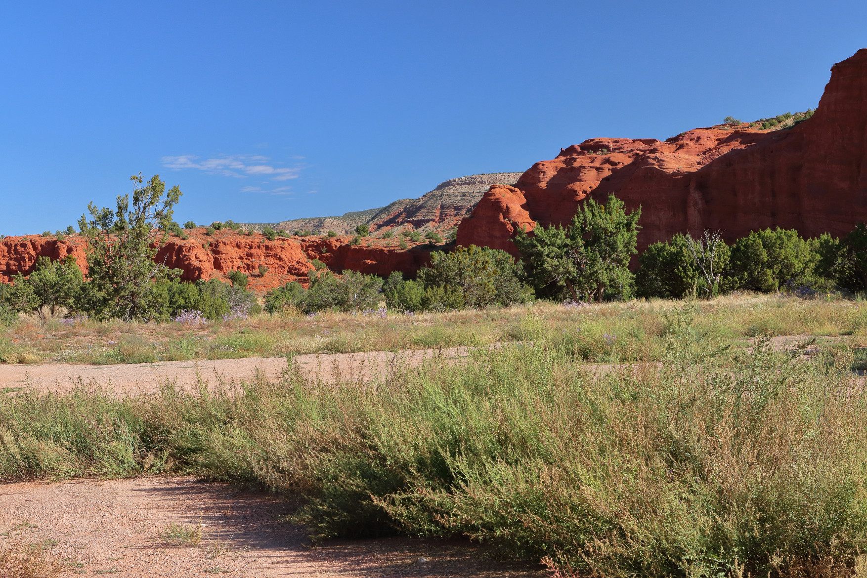
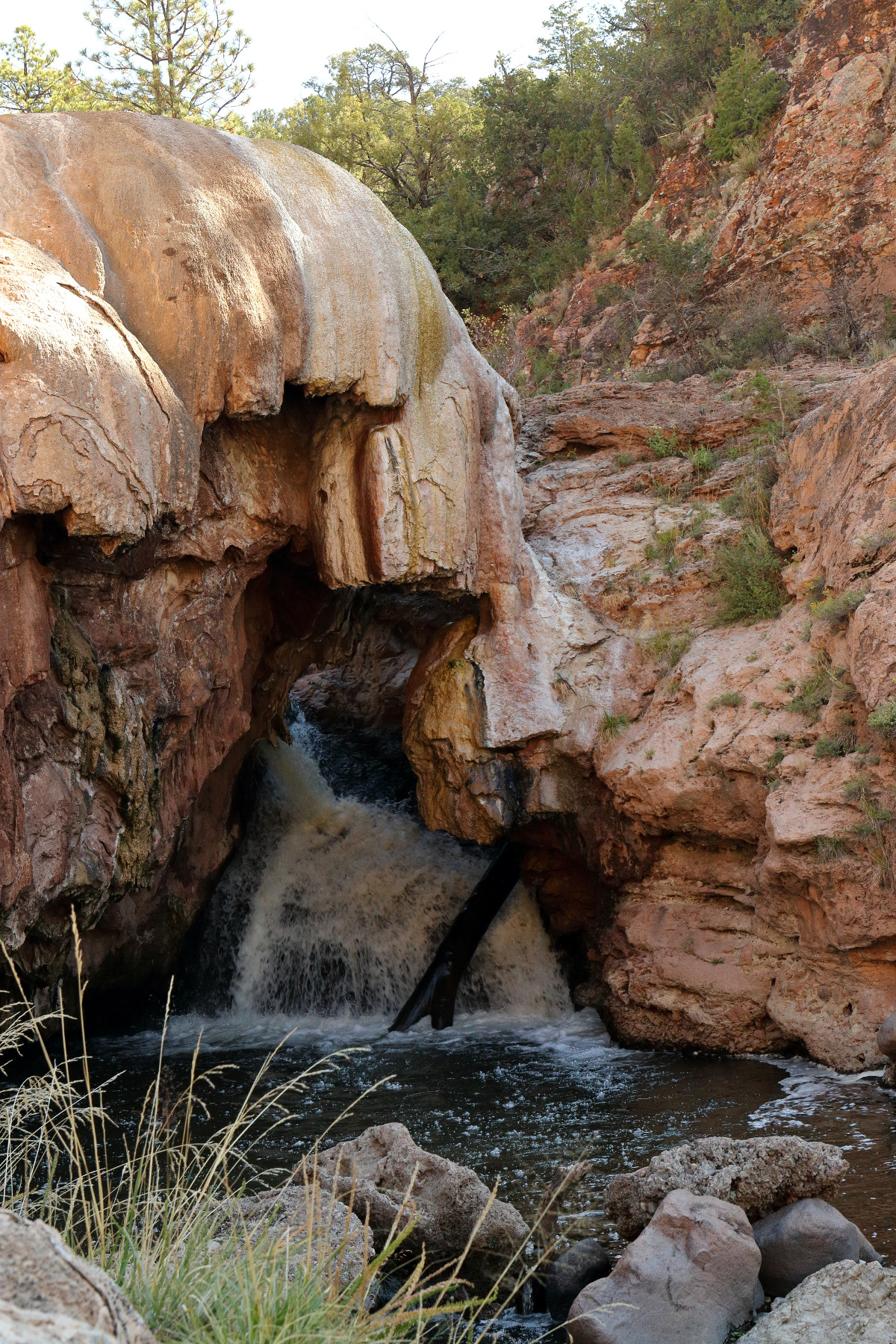
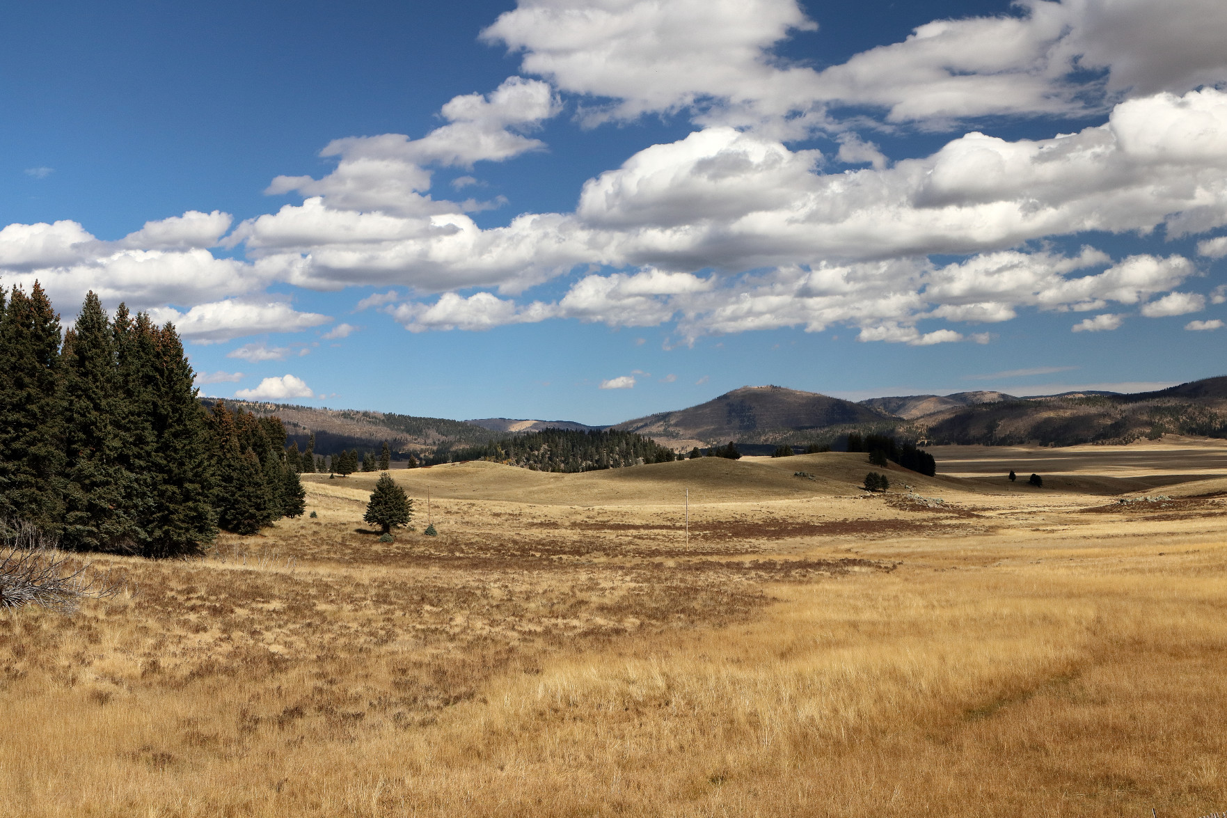
We then drove through Jemez Springs, stopping to take pictures of the red rocks, the sulfur hot springs at Soda Dam, and the Valle Caldera National Preserve.
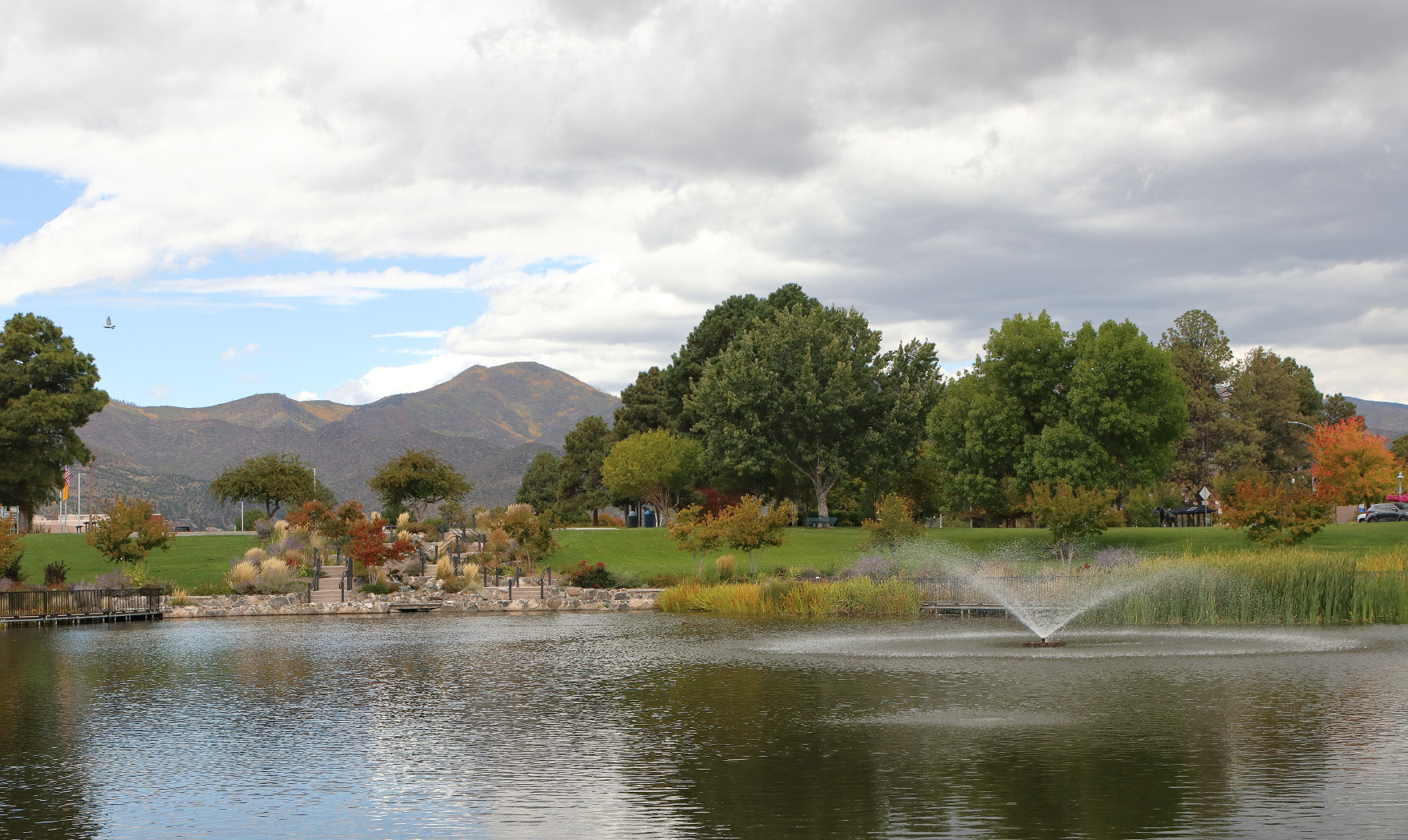
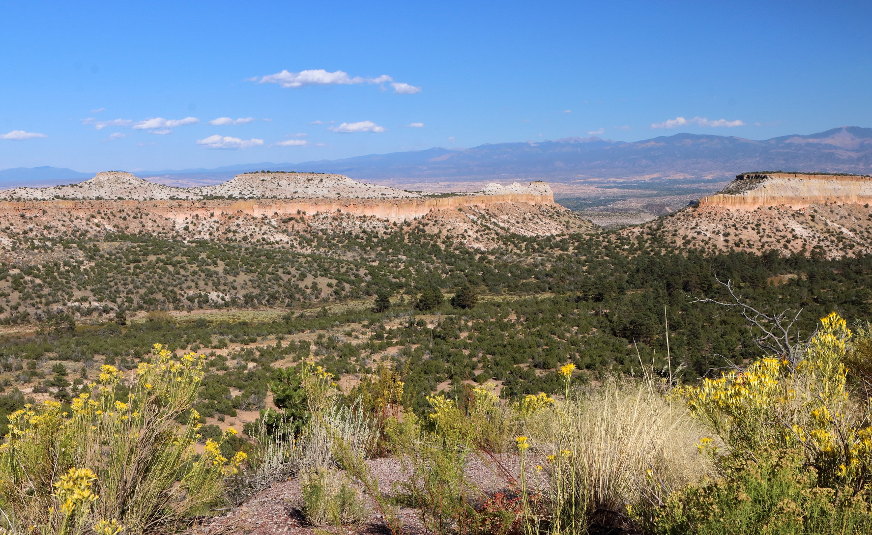
We then drove into Los Alamos, where we walked around Ashley Pond and through the Manhattan Project National Historical Park before driving to Overlook Park in nearby White Rock.
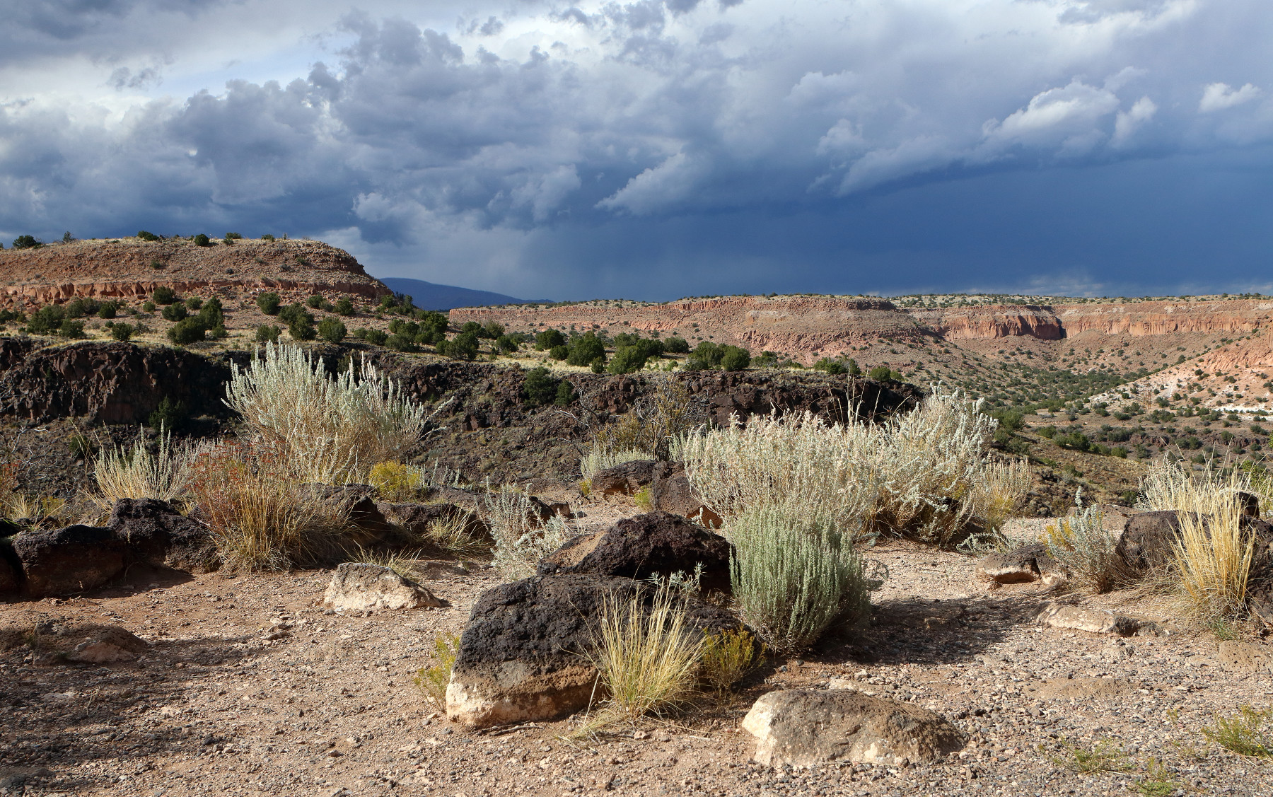
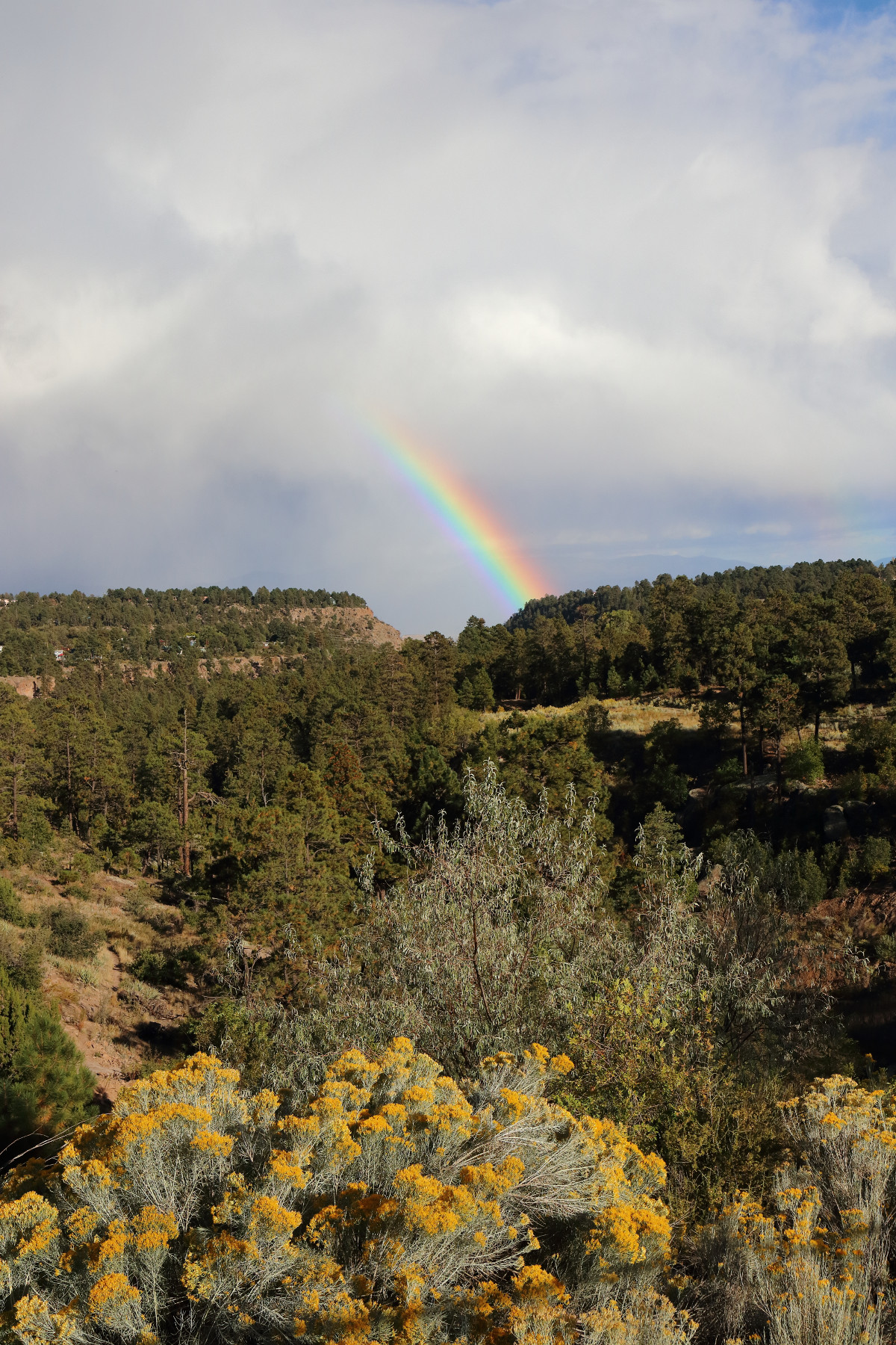
Despite being dry season, a storm had been brewing all afternoon, and we were able to capture the clouds over the mesas before the rain broke.
After the storm, we chased a double rainbow, with only marginal results.
Day 6 – Bandelier and Los Alamos
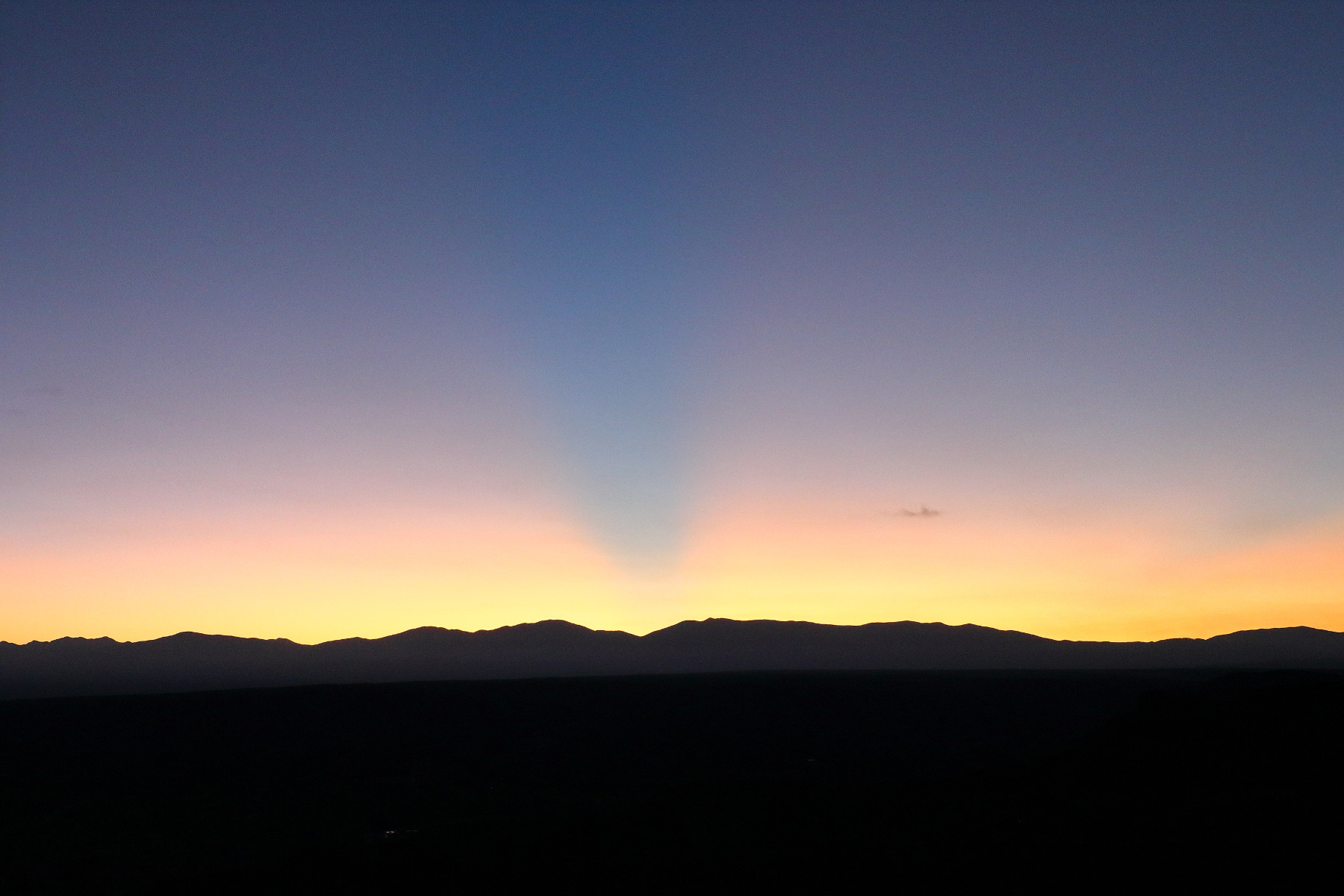
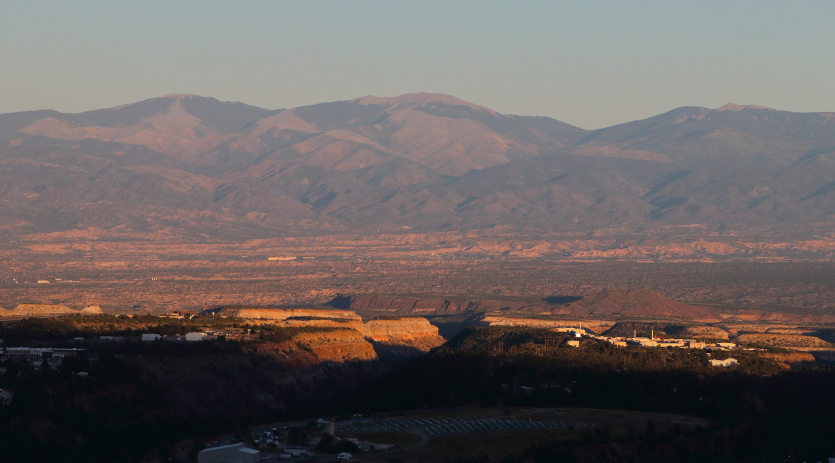
We got another early start, this time to catch sunrise at Overlook Park.
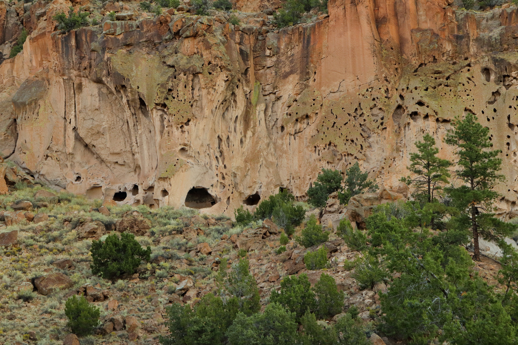
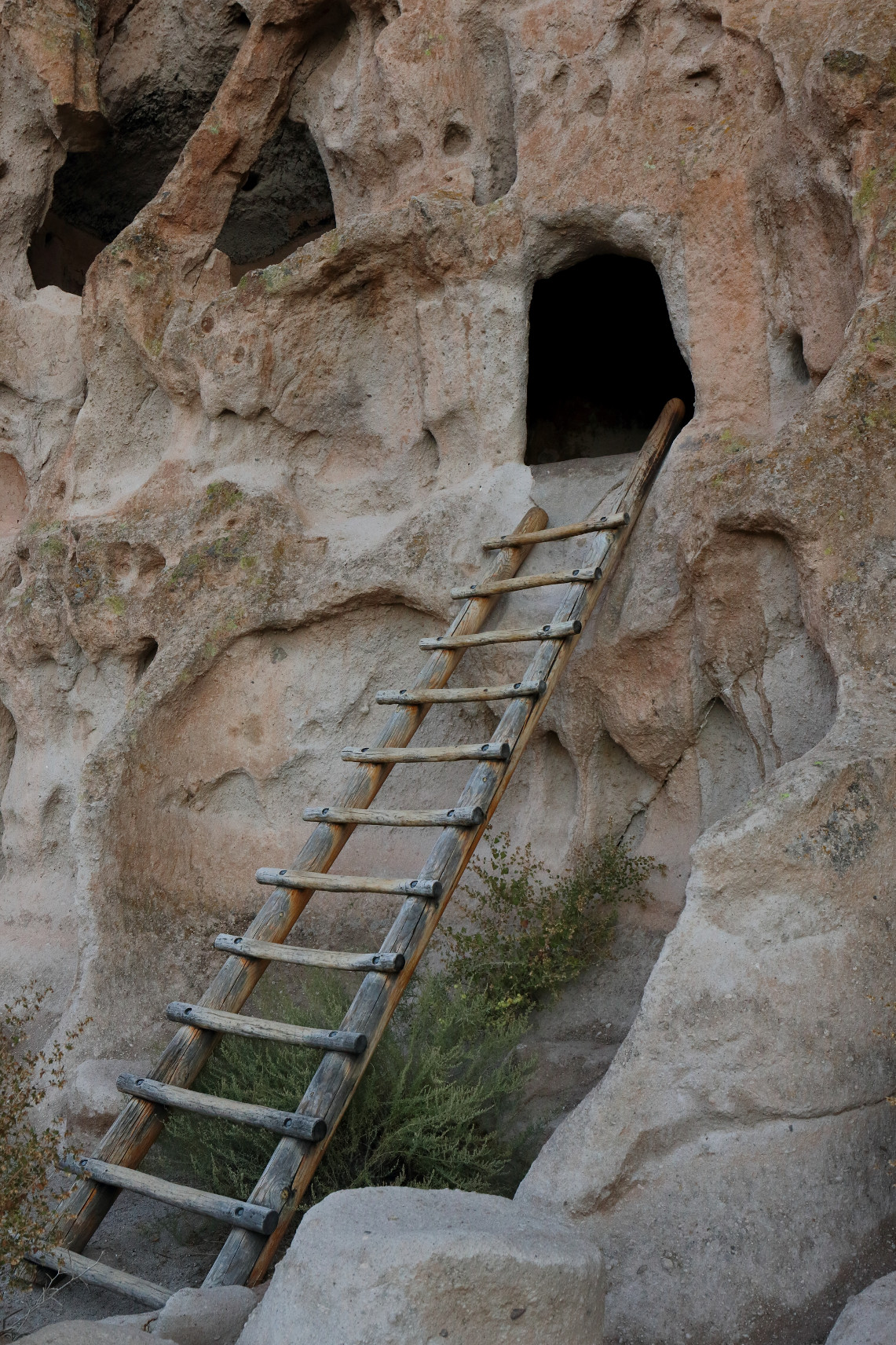
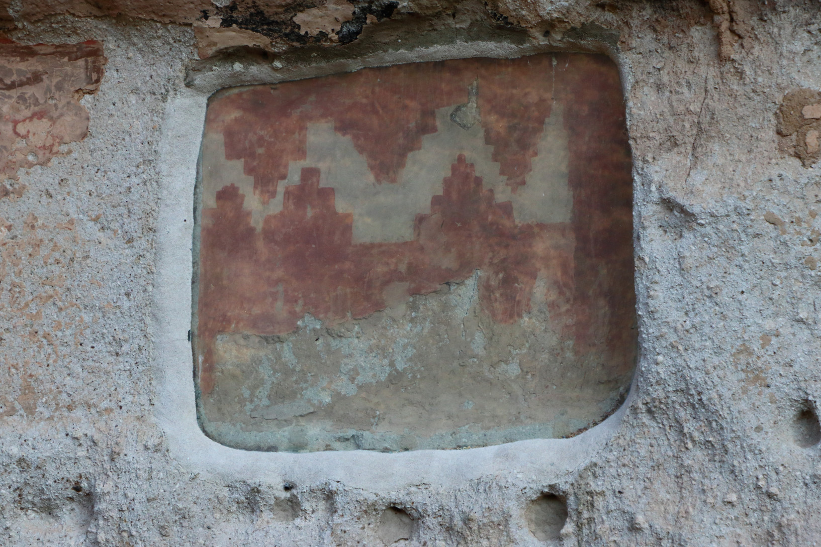
Visitors arriving at Bandelier National Monument before 9am can park at the visitor center. After 9am, visitors are required to shuttle from White Rock. We arrived early and not only avoided the hassle of the shuttle but also avoided the crowds. Bandelier was the first of two cliff dwellings we visited on our trip.
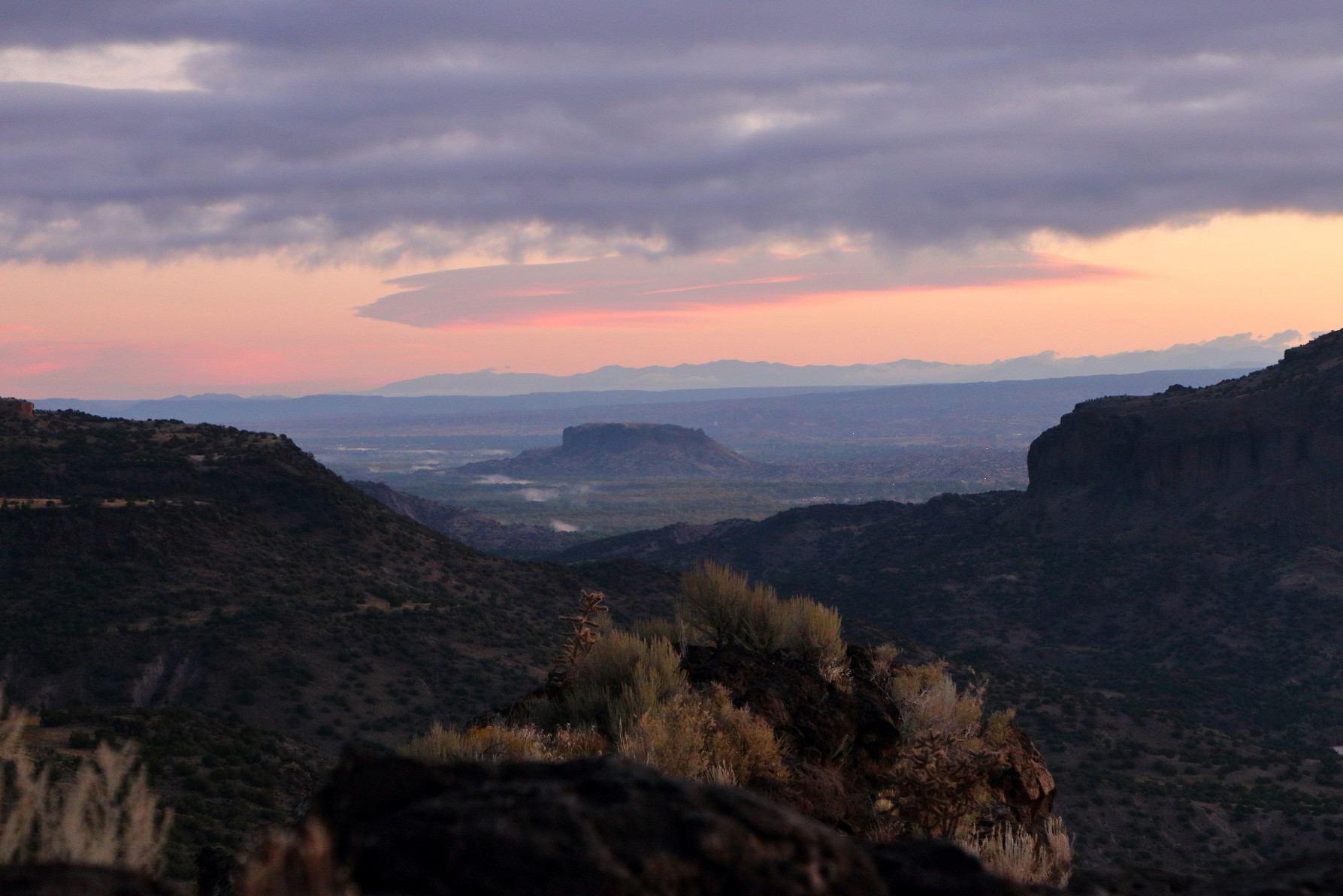
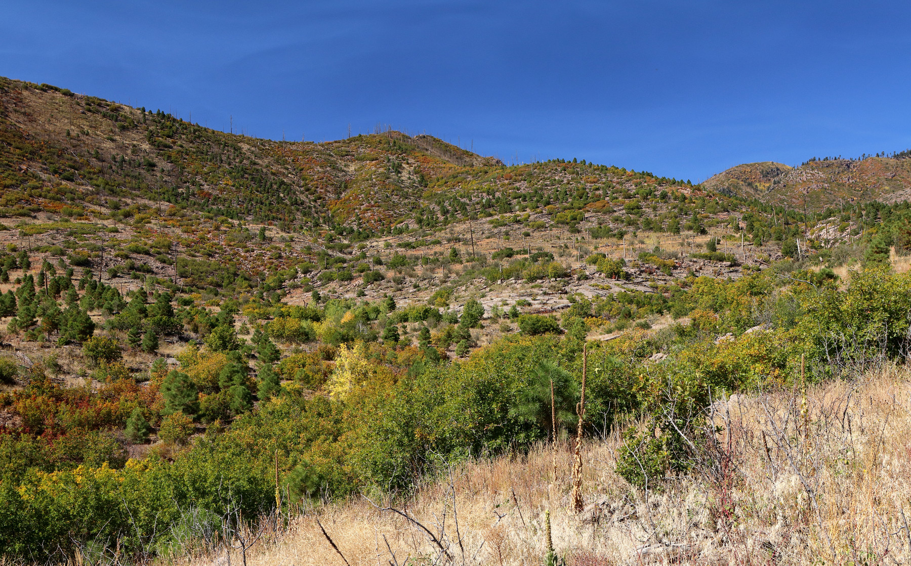
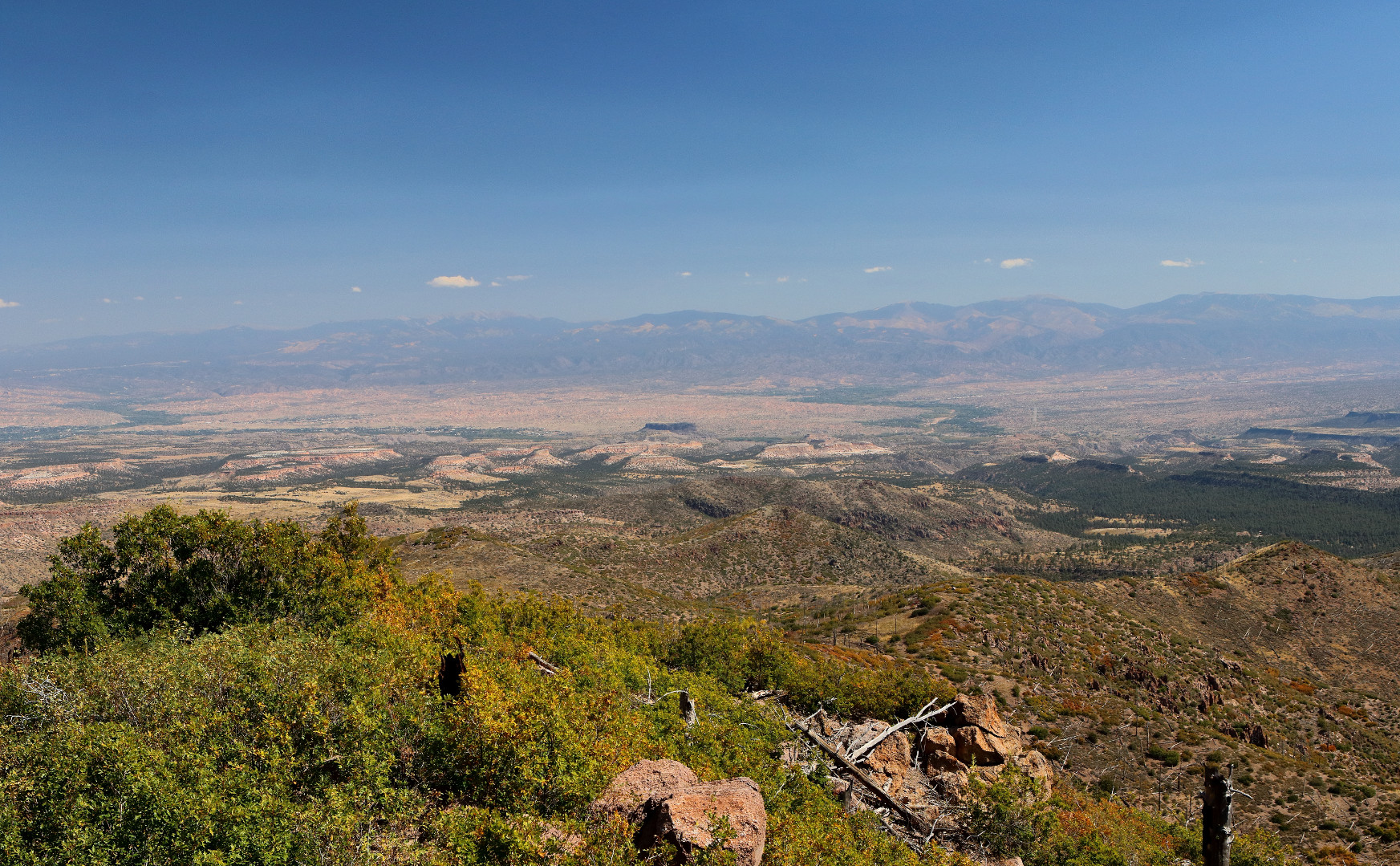
Afterward, we set out to hike the Mitchell Trail in Los Alamos to Los Alamos Natural Arch. The directions I’d found online, however, were less than clear, and we never made it to the Arch. Instead, we ended up at the top of a mountain ridge overlooking both the town of Los Alamos and the surrounding mesas, mountains, and valleys. It was exactly the view we wanted, so we considered ourselves fortunate that the directions were bad.
We attempted to visit the cliff dwellings at Puye, but they were closed on Wednesdays, so we took some pictures at pull-offs along the drive from White Rock back to Los Alamos.
Then we watched the sunset and caught the colors on the mountains.
Day 7 – Los Alamos to Silver City
The drive from Los Alamos to Silver City, where we would be visiting my aunt, is over five hours, so we planned several stops along the way to break it up. Our first stop was Petroglyph National Monument, where ancient drawings cover volcanic rock.
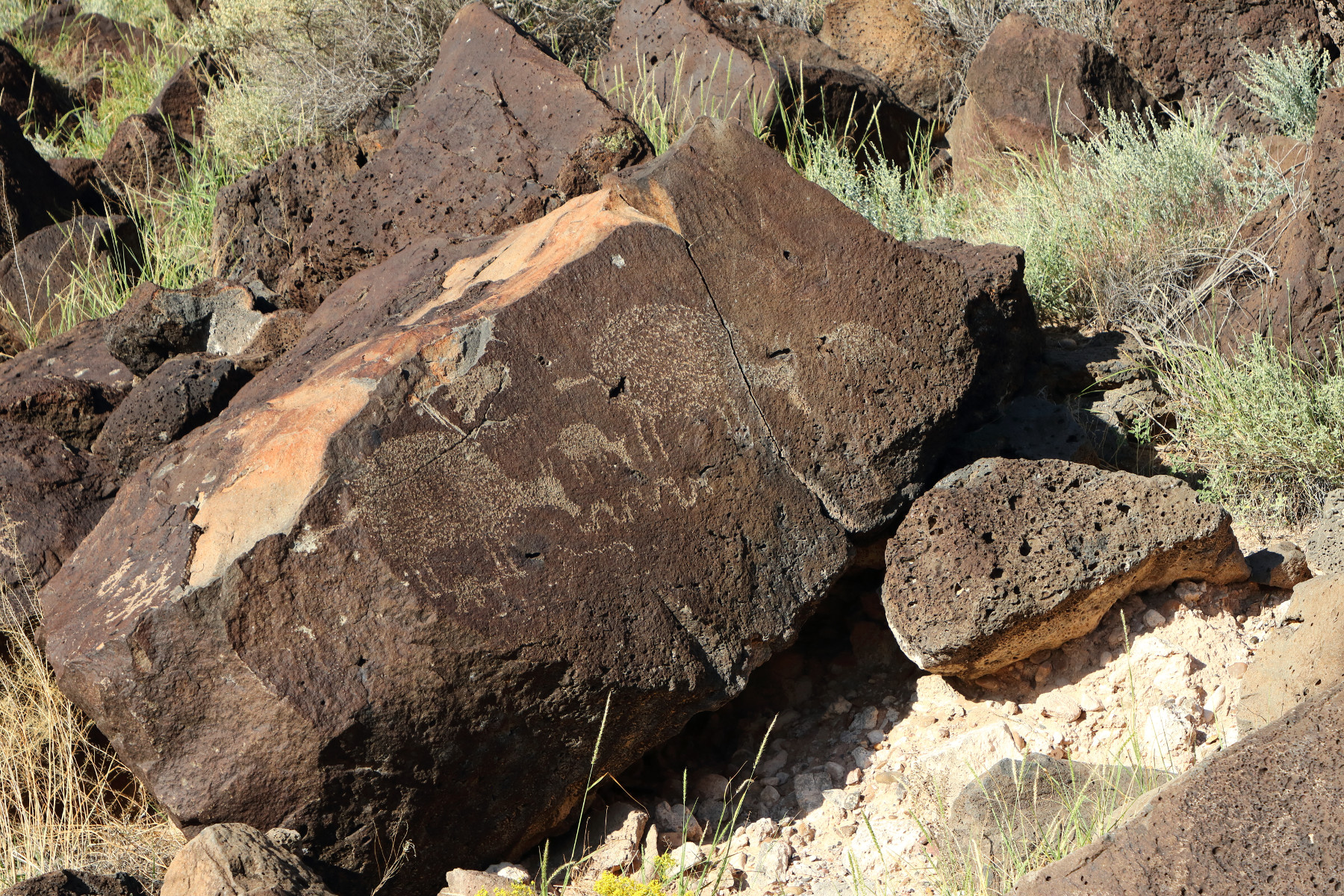
Most of the petroglyphs are difficult to see, being small and pale and far from the designated path. We still considered it a worthwhile detour.
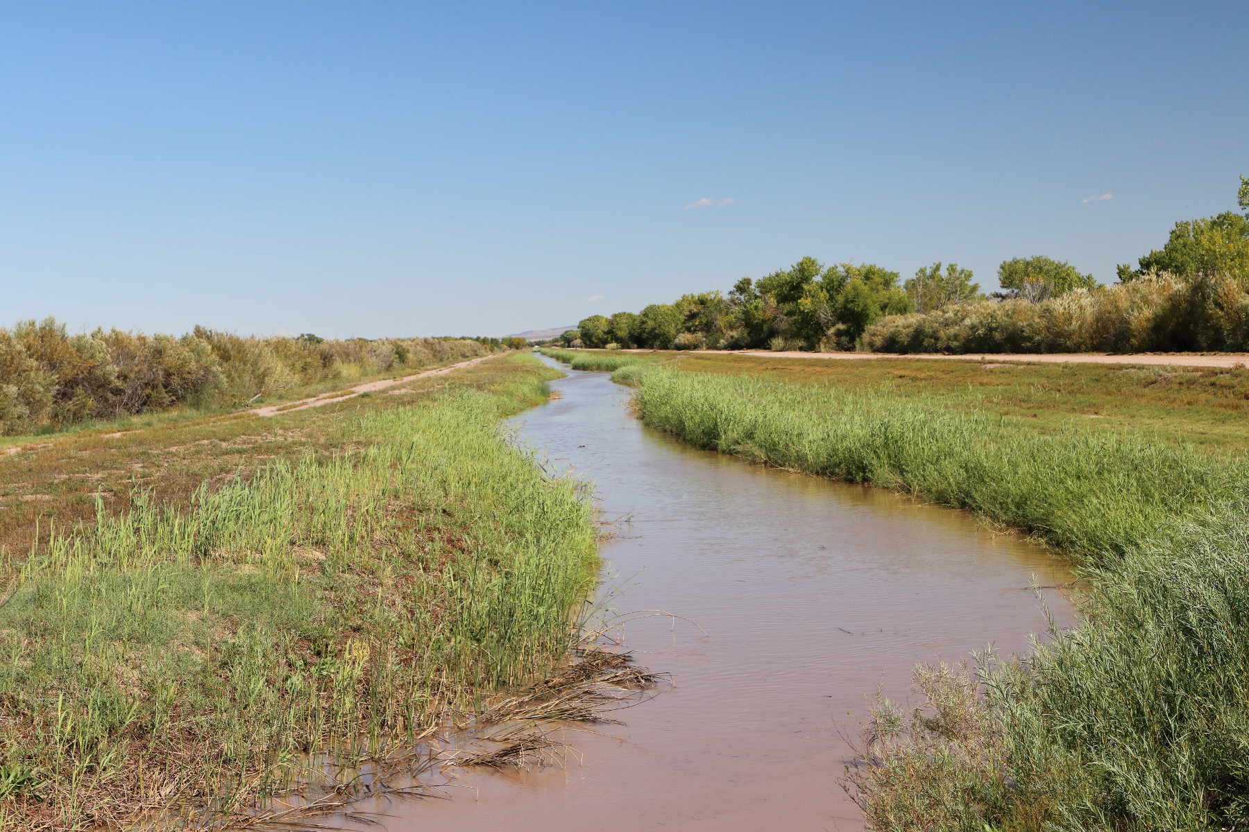
Our next stop was Bosque del Apache National Wildlife Refuge. There were a few birds at the various ponds, but it wasn’t a major migratory season, so there were not flocks.
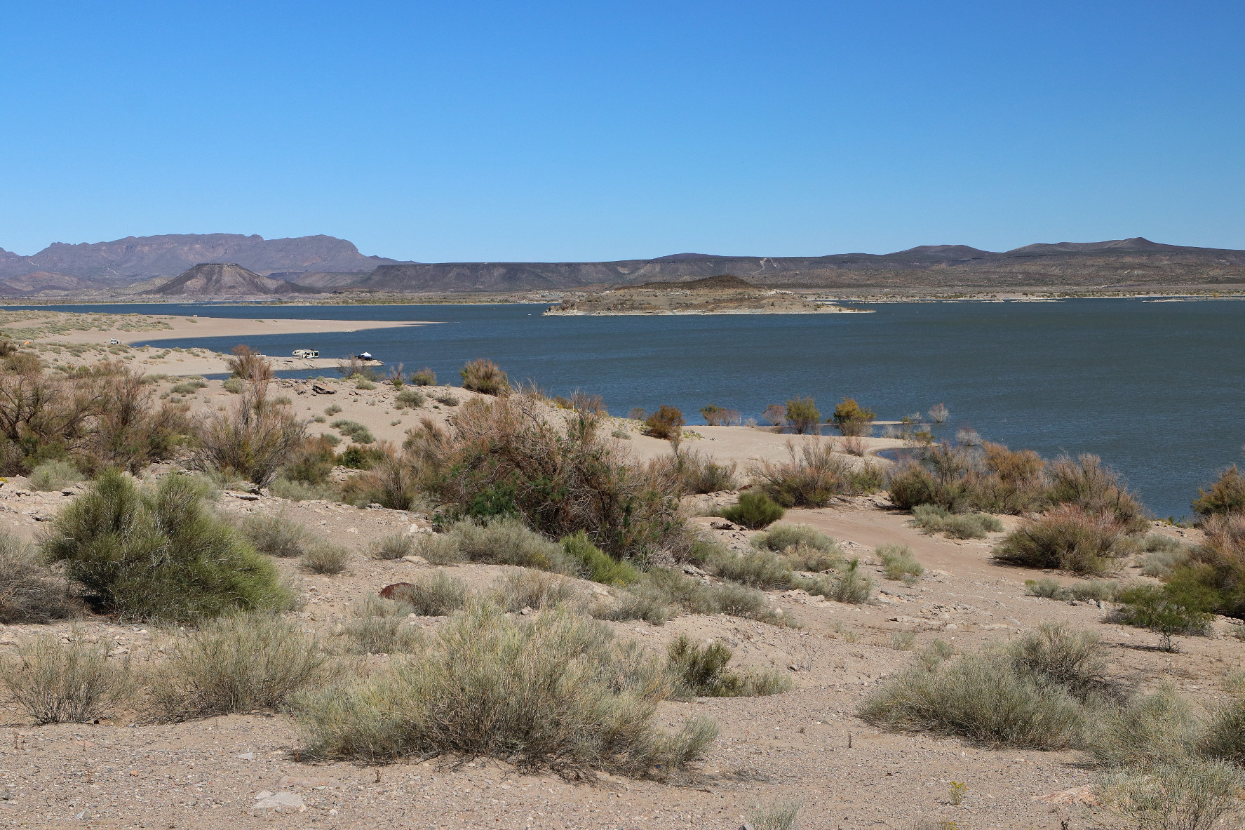
We stopped briefly at Elephant Butte Lake State Park at a reservoir along the Rio Grande near Truth or Consequences.
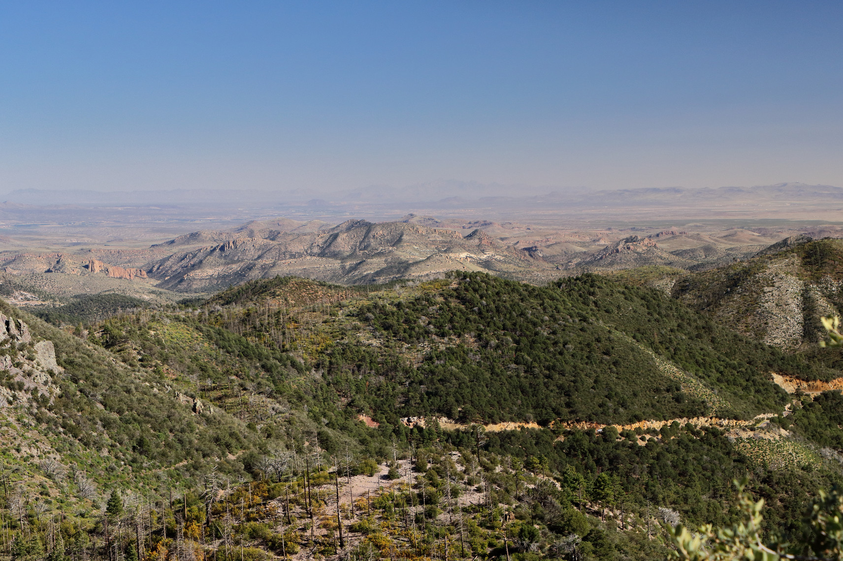
Along the very windy road through the Gila National Forest, we stopped at the overlook at Emory Pass.
Day 8 – Silver City
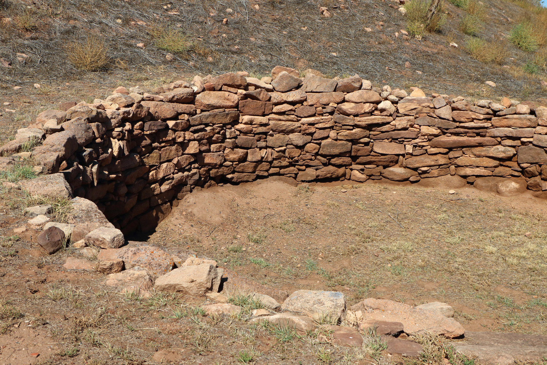
The second set of cliff dwellings we toured were the Gila Cliff Dwellings in the Gila National Forest. I had seen them 20 years earlier, when I had visited my aunt when I was in college, but I was excited to see them again (with the DSLR this time), and my husband was looking forward to seeing them for the first time. The cliff dwellings were inhabited by the Mogollon culture in the 1200s for about 20 years and then mysteriously abandoned.


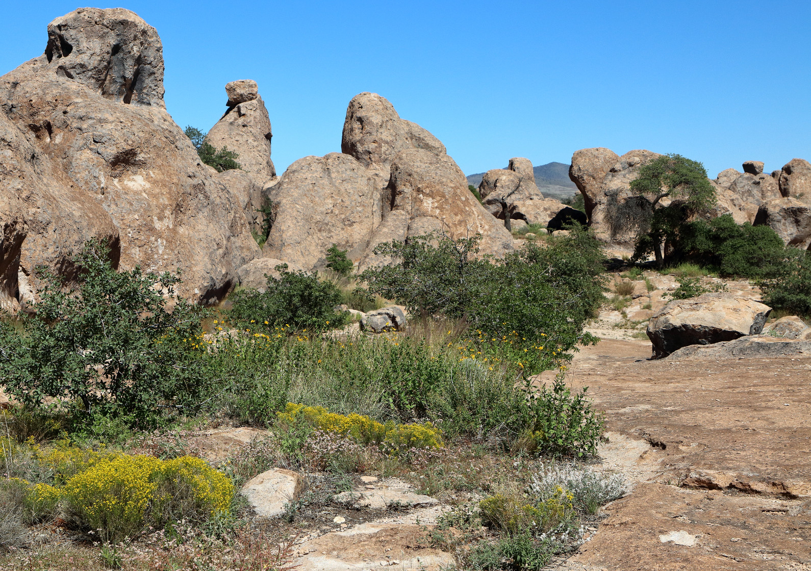
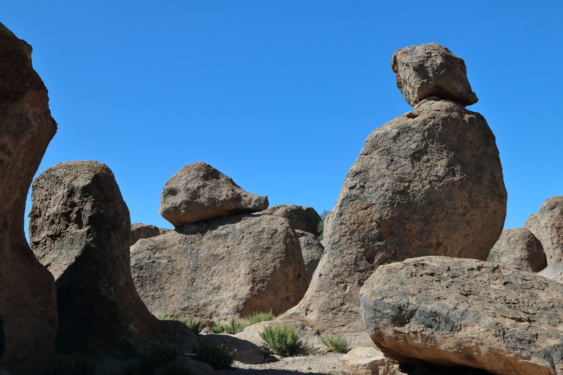
Our next stop was City of Rocks State Park, a set of volcanic rock formations in the New Mexico desert.
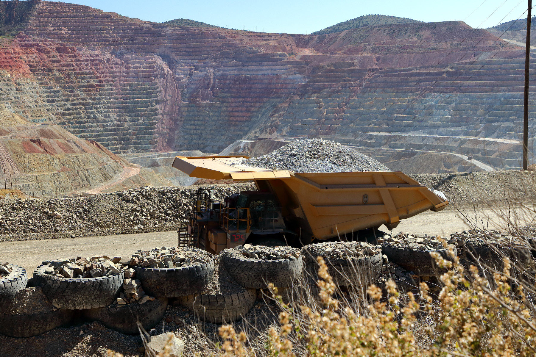
We also drove past the Santa Rita mine, where a mountain is being deconstructed, one dump truck load at a time.
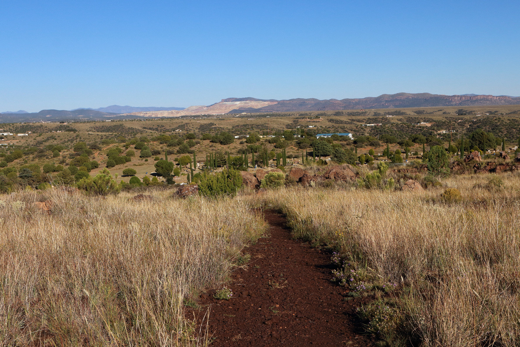
We spent the late afternoon in Silver City and the Boston Hill Park, located on reclaimed mining land that offers an overview of the town.
Day 9 – Tucson
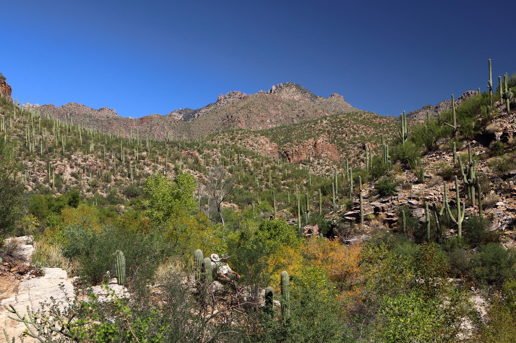
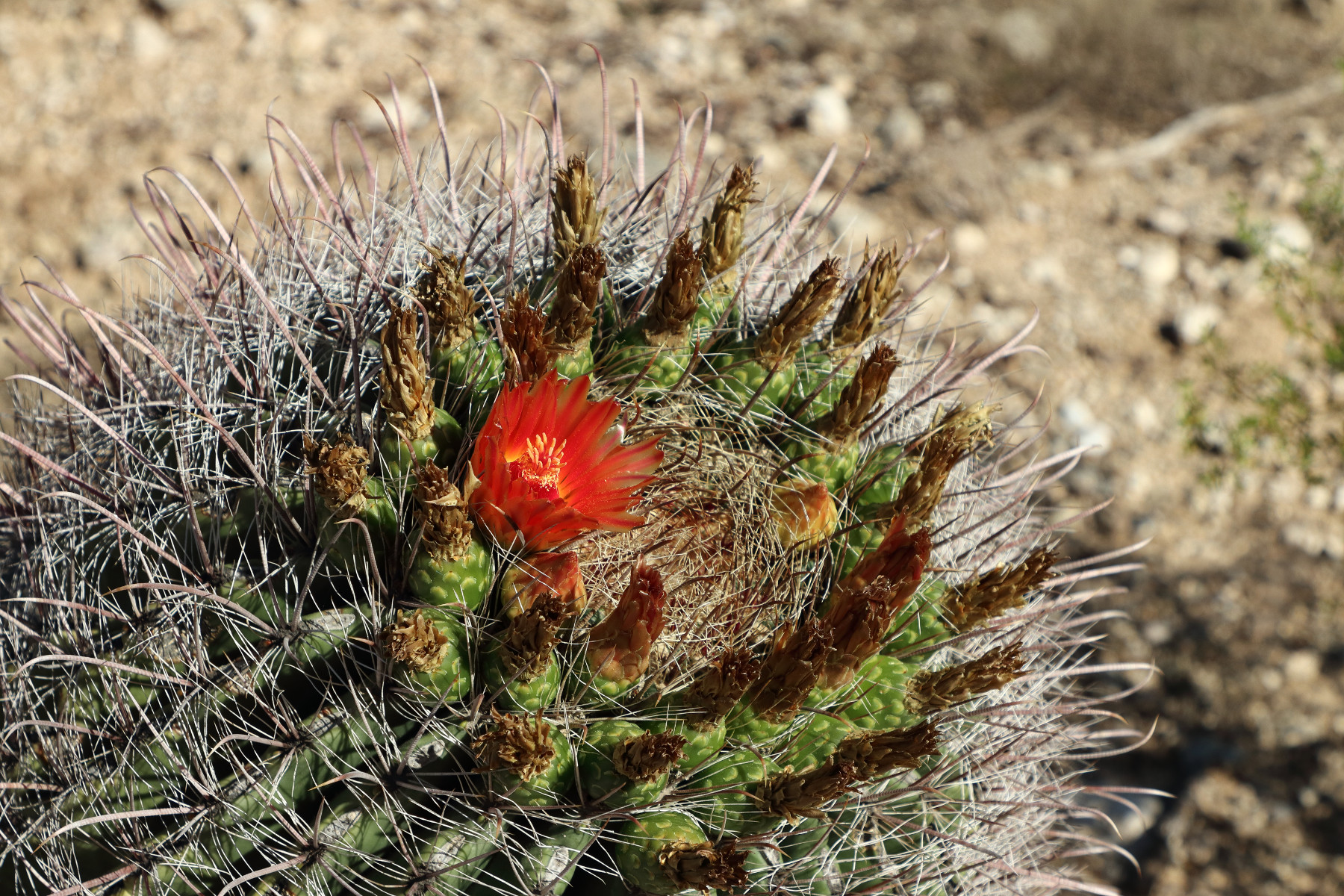
We arrived at Sabino Canyon before 9am, and it was already hot. It may be a “dry heat,” but it is still hot. Sabino Canyon is beautiful, and many of the cacti were in bloom as some of the trees had begun to change into fall color.
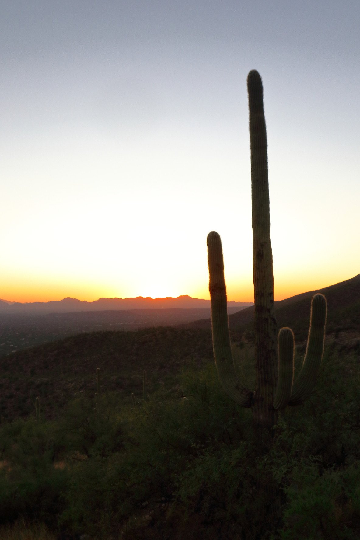
We spent most of the afternoon indoors at museums and the planetarium on the University of Arizona campus. That evening, we drove back to Mount Lemmon for sunset.
Day 10 – Tucson
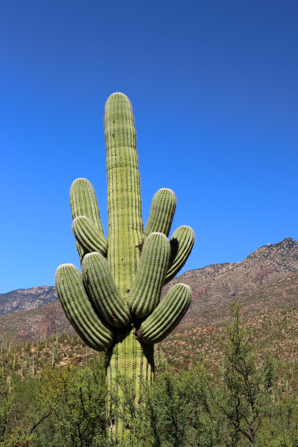
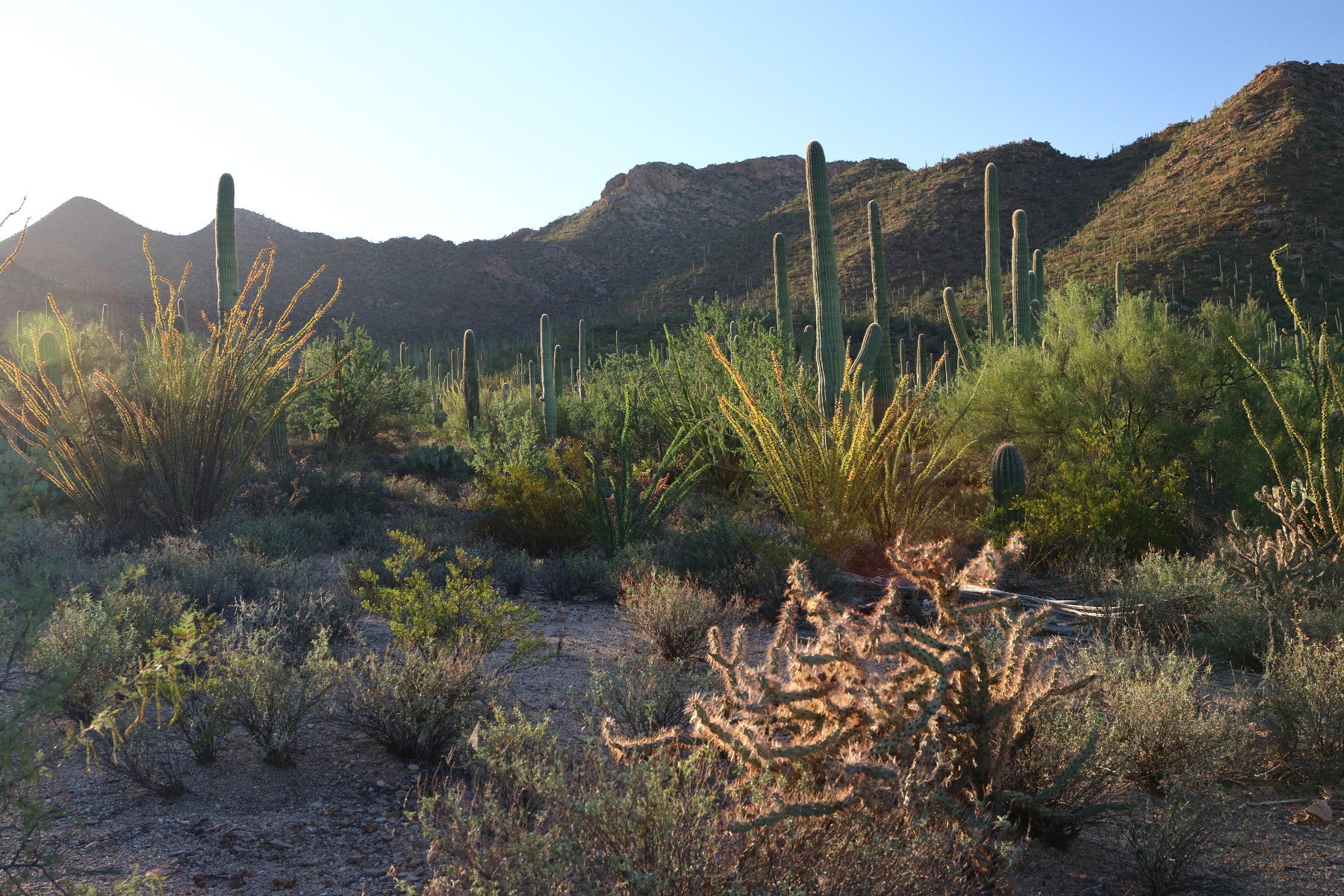
Once again, we started the day before dawn, this time catching sunrise at Saguaro National Park.
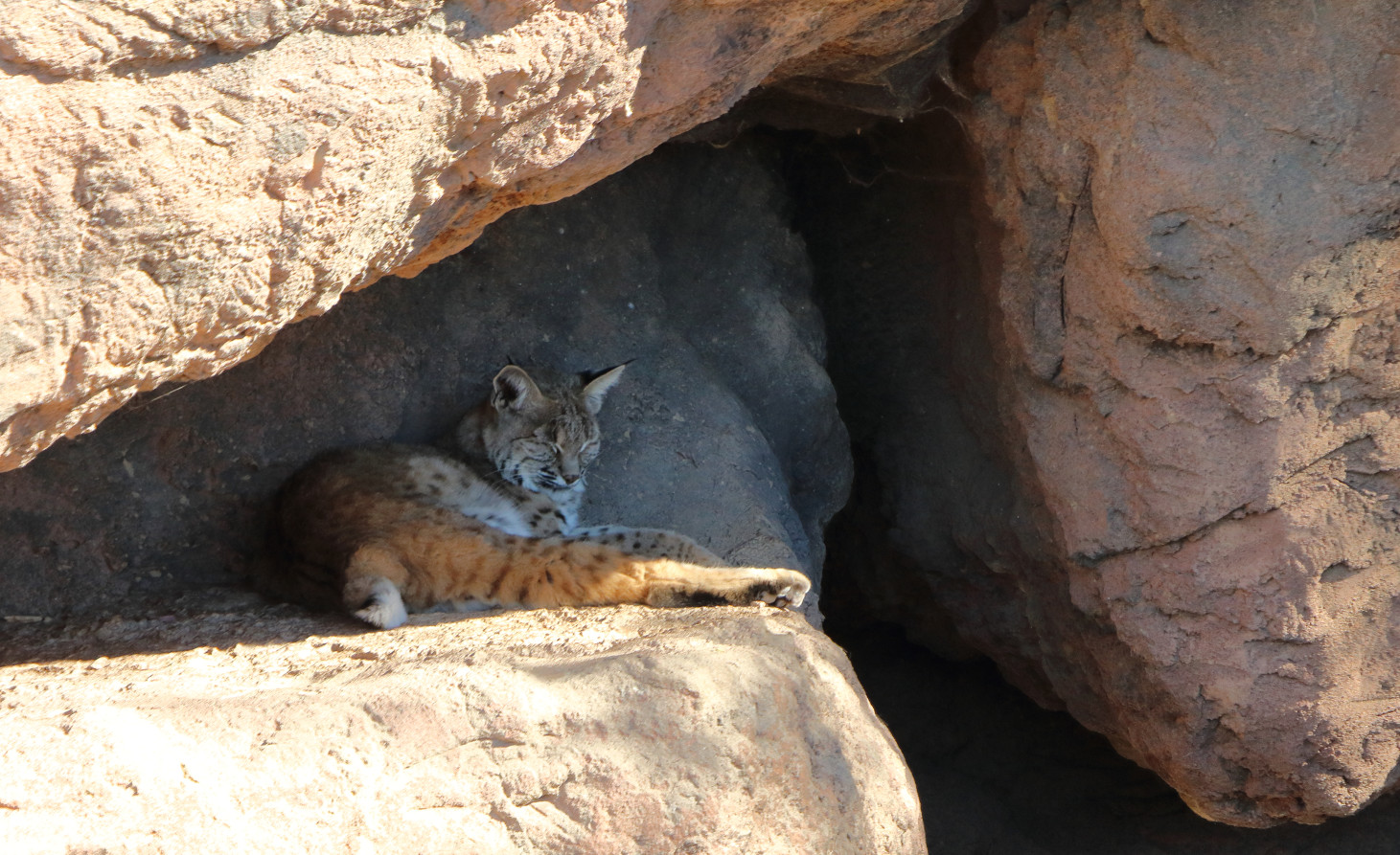
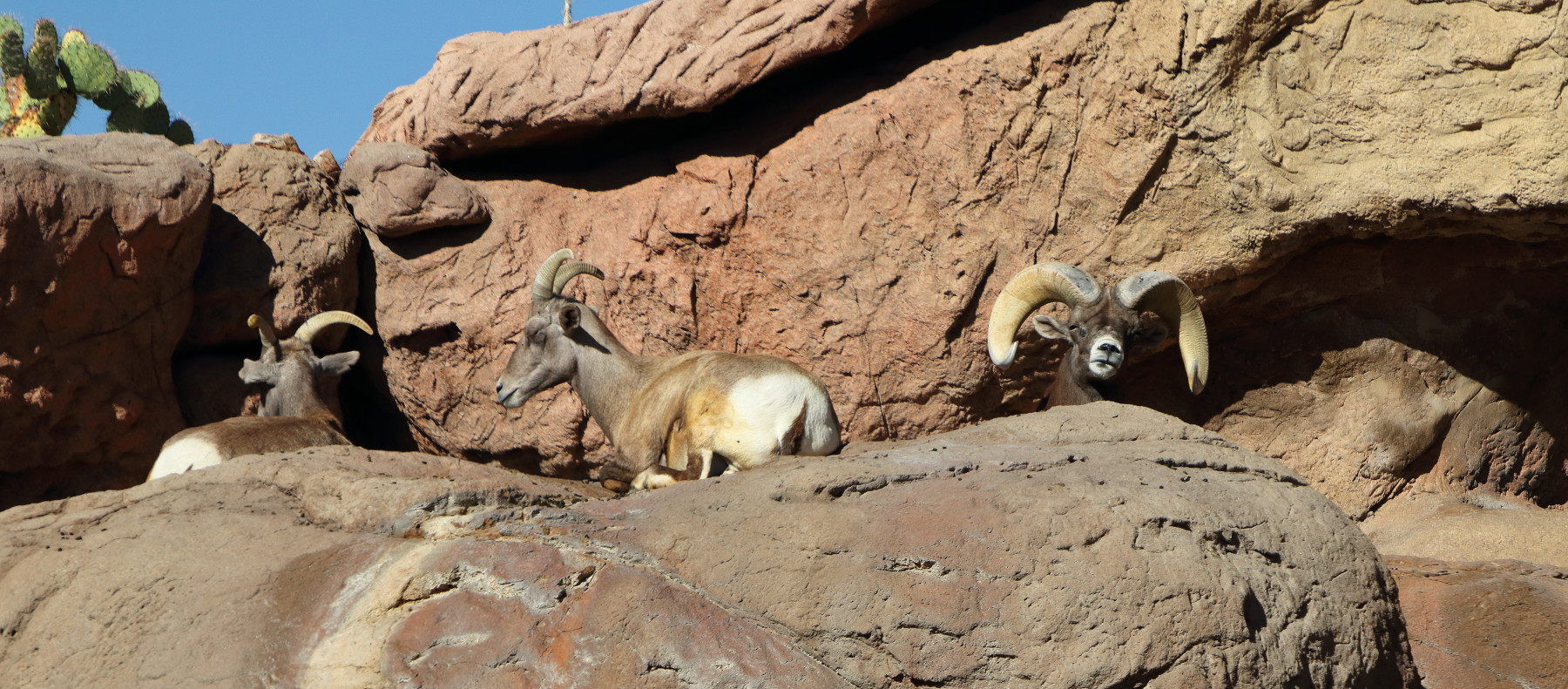
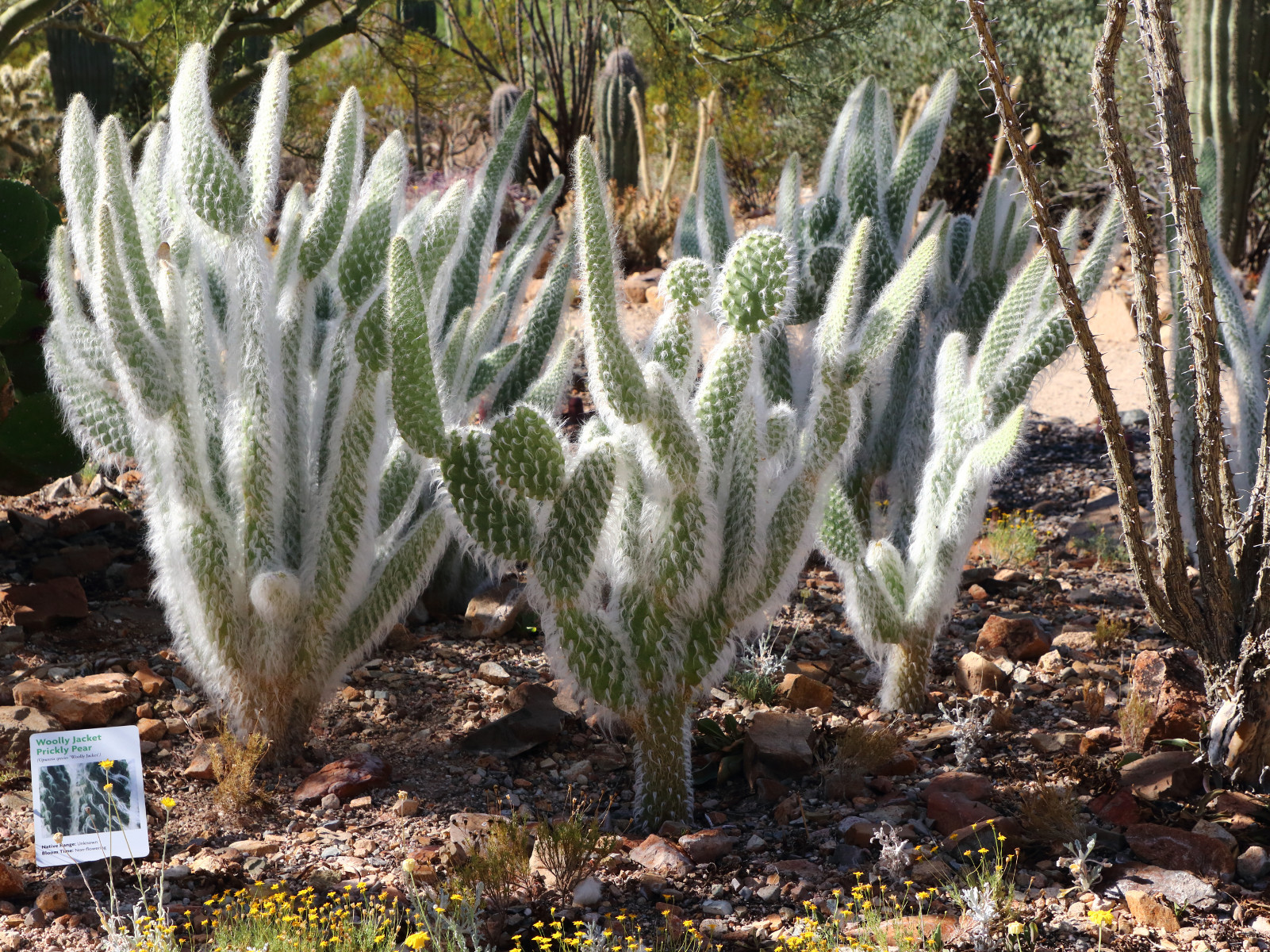
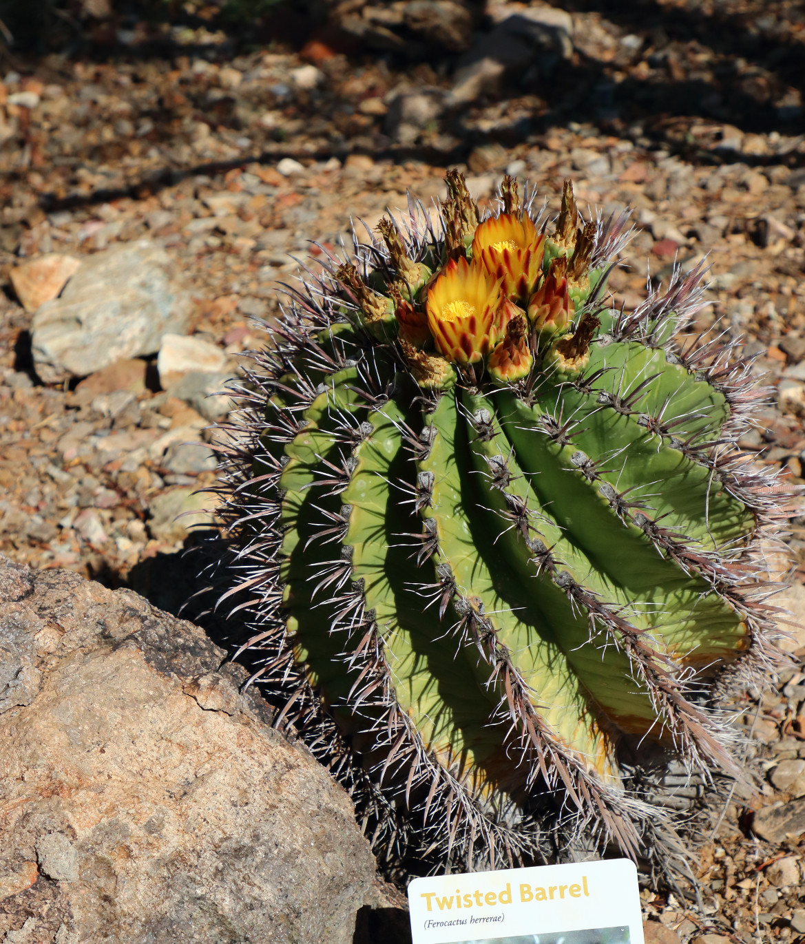
We then went to the Arizona-Sonora Desert Museum, which is home to a large variety of desert animals (including the mountain lion and bighorn sheep) and plants (including a cactus garden).
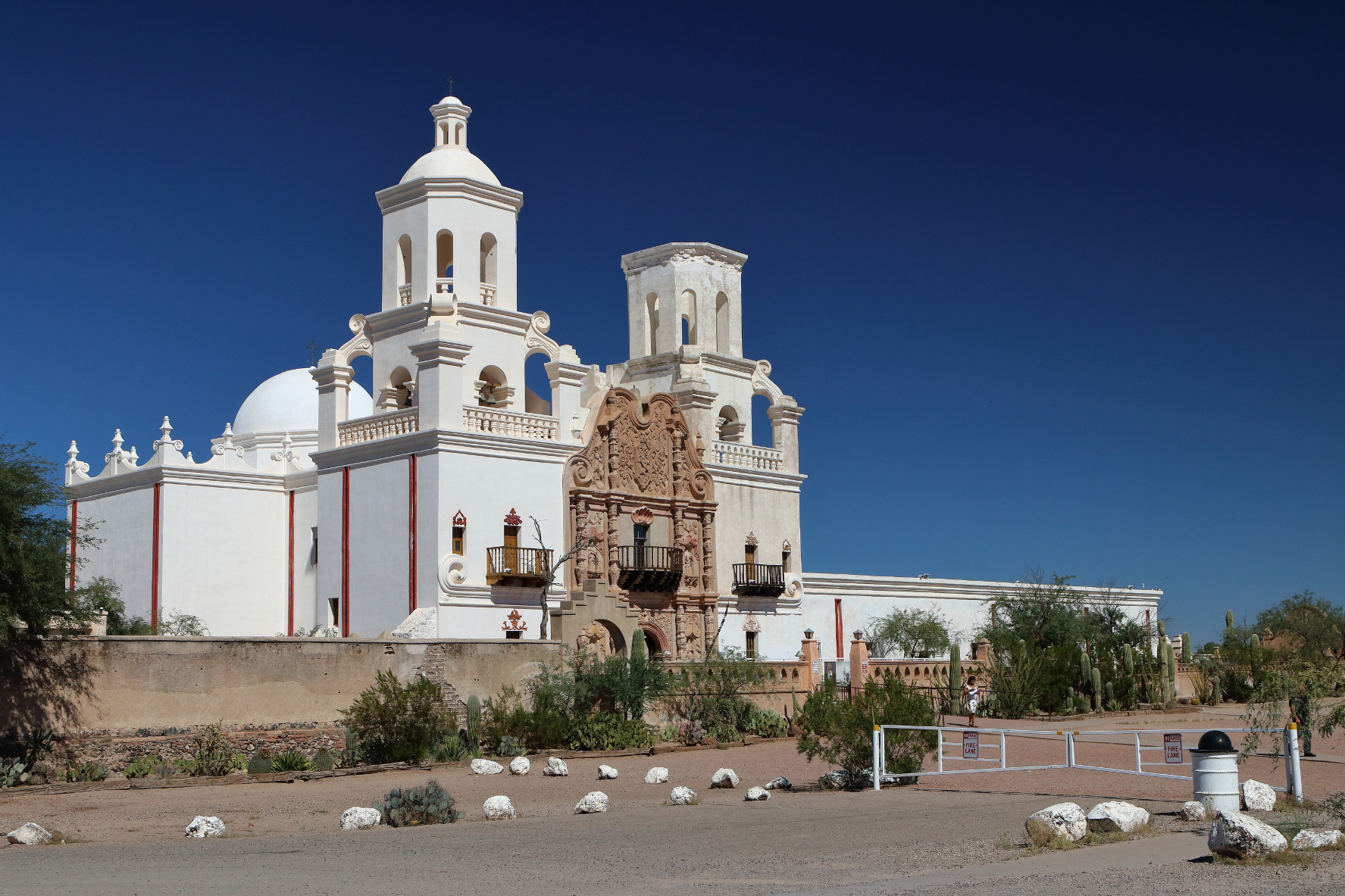
After lunch, we toured the San Xavier mission, founded by the Jesuits in 1692, and now an active church, operated by the Franciscans.
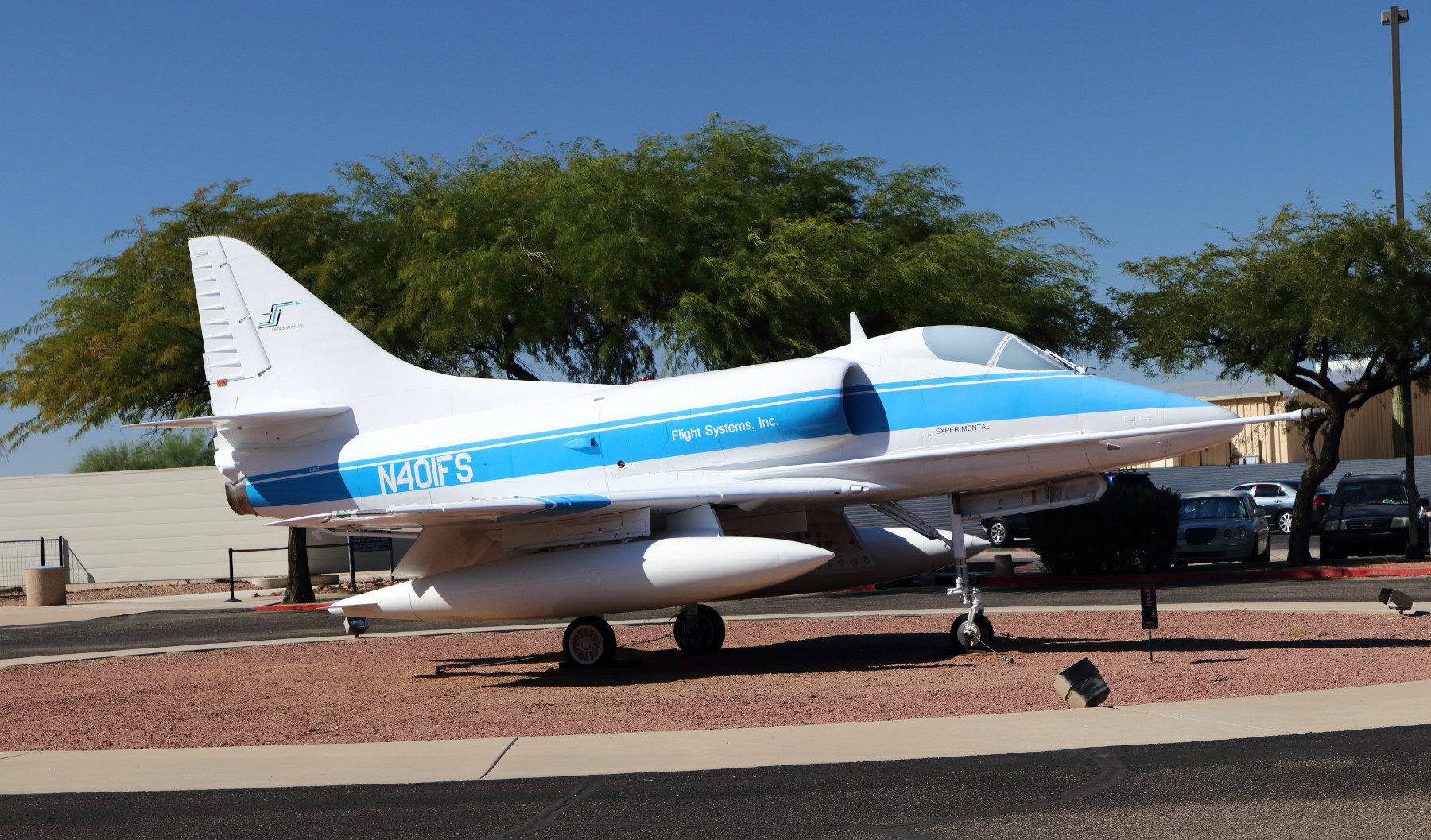
We then went to the Pima Air & Space Museum. Having been to the Udvar-Hazy Center several times, we weren’t sure what to expect. Pima was impressive. It has a large and diverse collection of aircraft, including a Blackbird, Blue Angels, and Air Force Ones.


Our final stop was Sentinal Peak, where we enjoyed golden hour and a 365 degree view of the city.
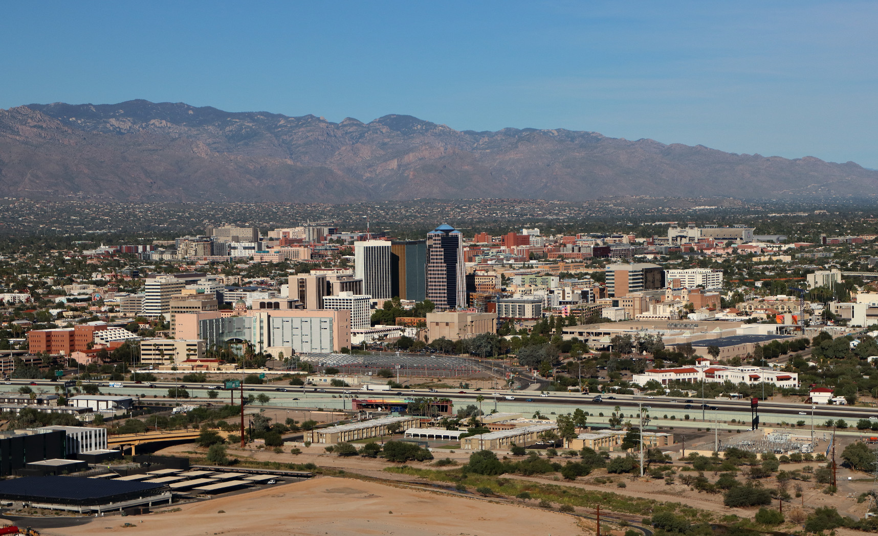
In the distance, we could see the airport where we would fly out the next morning.
All photos (c) 2019 J. Atwater. All rights reserved.