Our original travel plan for 2020 was a trip to Maui in April. Due to Hawaii COVID-19 quarantine laws, we were forced to cancel the vacation. For several months, there were few places to go, but by late summer, states were starting to reopen, and we were ready for a break from the monotony of our restricted daily activities. We knew that travel was a risk, but we also knew that we needed to live.
We chose a trip we had planned to take at some point in the future and traveled to the Grand Canyon and national parks in Utah. We decided to travel in October when we hoped the weather in the desert would be a bit cooler but not yet cold.
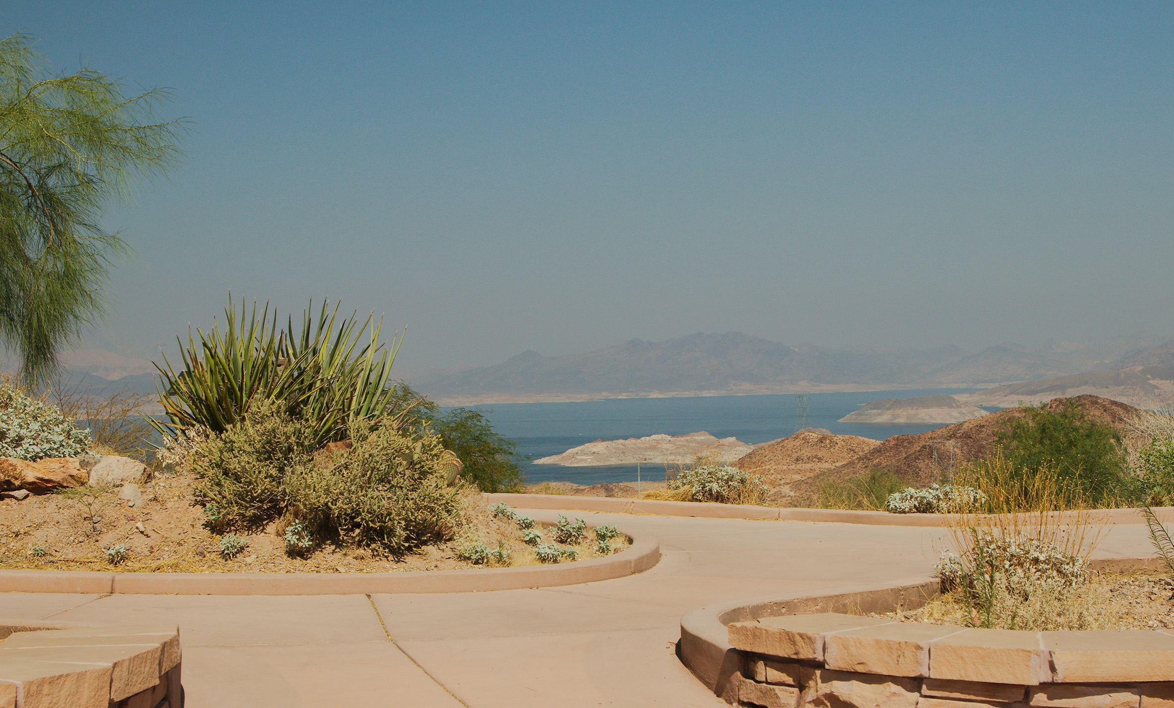
Day 1. We flew into Las Vegas and started our drive to Flagstaff, passing by Lake Mead.
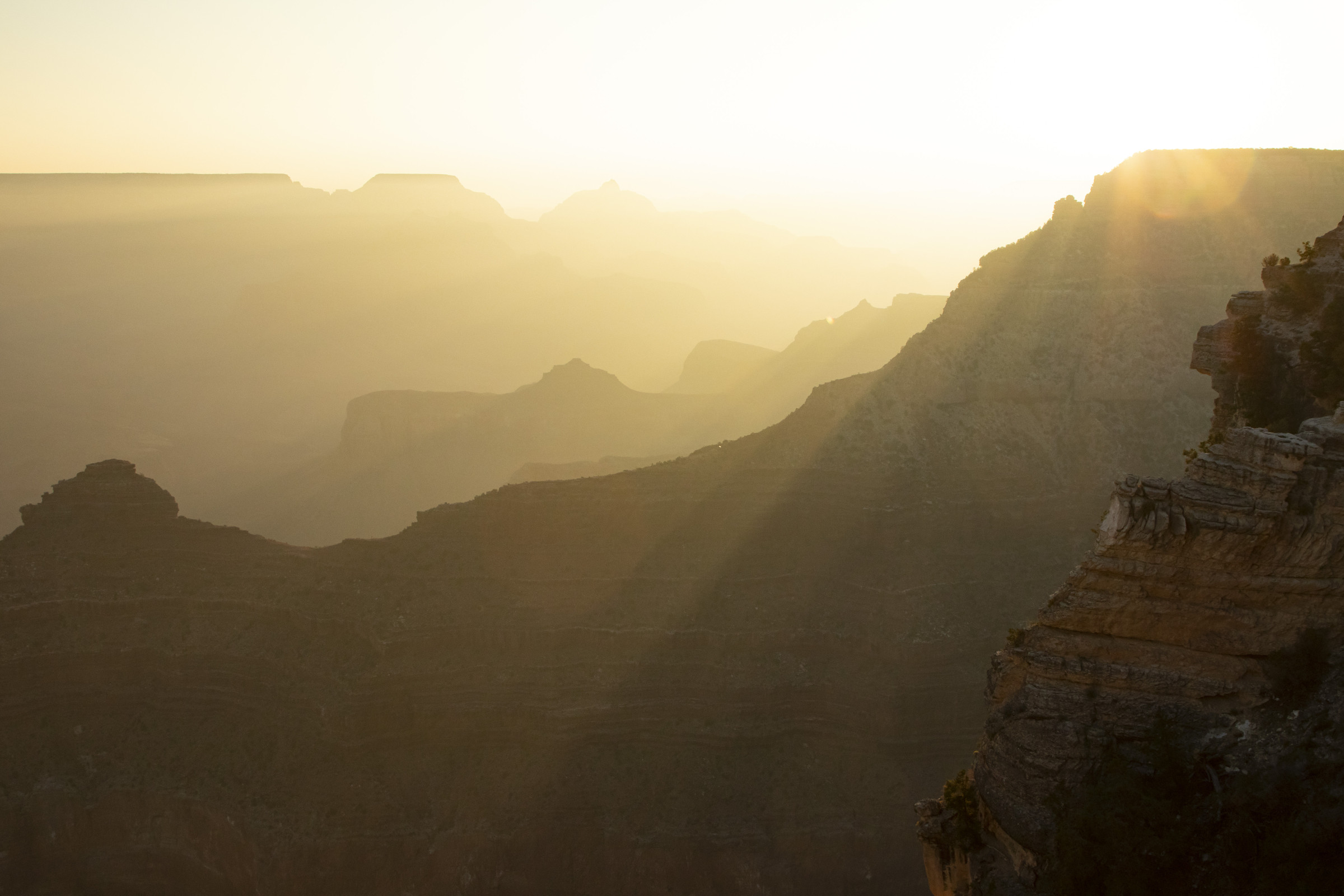
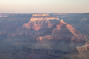
Day 2. We rose well before dawn to arrive at the South Rim of the Grand Canyon in time for first light. This schedule would become our routine for the trip.
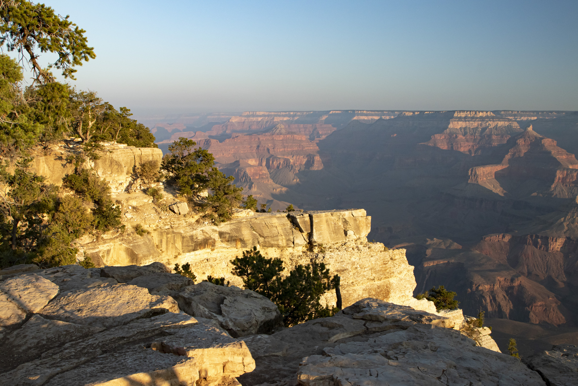
We walked along the rim trail for a few miles before starting our drive to St. George.
Day 3. Once again, we woke before dawn, this time to drive to Bryce Canyon and watch sunrise at Inspiration Point.
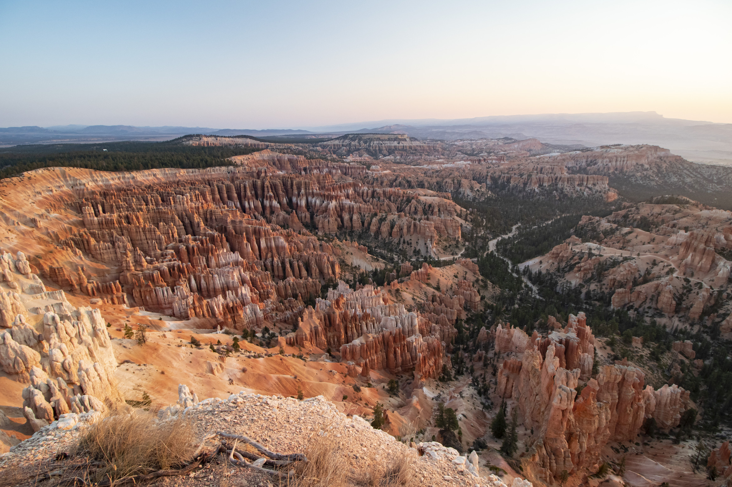
Bryce is known for its hoodoos, the earth’s largest concentration of these thin column rock formations.
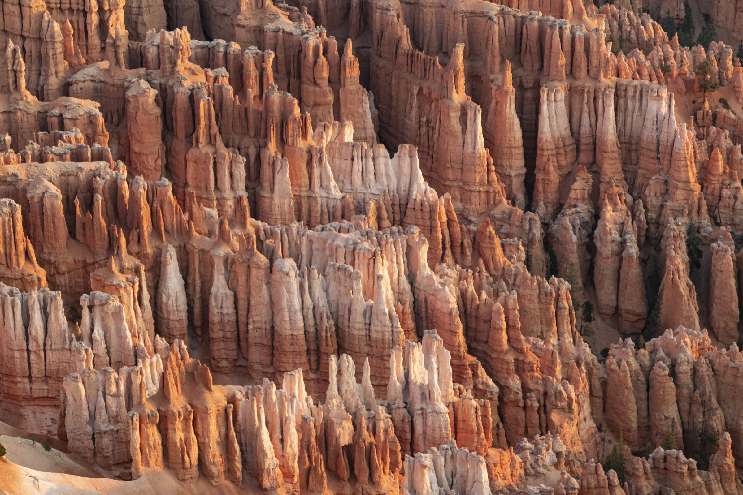
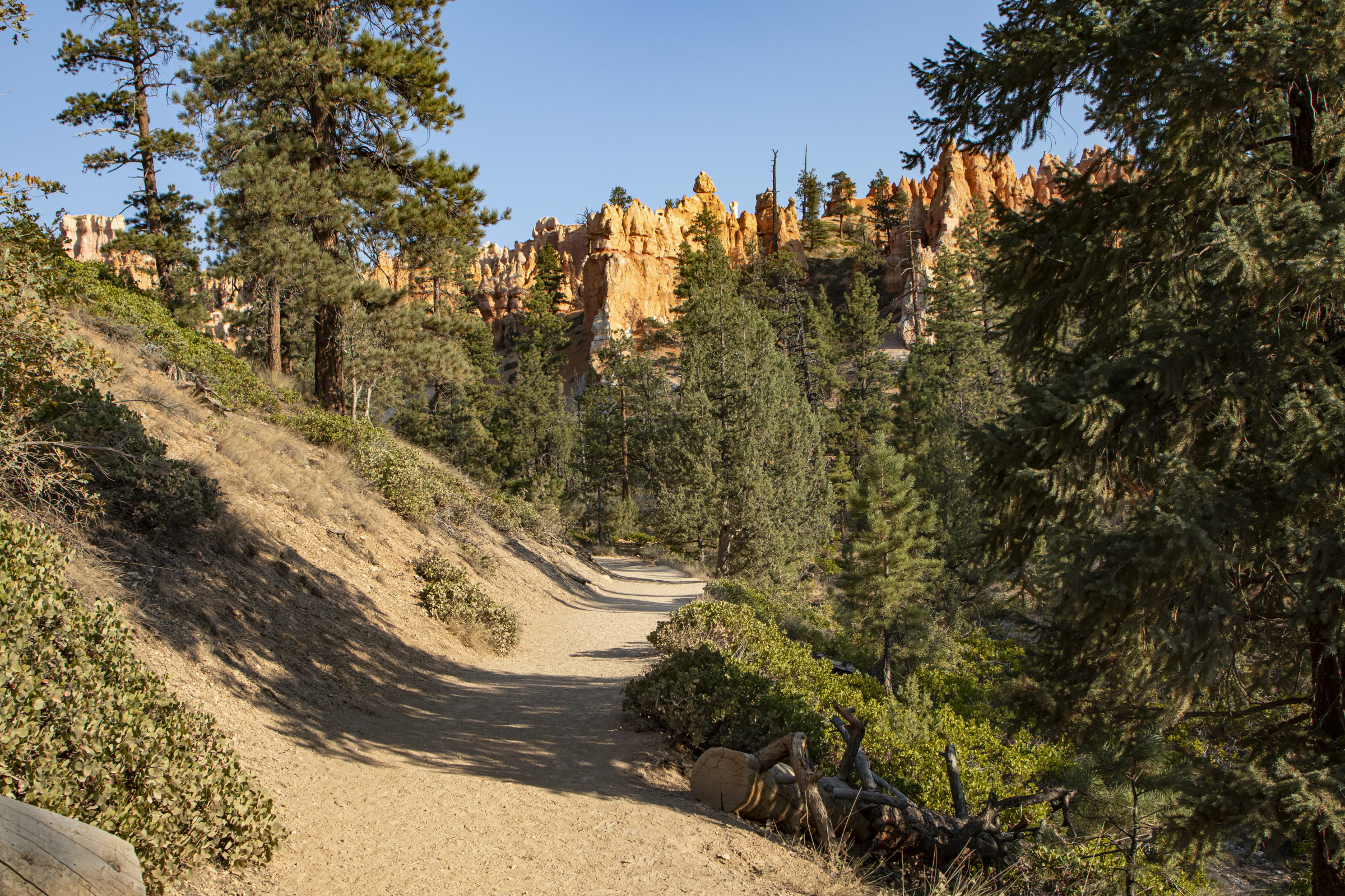
We took the Navajo Trail from Sunset Point into the canyon and to the Queens Garden Trail, which led us to Sunrise Point at the rim. The elevation of Bryce Canyon ranges from 8,000 to 9,000 feet, and I experienced a bit of altitude sickness as we climbed our way up through the hoodoos.
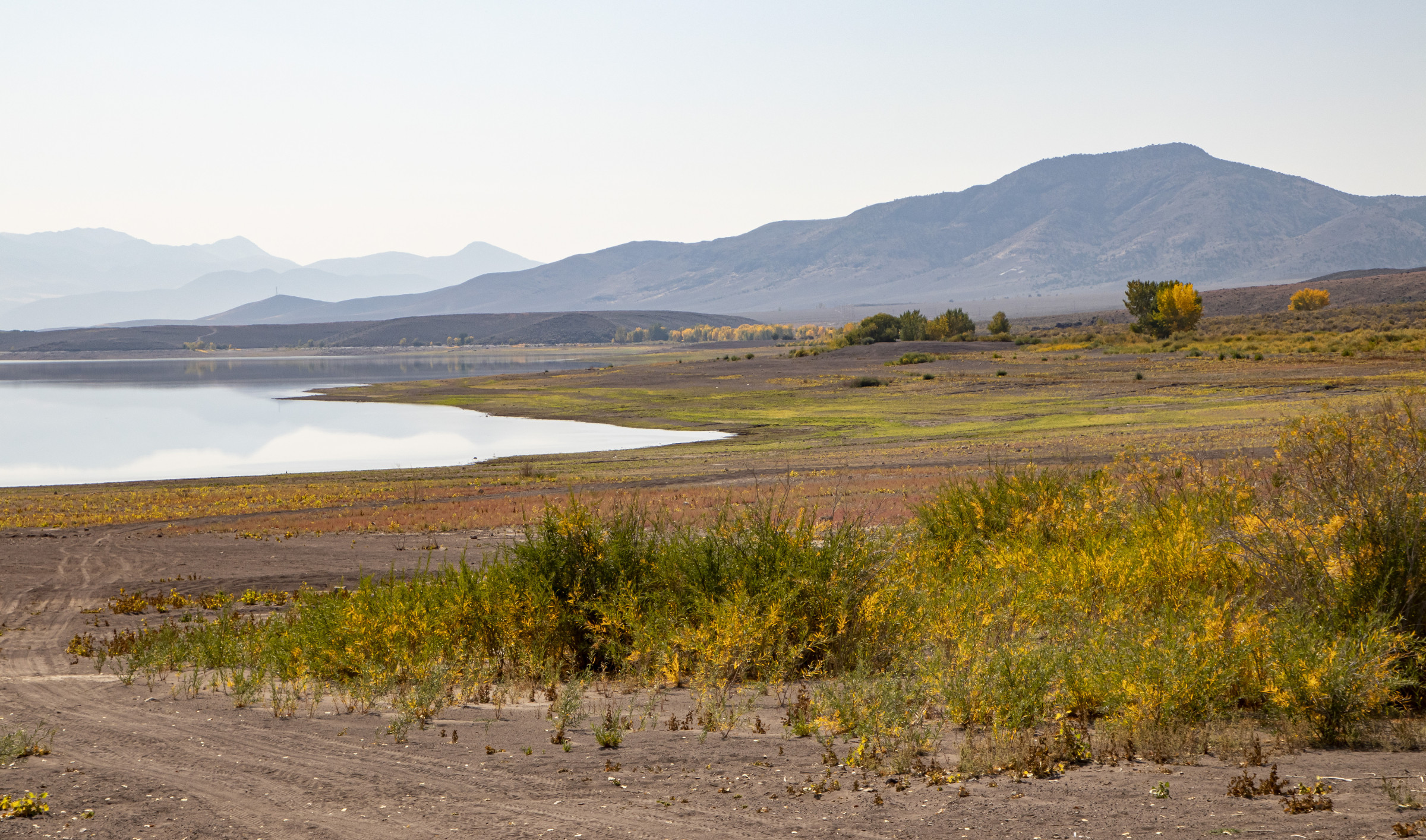
We had a long drive to Moab, so we left Bryce around noon. Along the way, we spotted a lake, which turned out to be a reservoir. We stopped at Piute State Park where the cottonwood trees were changing to brilliant yellow.
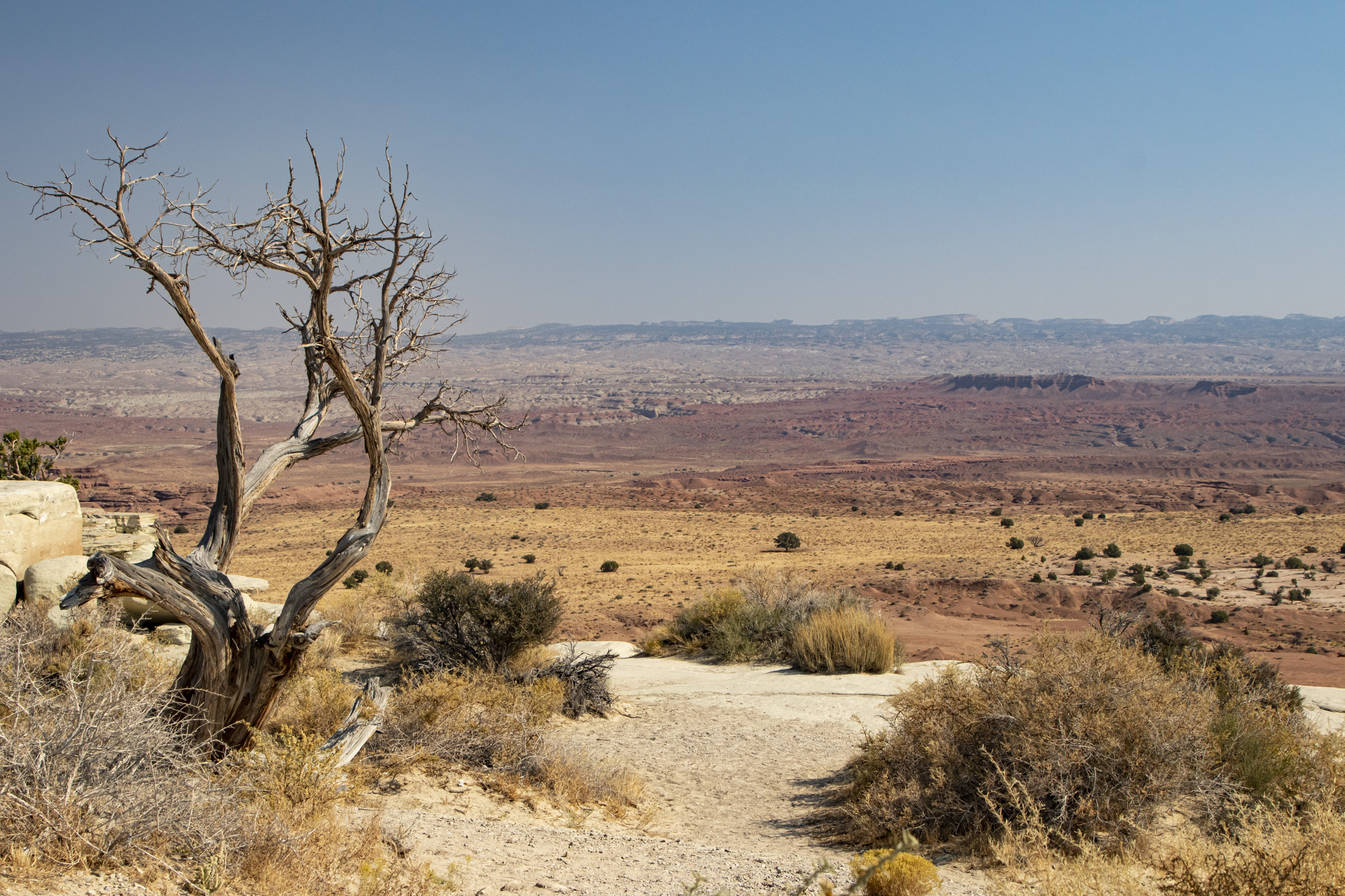
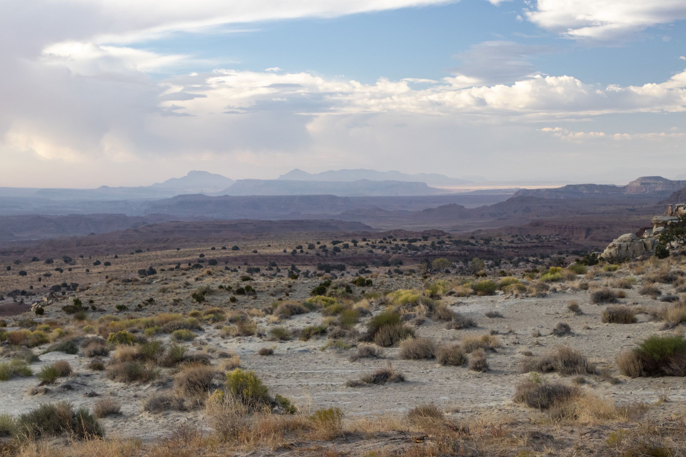
There were several pull-offs along Interstate 70, all of which had amazing views of the desert.
Day 4. From Moab, we once again started out in the darkness to watch sunrise at the Windows Section of Arches National Park.
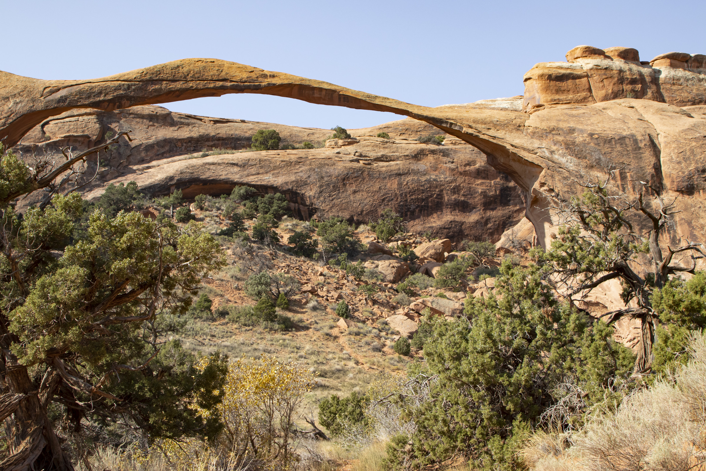
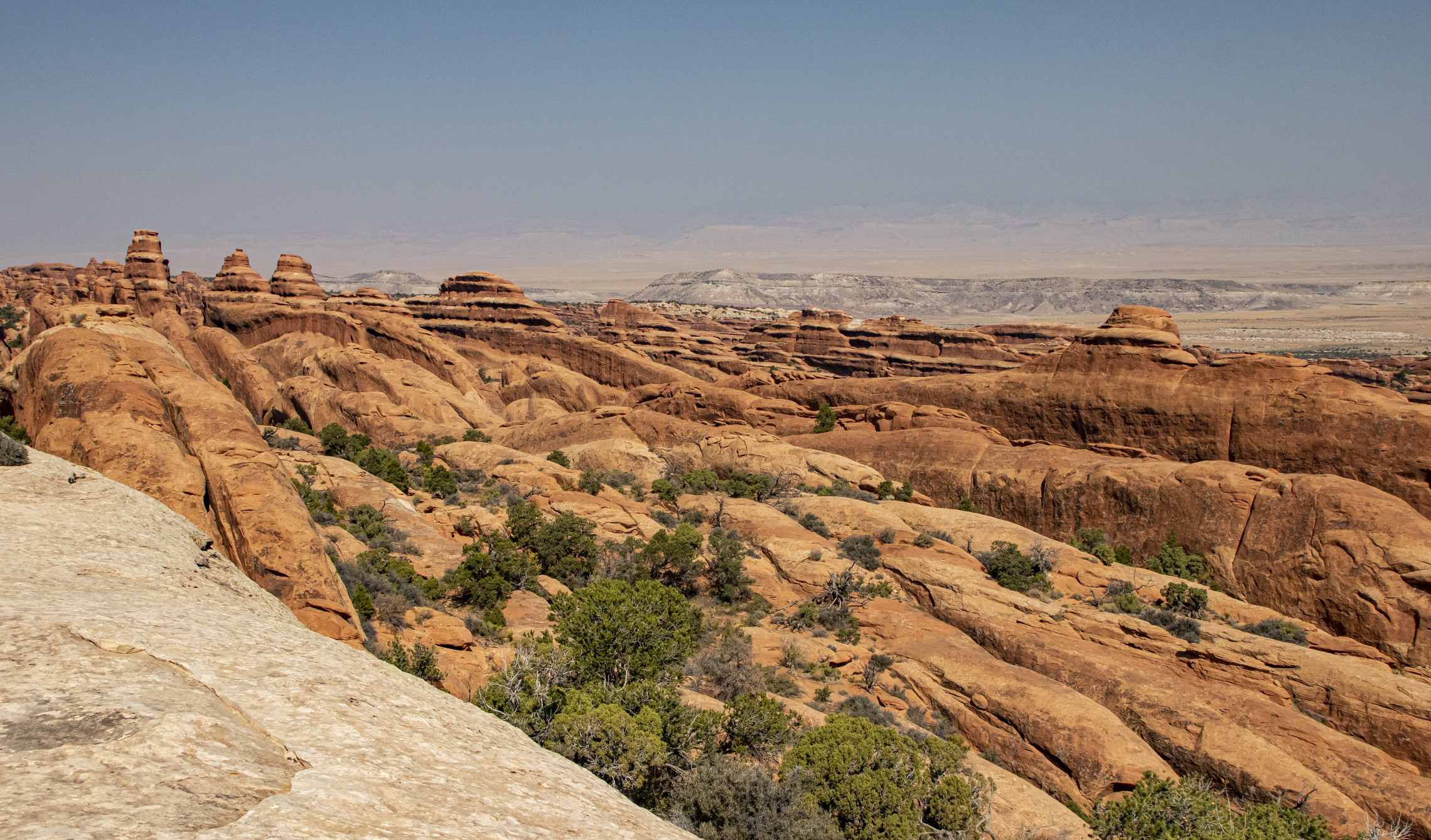
By late morning, we arrived at Devils Garden and walked to Landscape Arch.
When we set out, we weren’t certain whether we would continue past Landscape Arch to Double O Arch and Dark Angel. The hike to Landscape Arch was about 2 miles round trip, but if we hiked all the way to Dark Angel and took the spur trails to Navajo and Partition Arches, it would be closer to 7 miles round trip. While we’re accustomed to that distance, it was quite warm, and we hadn’t planned for lunch. We decided to go for it anyway. It was well worth the time and effort!
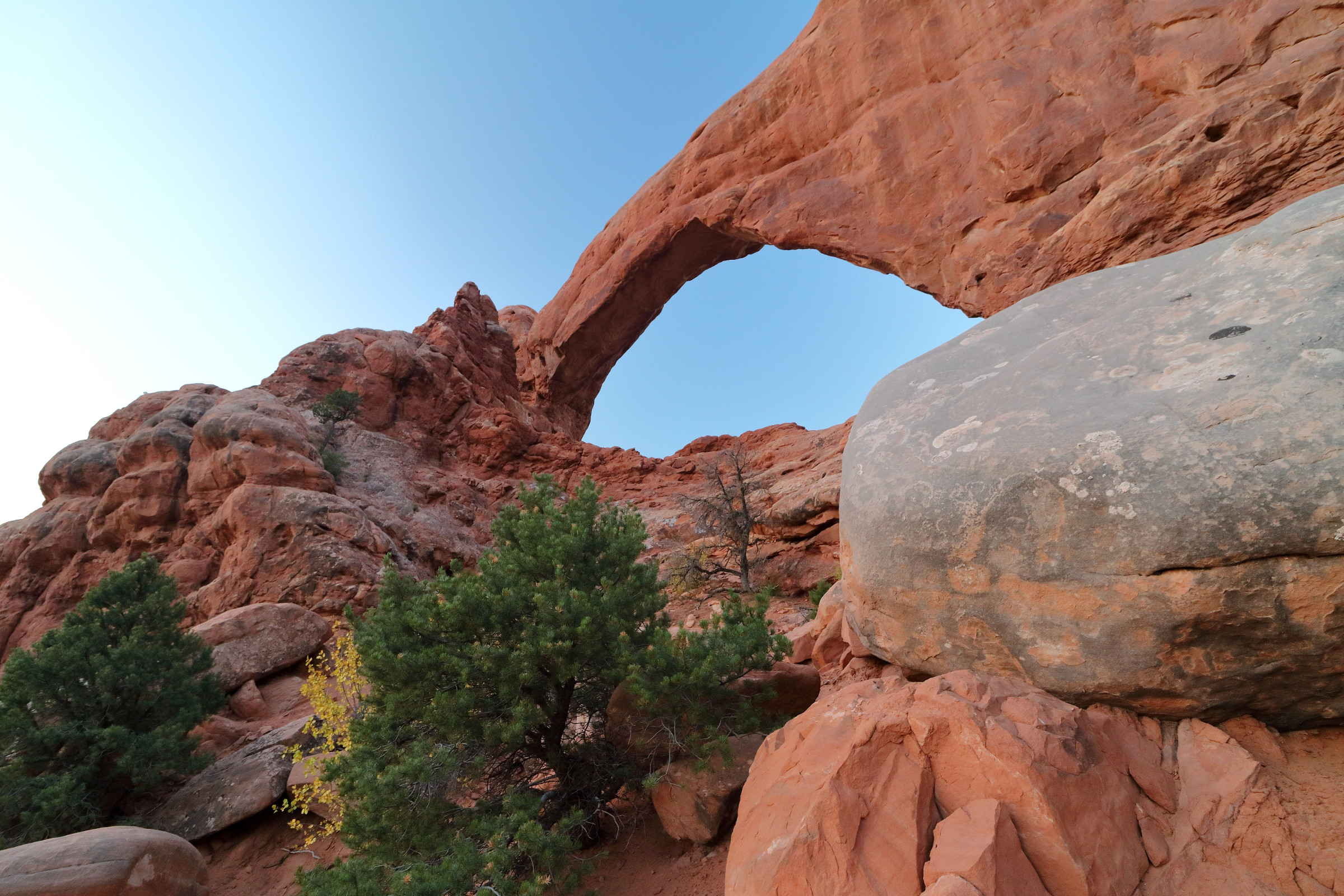
We took the spur trail to Partition Arch, which is to the right of Landscape Arch and overlooks the valley.
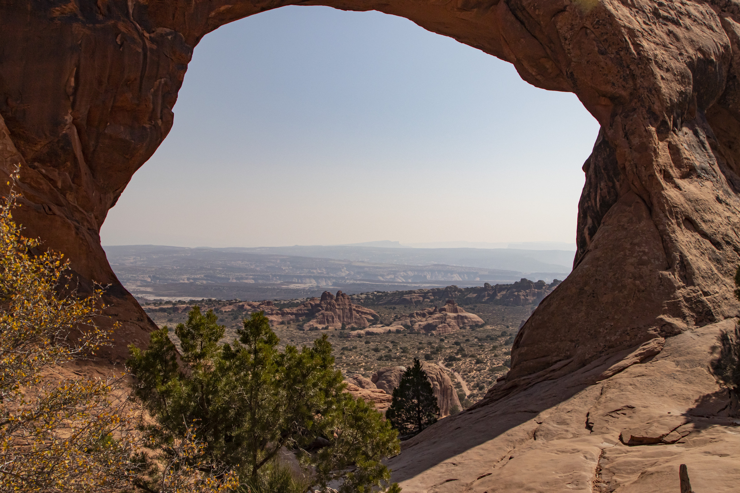
Back on the main trail after the Navajo/Partition Arch spur, rows of fins (narrow rock walls) appear, and the trail traverses one, yielding spectacular views.
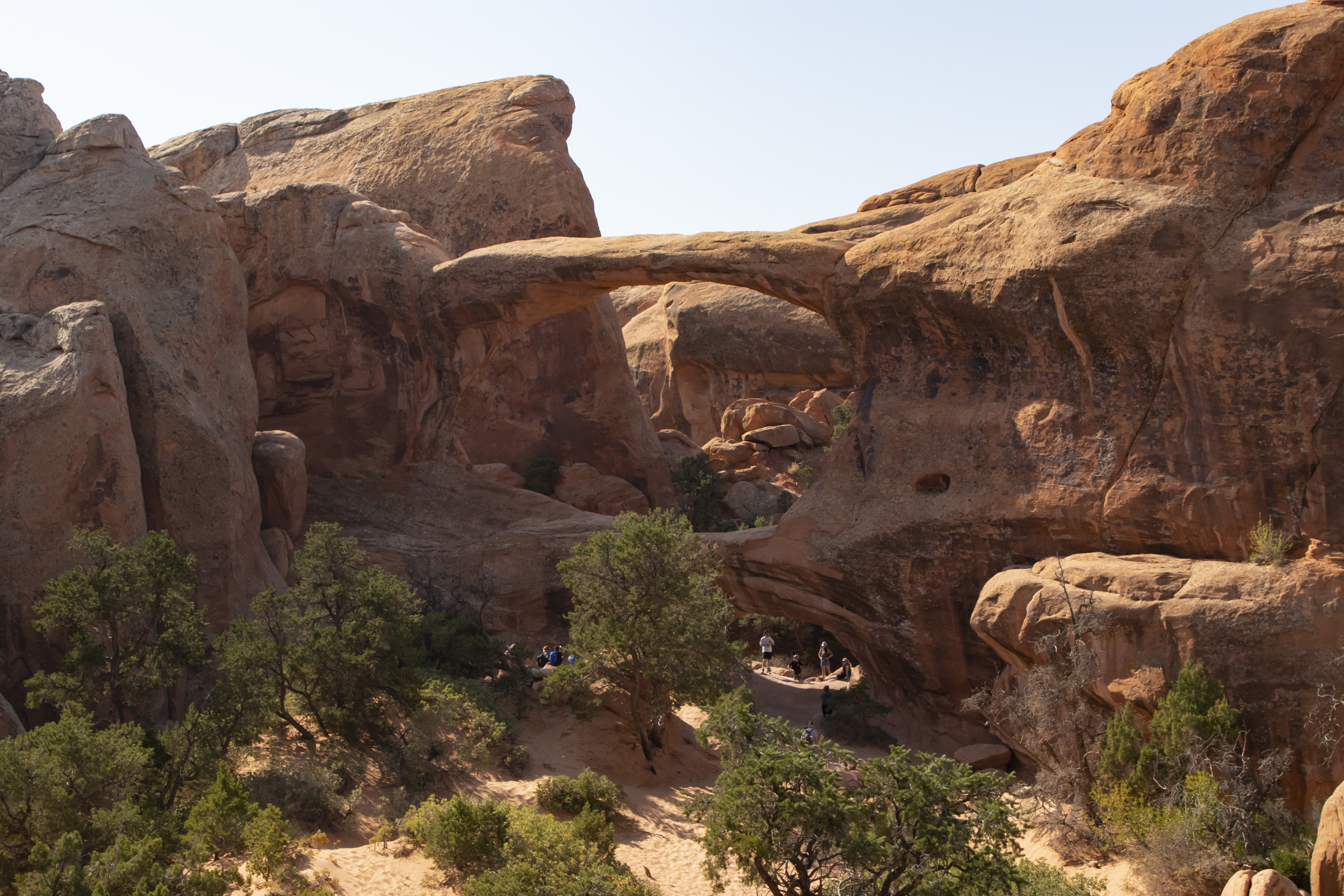
While difficult to see in the photograph, Double O arch is one arch on top of another.
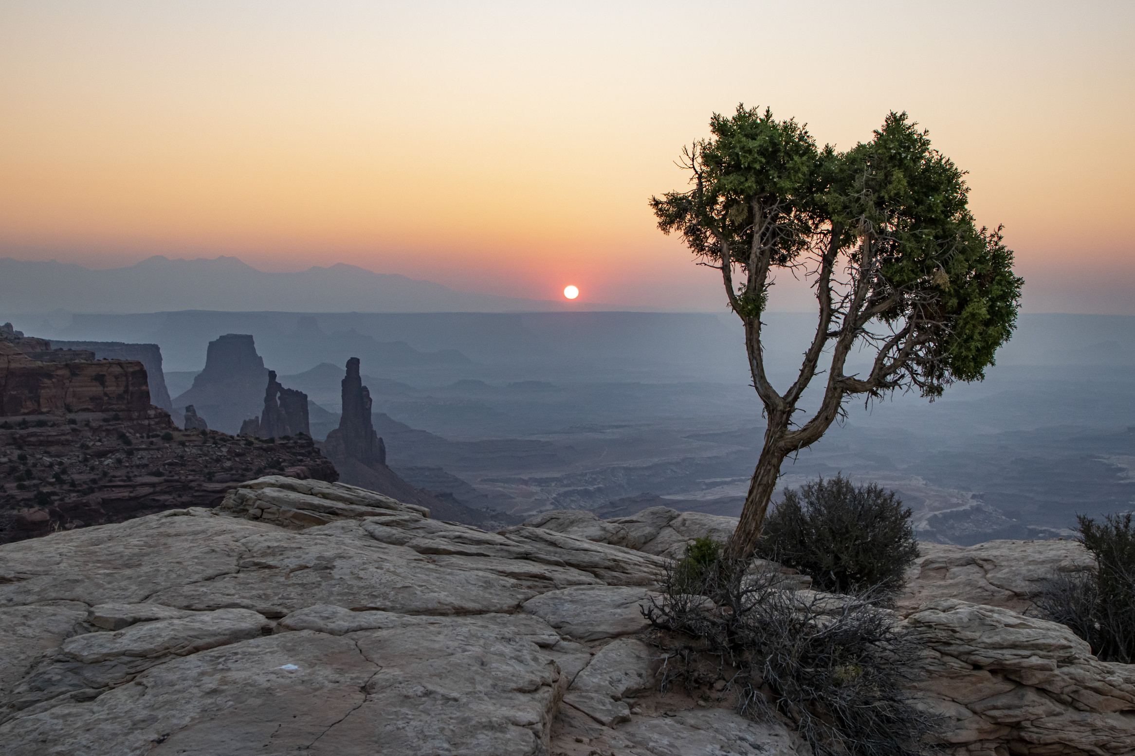
Day 5. We chose Mesa Arch at Canyonlands National Park to watch sunrise. The area in front of the arch was crowded, so we found a spot on the cliff to the north of the arch and set up there.
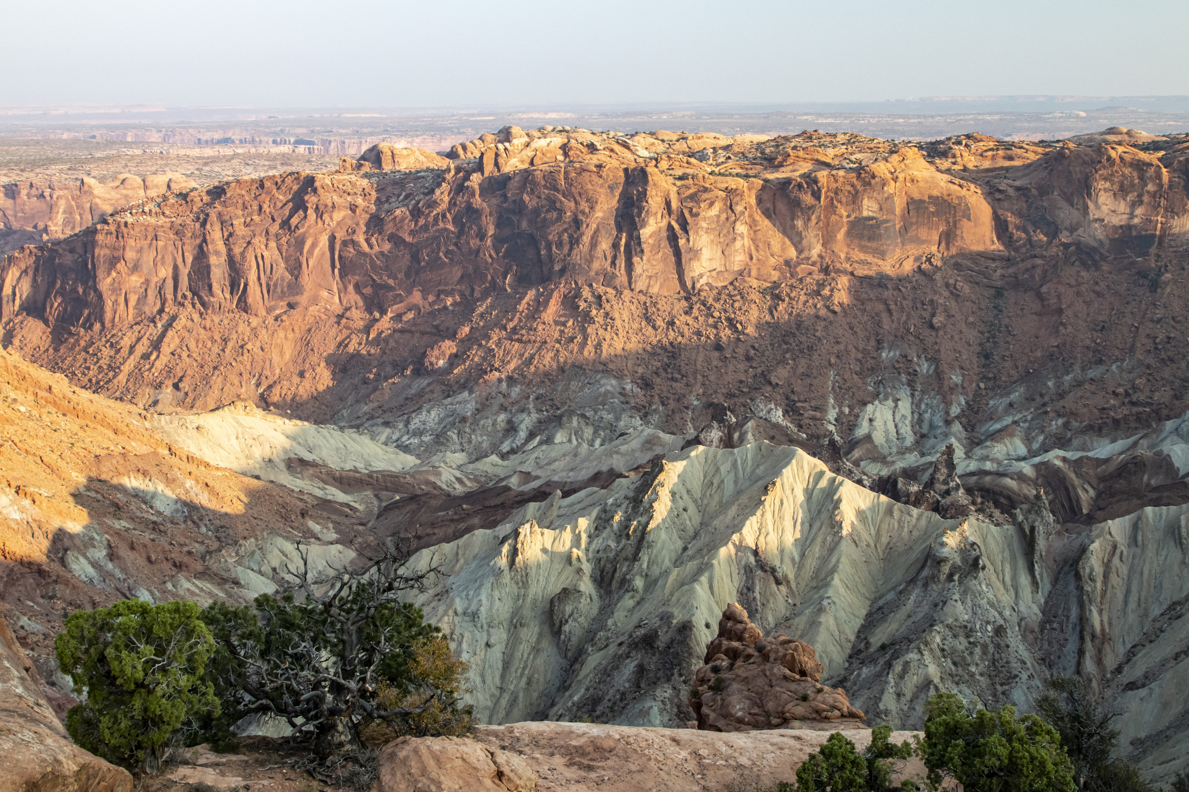
After sunrise, we hiked to Upheaval Dome, which geologists believe was created by a meteorite impact.
We then drove to Aztec Butte. Enticed by the presence of an ancestral Puebloan structure on a smaller butte along the trail, we decided to climb the Butte.
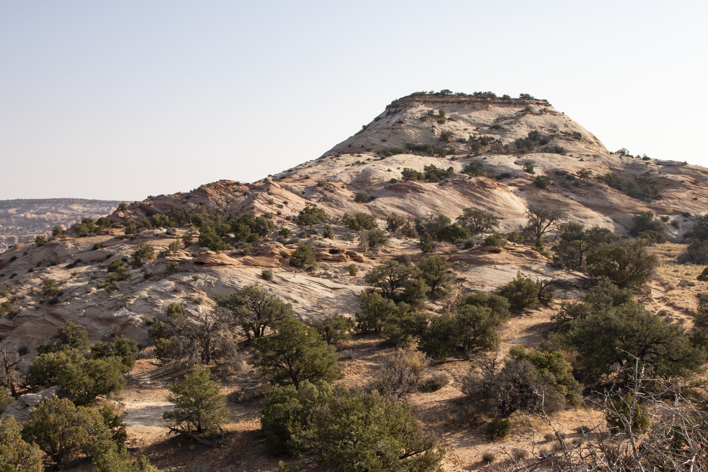
The views from the flat top of the butte were stunning.
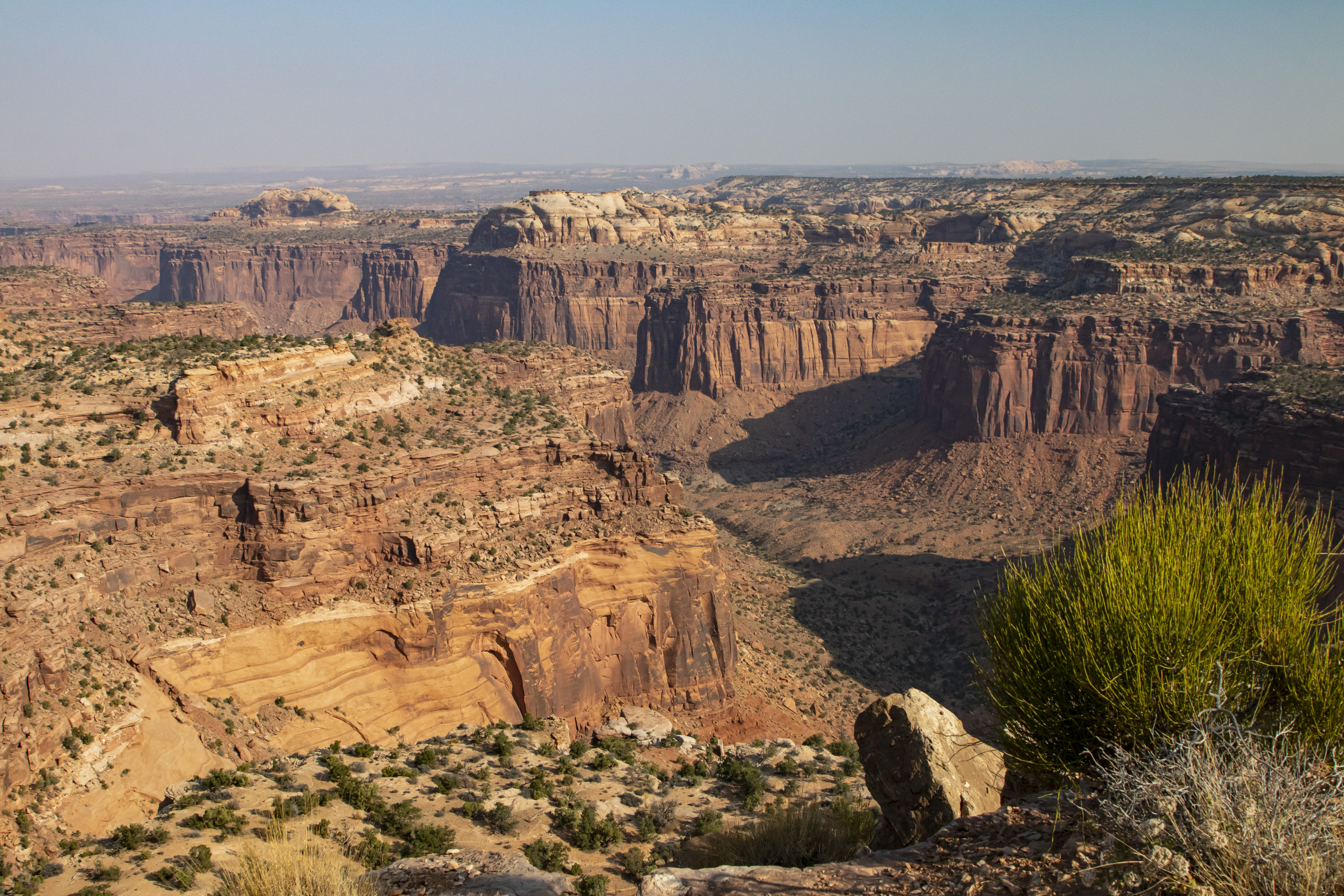
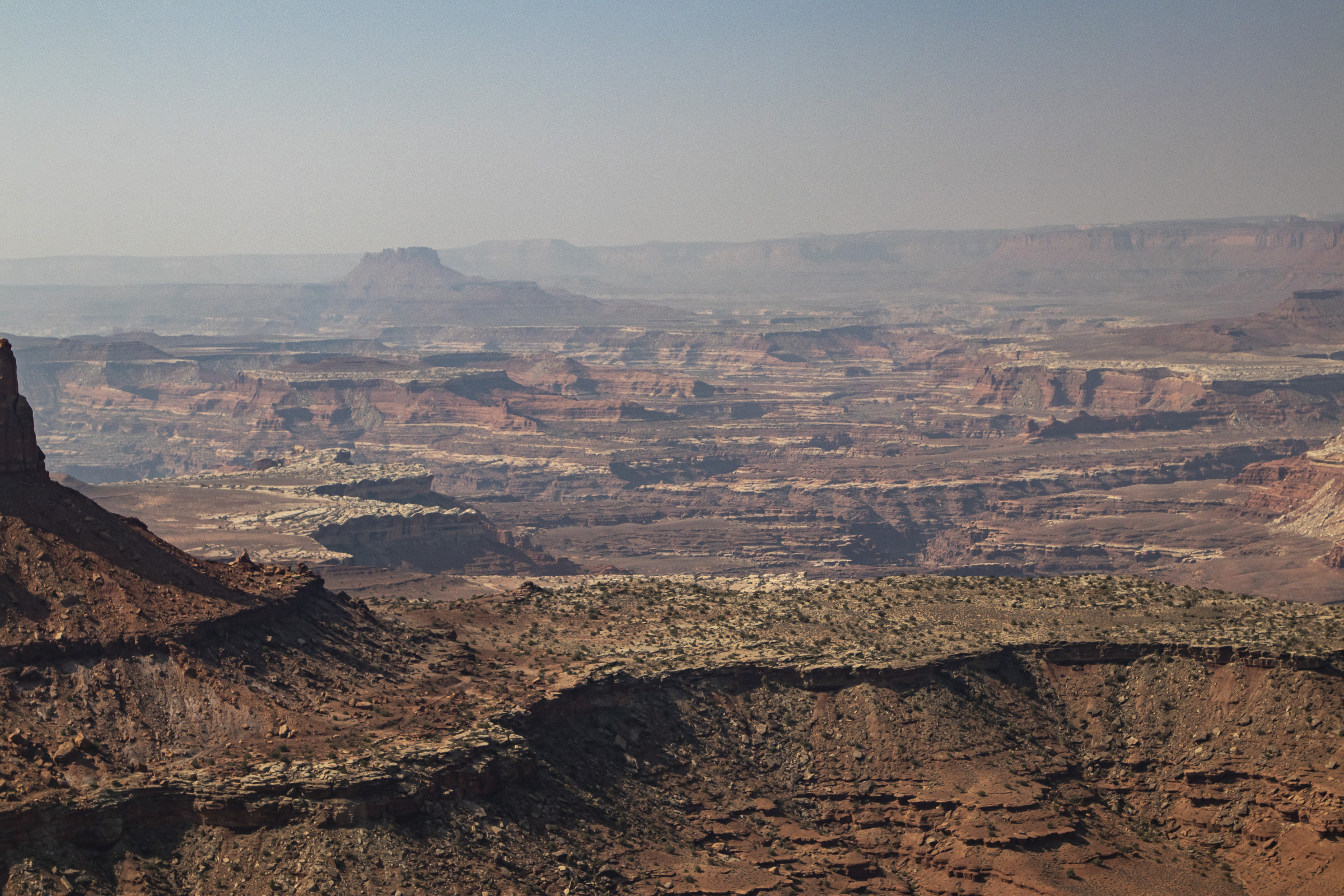
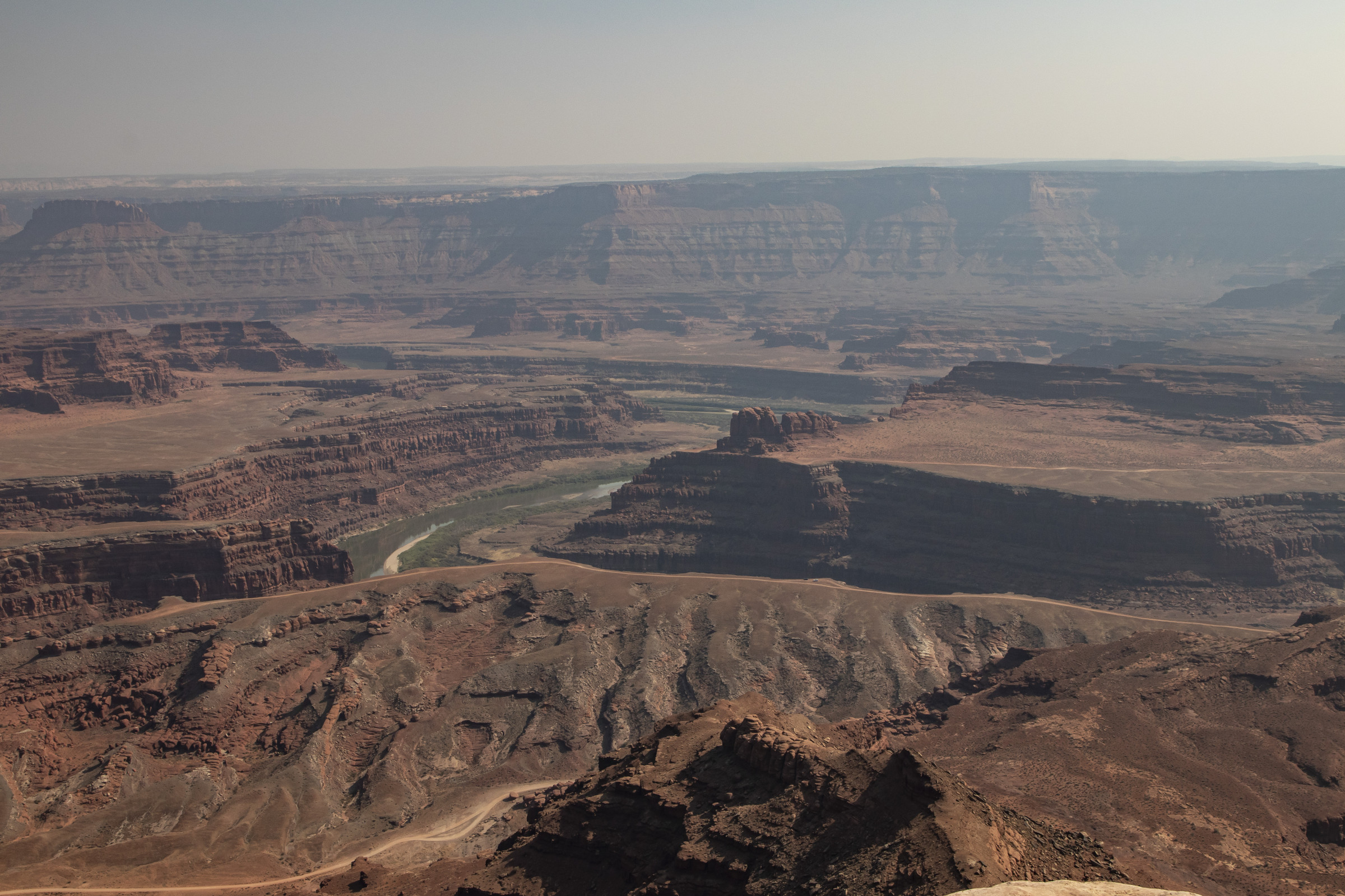
Equally impressive were the views from Grand View Point. Due to fires in California and northern Utah, there was a fair amount of haze throughout the trip. It was still amazingly beautiful, and we don’t regret going when we did.
 \
\
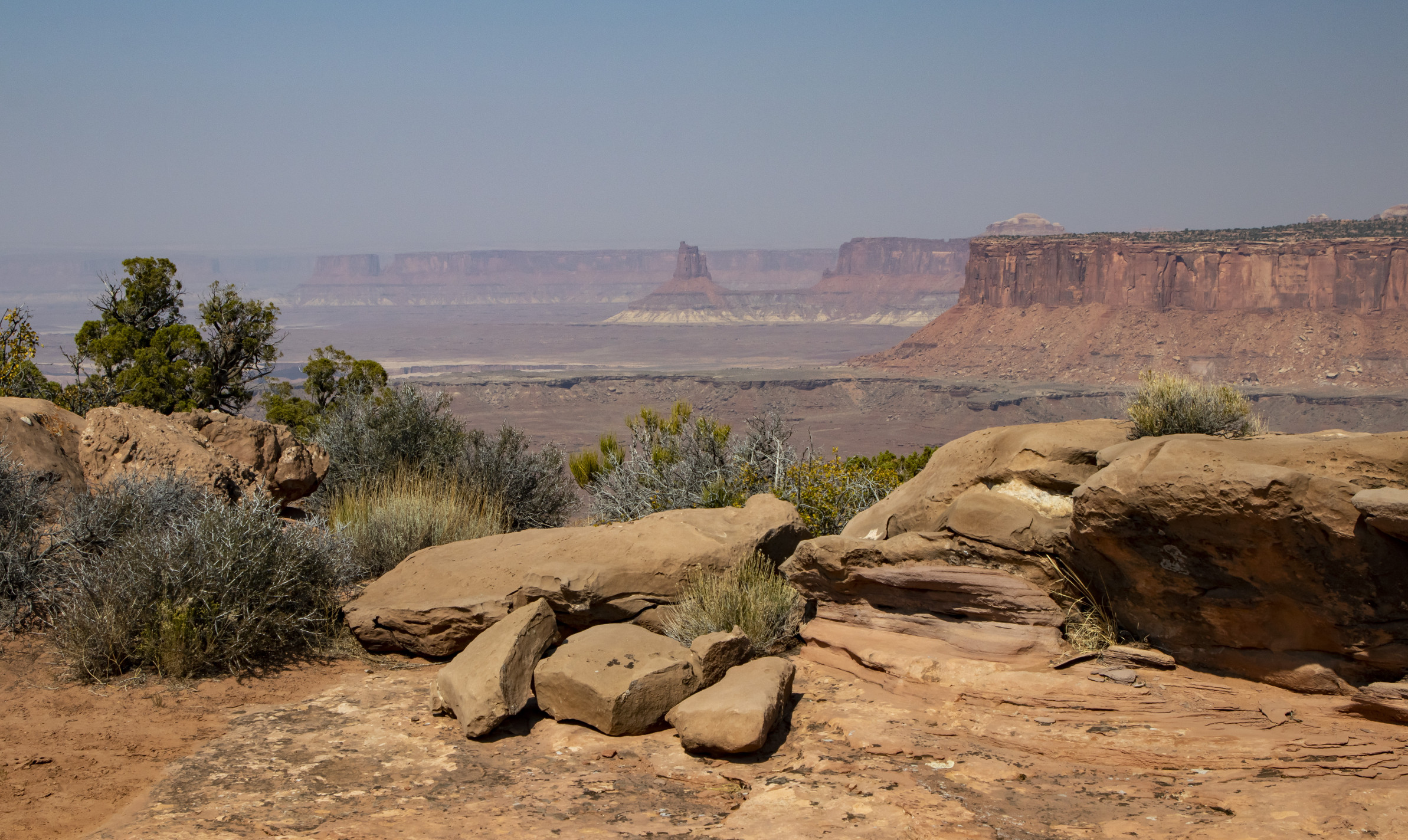
We left Canyonlands and stopped at Dead Horse Point State Park, which also offers views of the Colorado River.
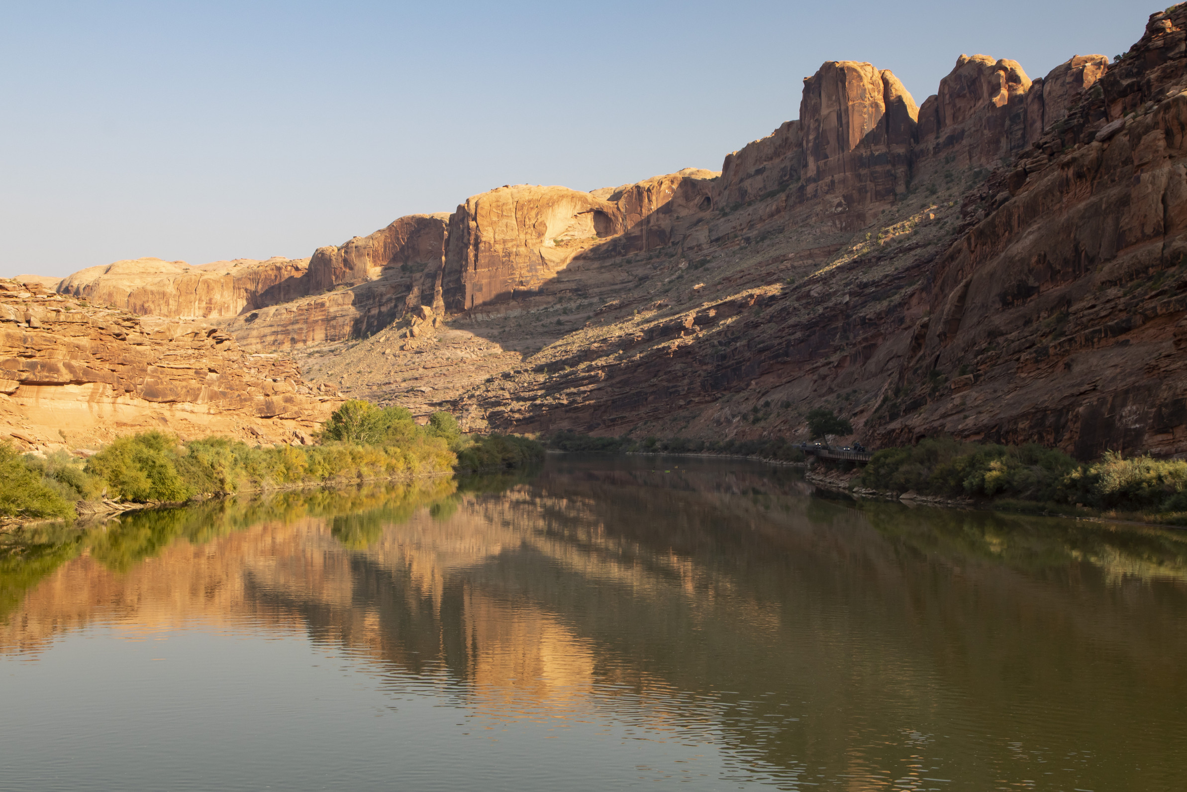
On our way back to the hotel, we made a final stop at a park in Moab along the Colorado.
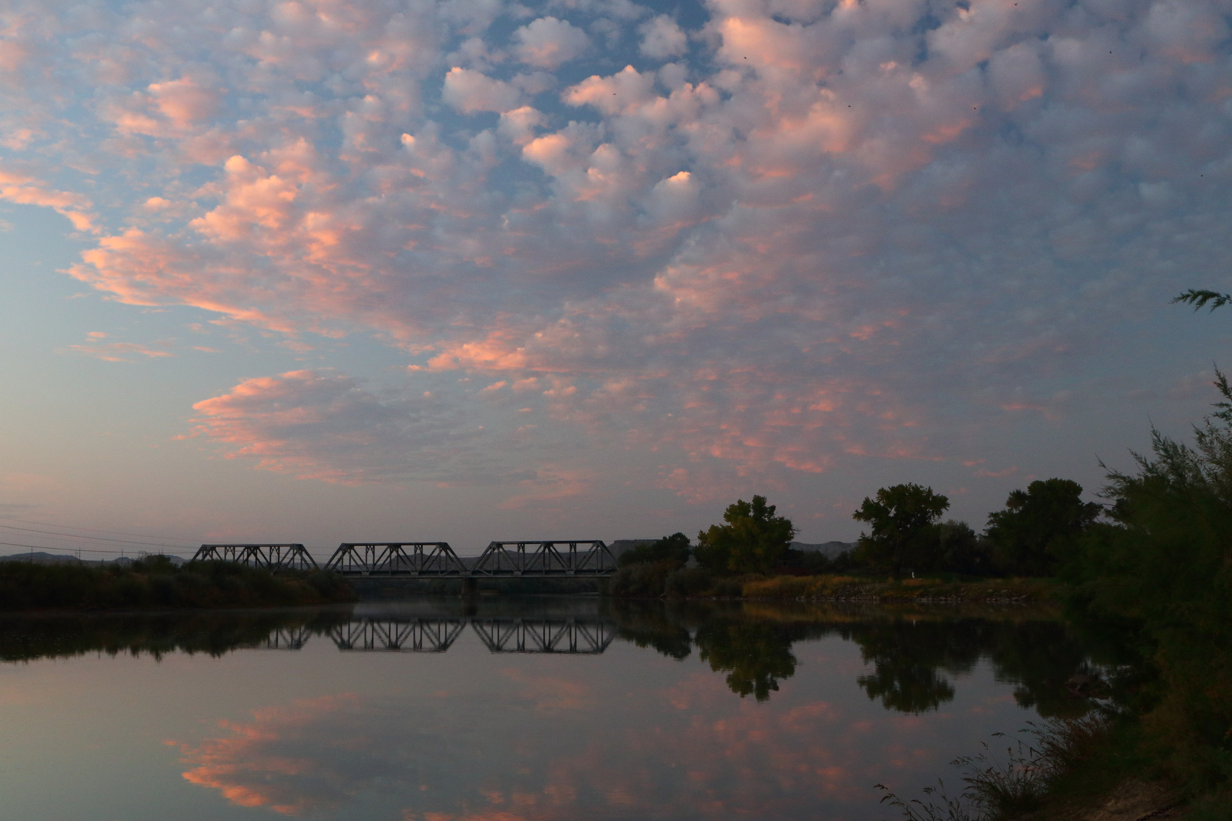
Day 6. Once again, we left our hotel before dawn to watch sunrise, this time at Green River State Park. Much of the park is a golf course, so there wasn’t a lot to see other than a small section of the river.
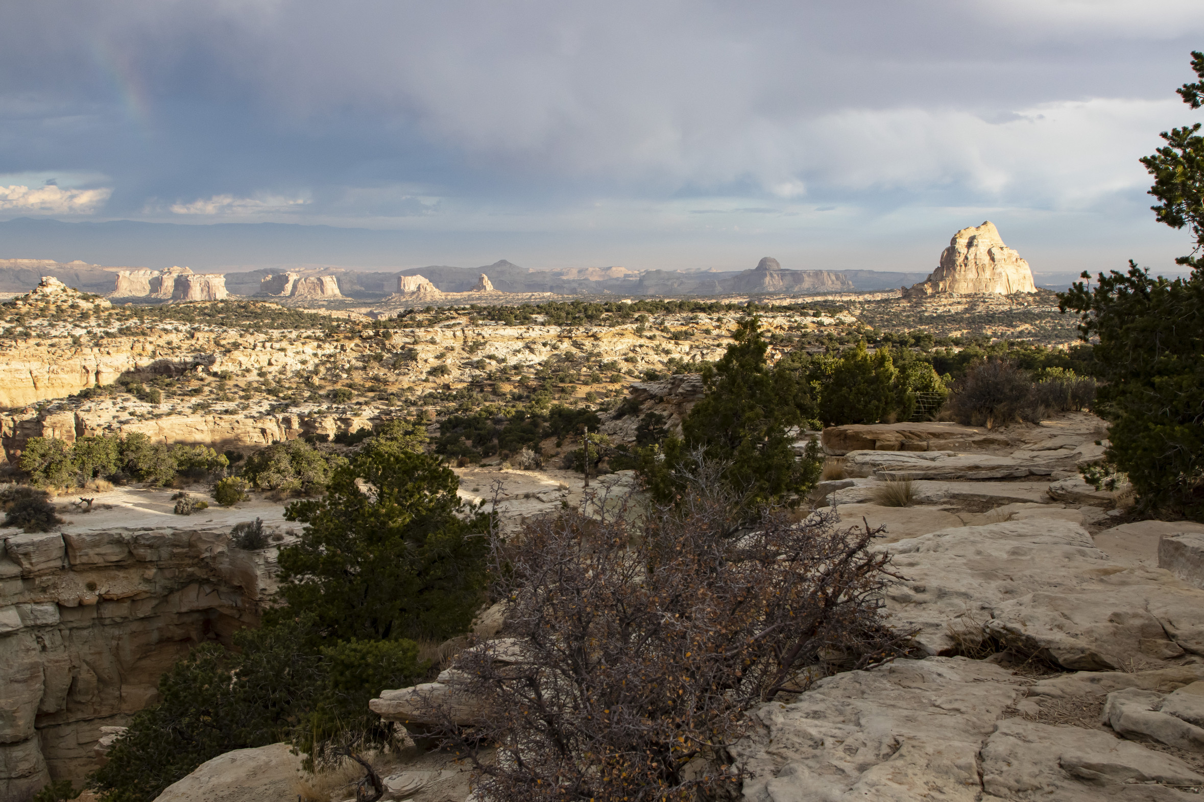
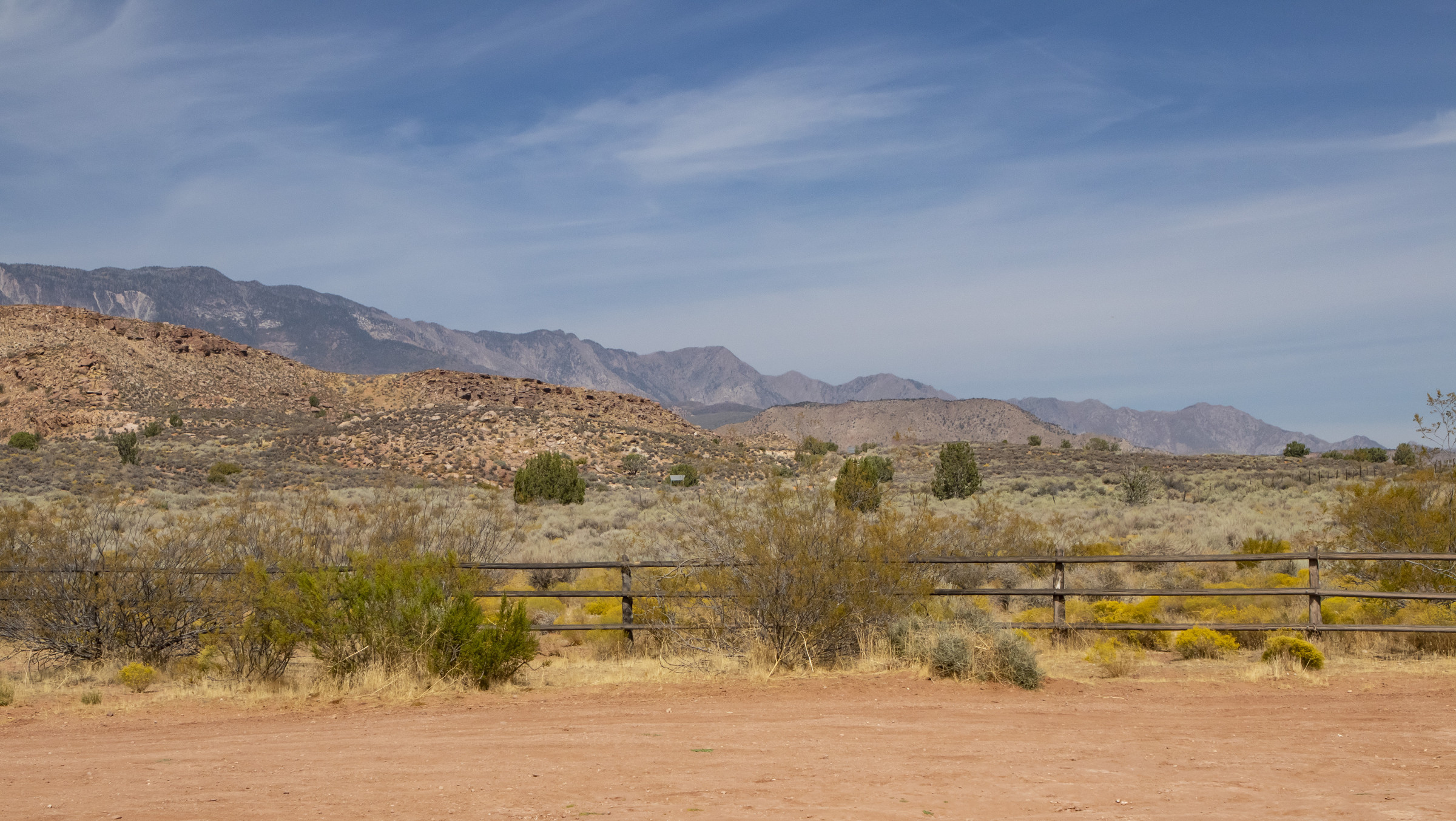
We were then back on Interstate 70, stopping at pull-offs along the way. It seemed as if there were a storm brewing, though, fortunately, it never broke. The clouds and desert colors made for excellent photography.
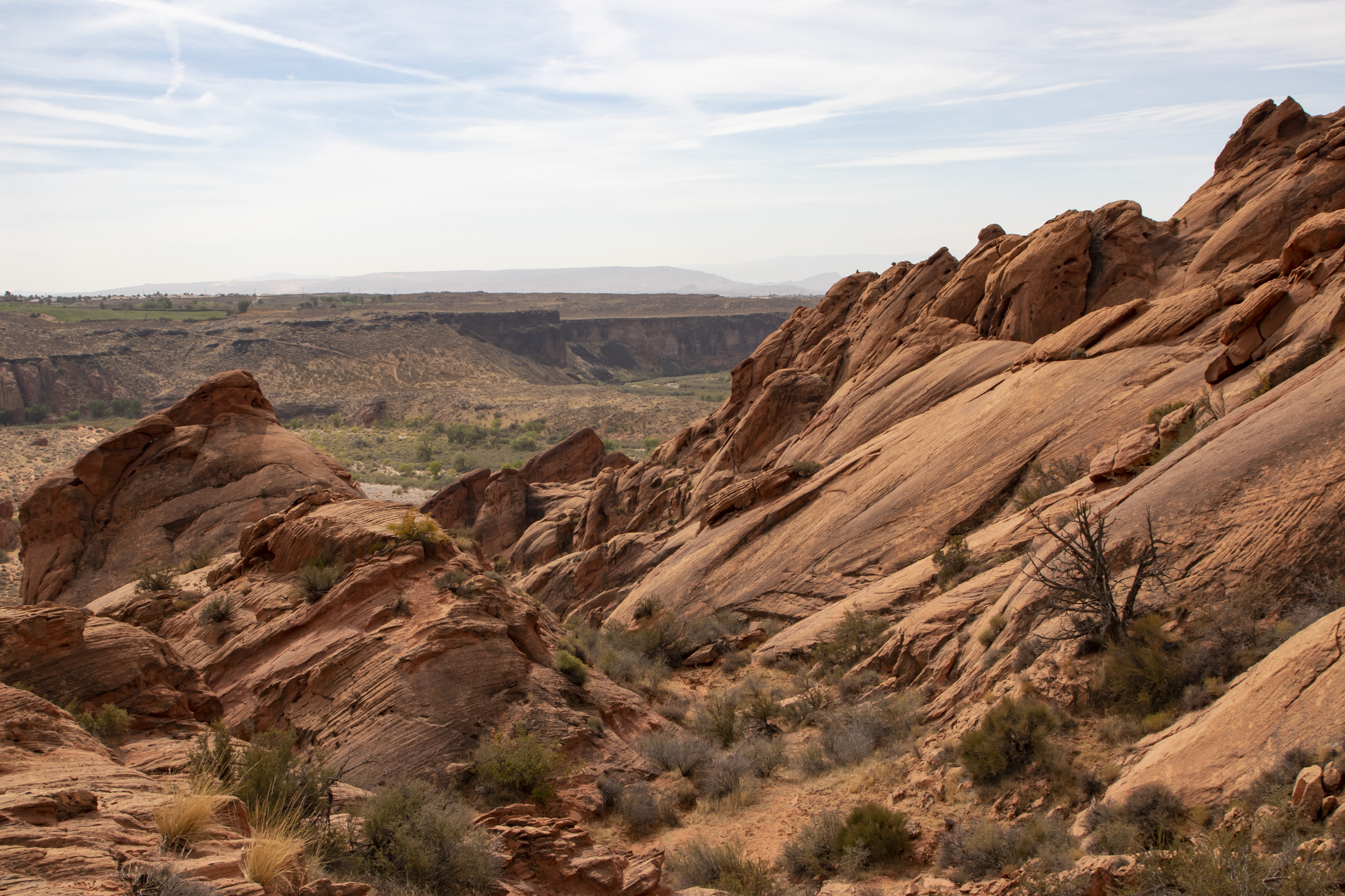
Though Day 6 was predominantly a travel day, we had one activity planned: a short hike to Babylon Arch at Red Cliffs National Conservation Area near St. George, Utah.
There was a map of the trail at the trailhead kiosk, but no signage along the trail, which seemed to disappear in the rocks and sand.
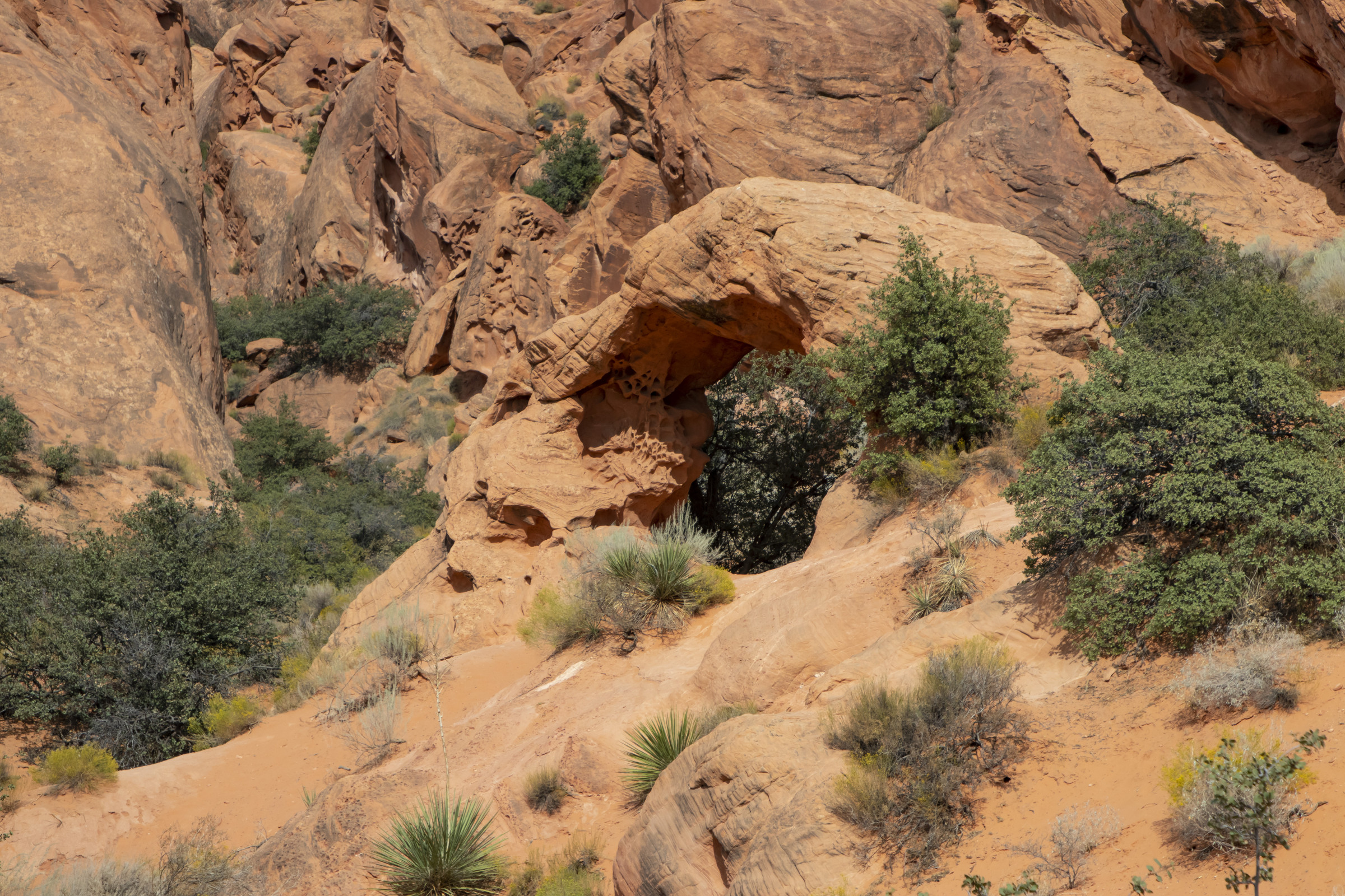
With the complete lack of signage, we got off trail and found ourselves atop the red rock formations, searching for a way to the sandy areas below where we believed the arch was located. We managed to find a narrow passage and, using the GPS on our phones, to navigate to the arch. We were elated that our rock climbing efforts had not been in vain, and we’d found our destination.
On our way back, we found what appeared to be the trail. There were a few markers, but in general, returning to the trailhead was something of a process of trial and error. At the top of a sandy incline, we got a view of the Virgin River.
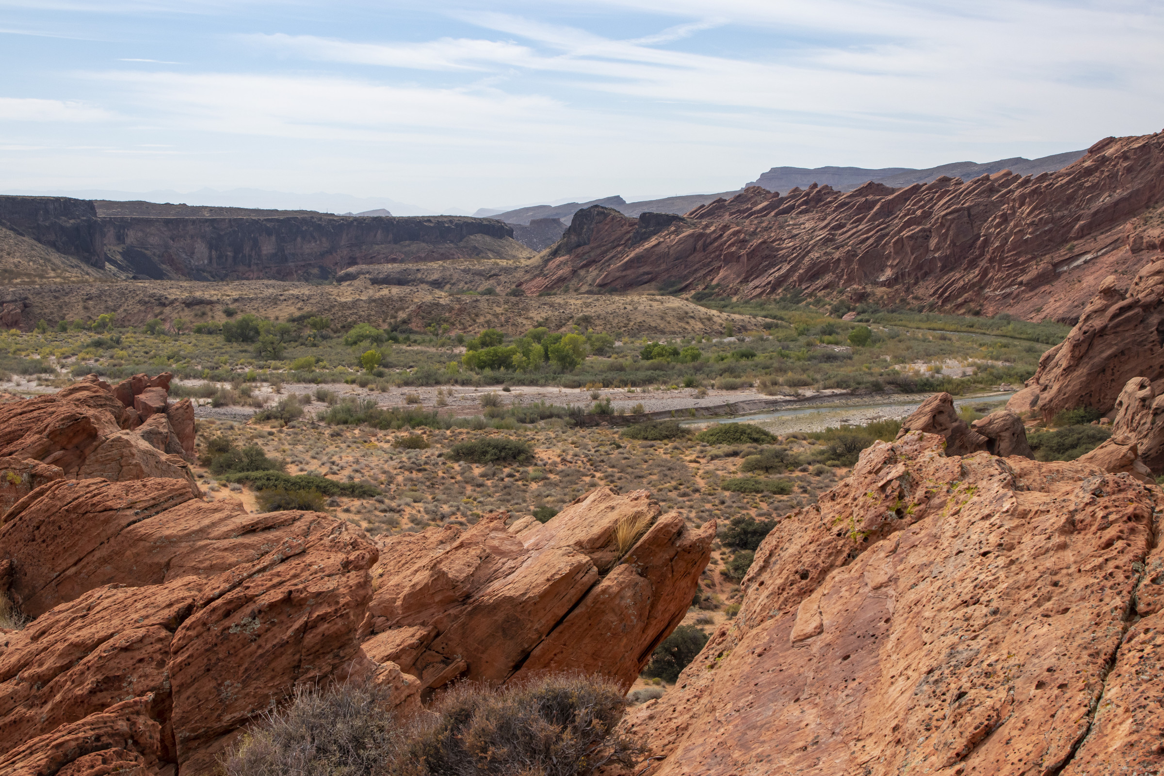
Note: although we had no idea where, specifically, we were at times, the area has excellent cell service, so we were able to navigate and weren’t “lost” in the wilderness. The Virgin River serves as a landmark and can be seen from many of the rock formations. We’d recommend the hike due to the unique geology and scenery but warn not to count on signage or a well-worn trail.
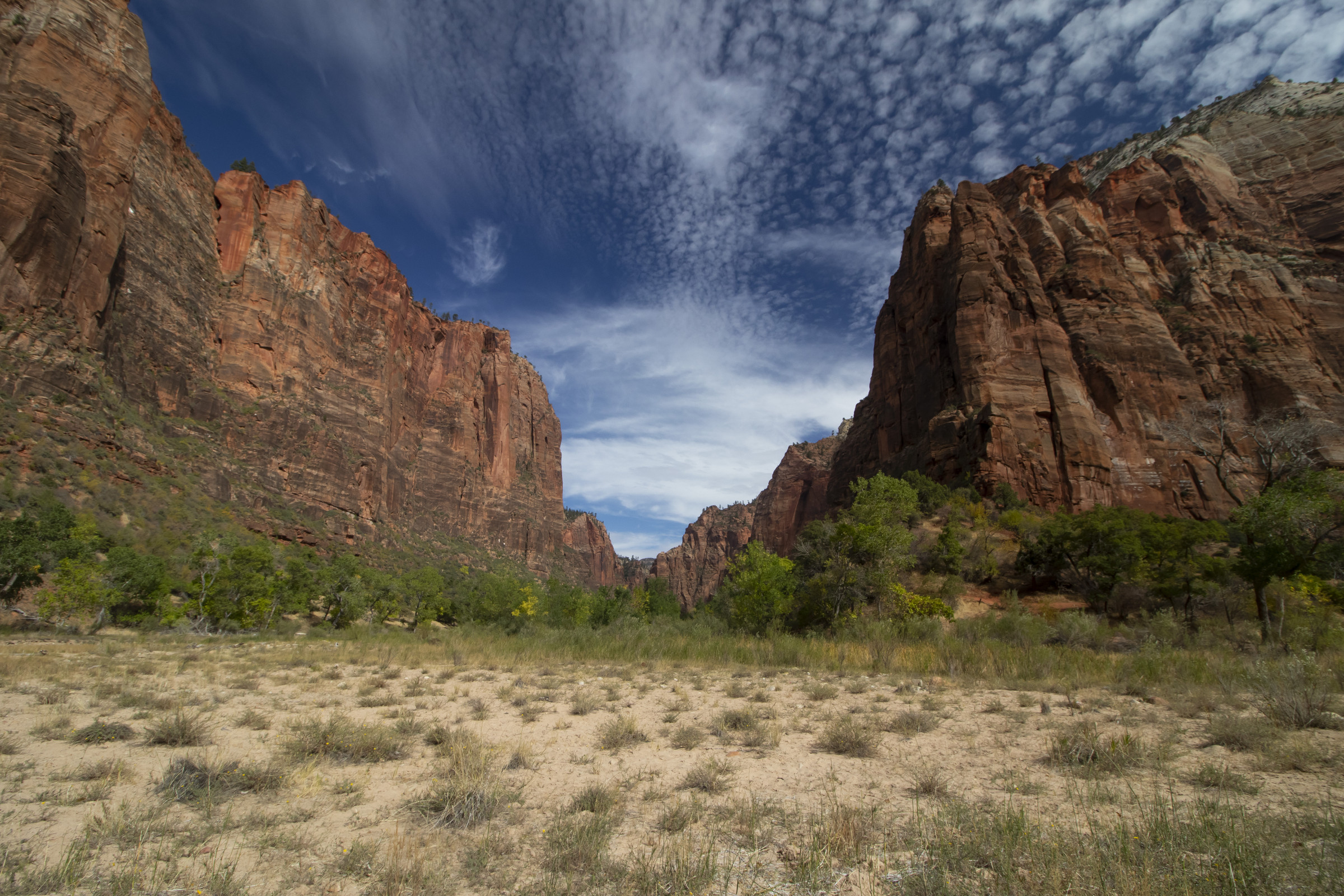
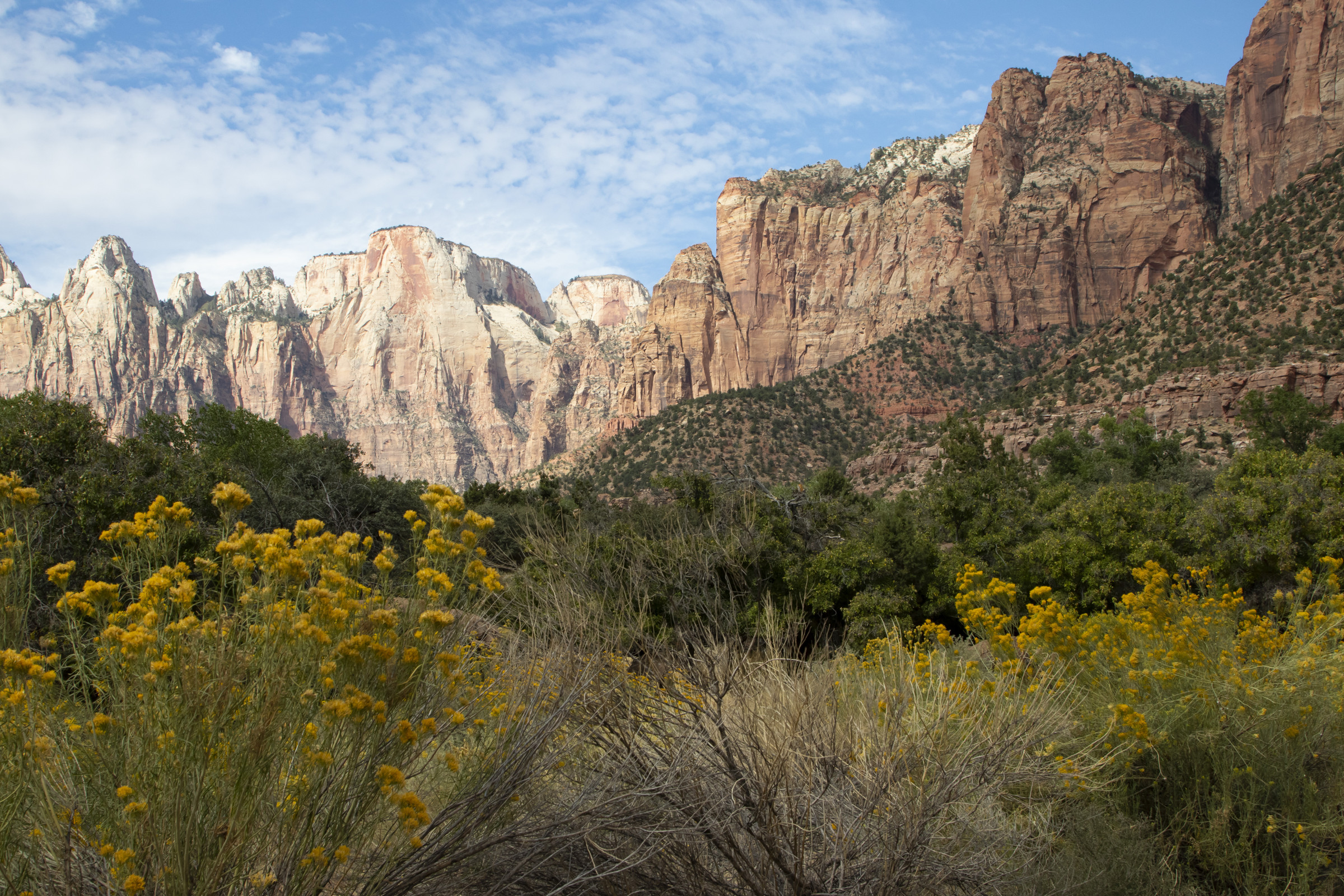
Day 7. To access many parts of Zion National Park, we had to book shuttle tickets in advance. To ensure we had enough time to find parking, we chose the 8am shuttle, so we missed first light (though the sun didn’t actually rise over the cliffs to light the valley until much later). We hiked the Lower Emerald Pools Trail from Zion Lodge to the Grotto. The waterfalls were barely flowing as dry season was well underway.
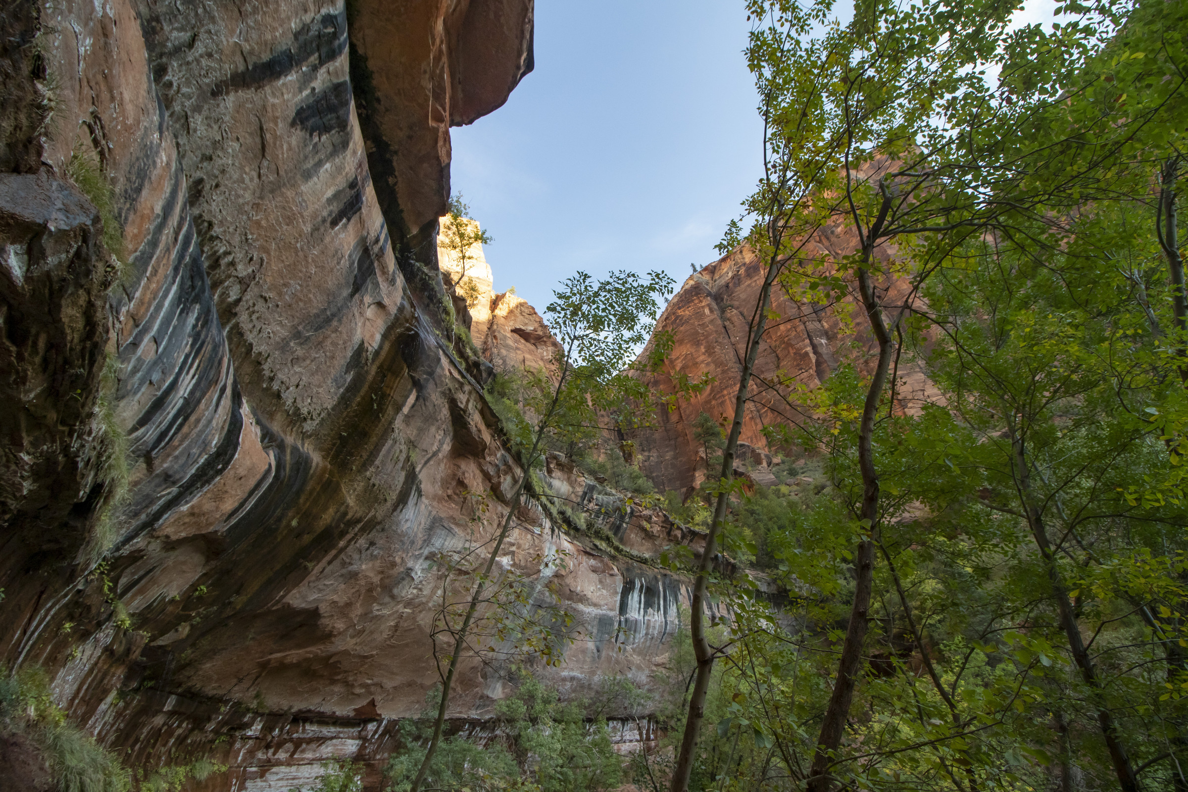
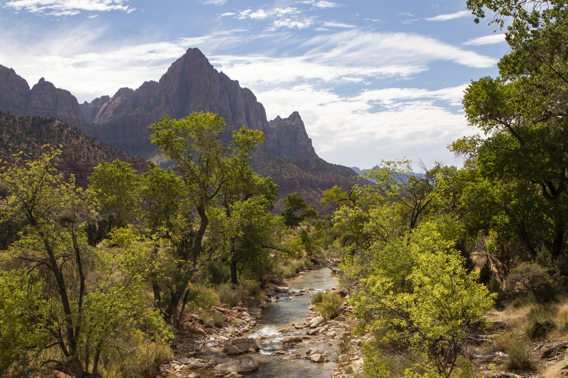
The hike offered many views of the Virgin River, which, during our visit, was contaminated by a toxic cyanobacteria bloom.
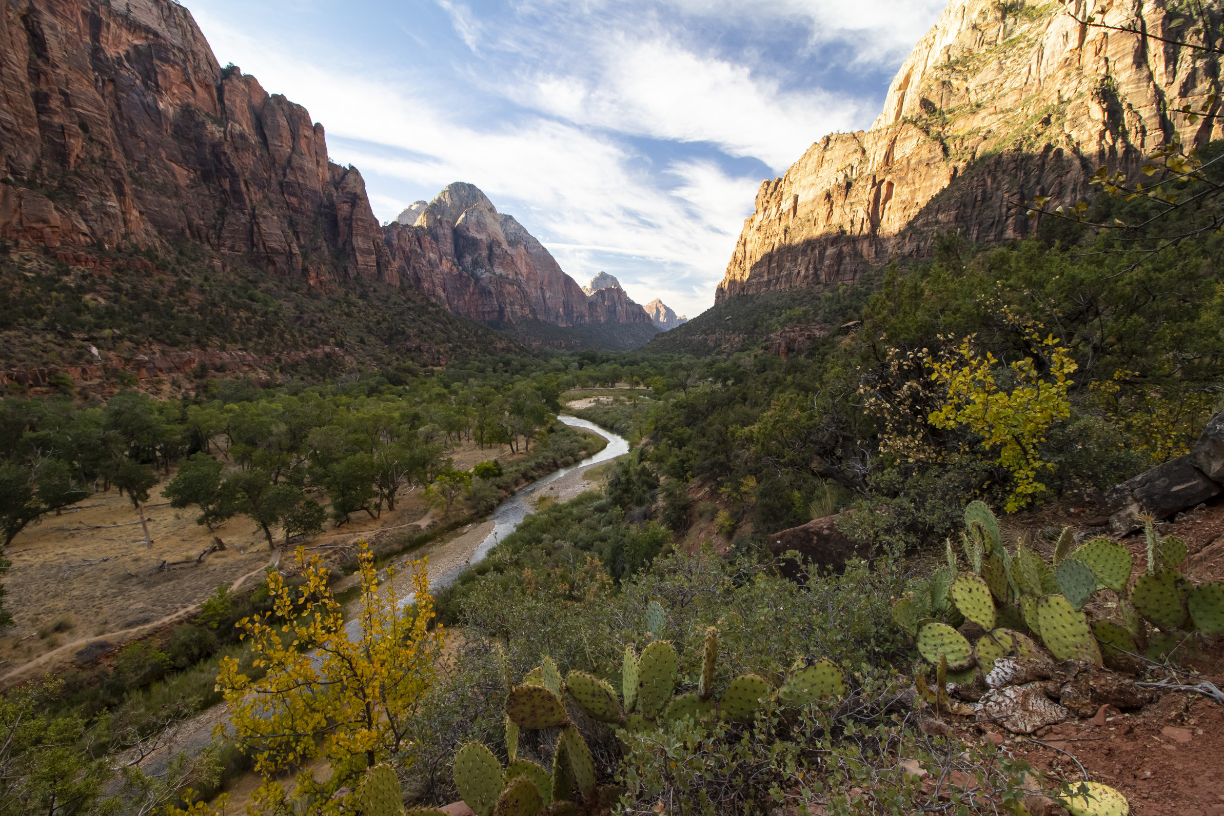
We then took the shuttle to the Temple of Sinawava, where we hiked the Narrows Trail up to the point where it crosses the Virgin River.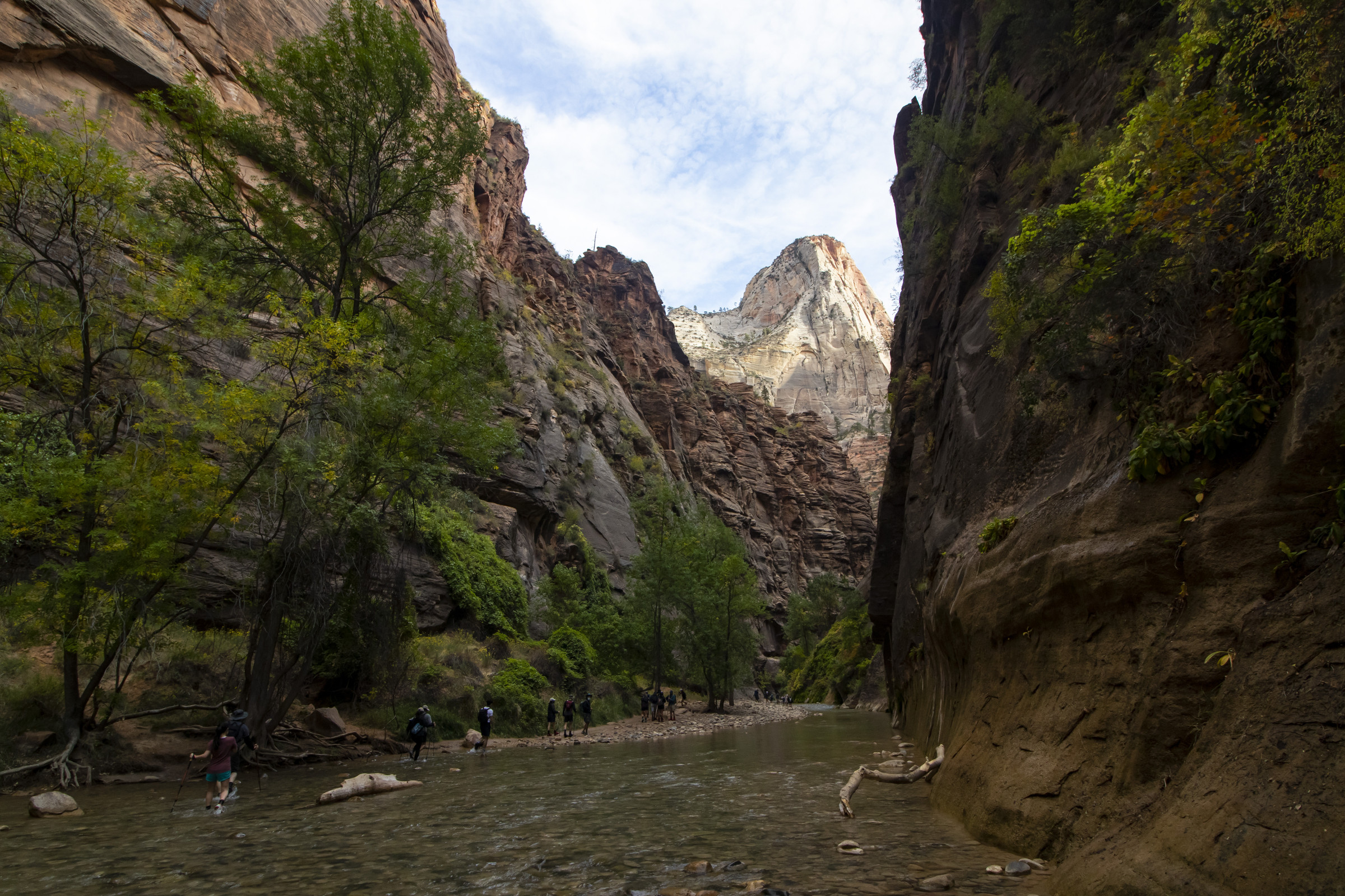
We shuttled back to Big Bend…
…then walked along the Pa’rus Trail.
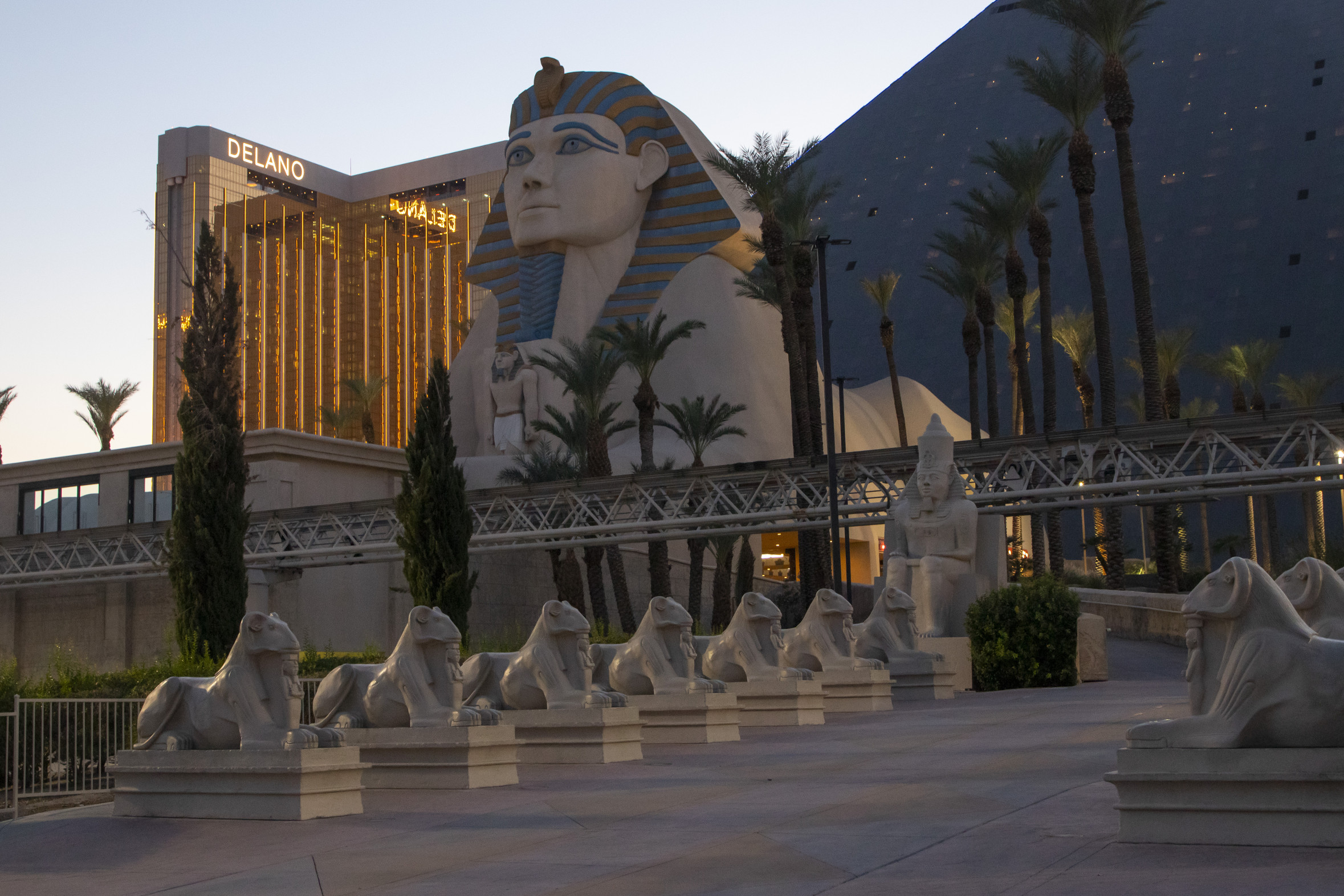
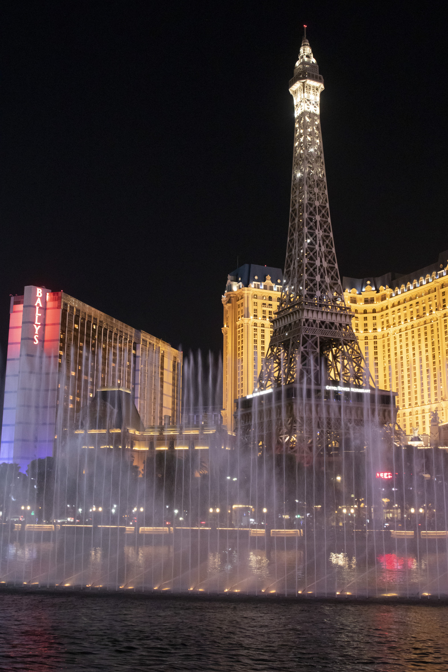
We aren’t gamblers, nor are we comfortable in large crowds, but we decided our trip would not be complete without one night on the Las Vegas Strip. We chose the Luxor due to my fascination with ancient Egypt. (I admit it was super cool to spend the night in a giant pyramid!)
We walked along the Strip and watched the water show at the Bellagio.
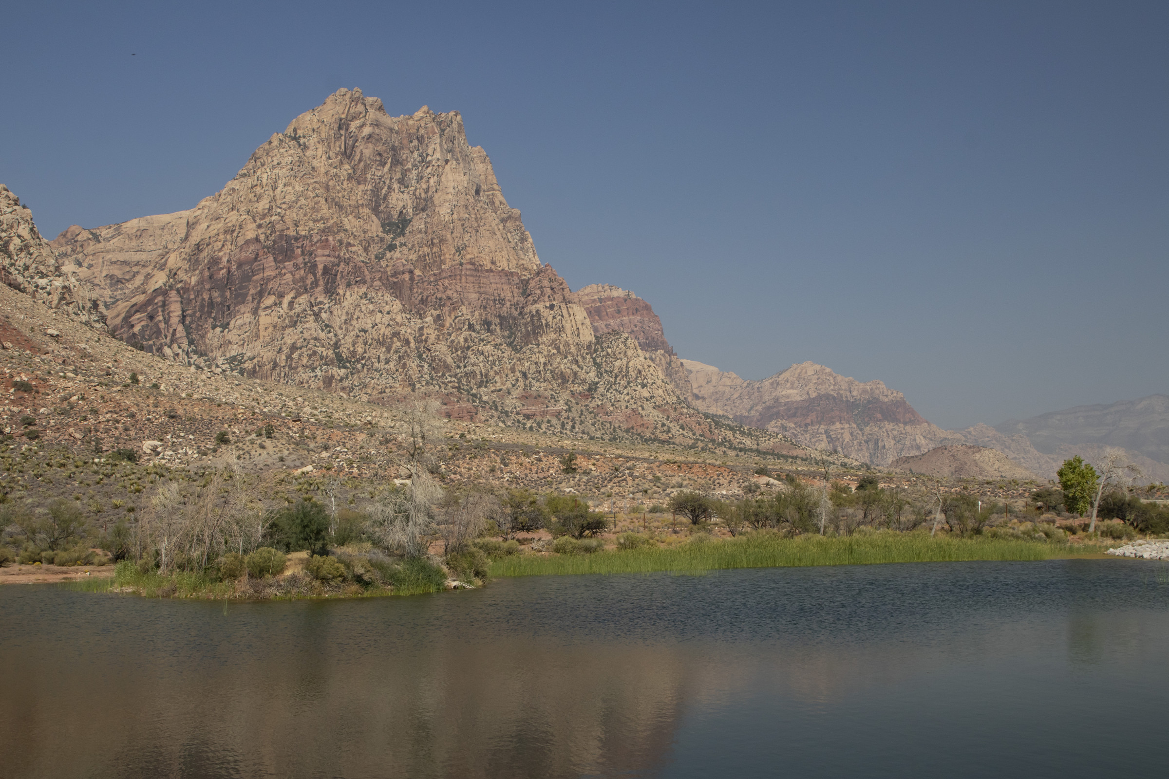
The next morning, we went to Spring Mountain Ranch State Park. It looked to be a bit different from what we’d been seeing for the past several days, and we were extremely pleased with our choice. We arrived just in time to take a ranger-led tour of the restricted parts of the park, including Lake Harriet, which is a sanctuary for endangered fish.
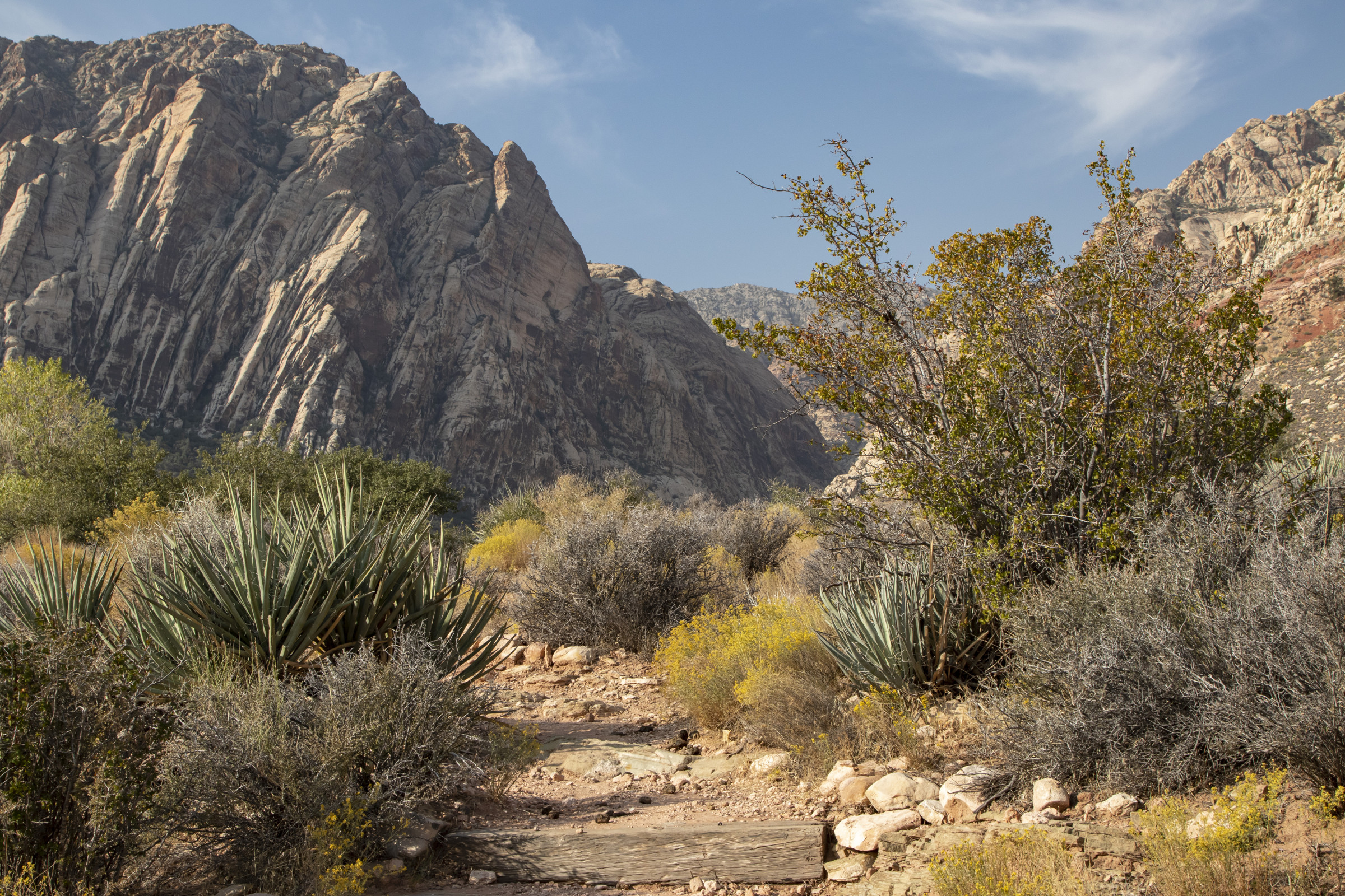
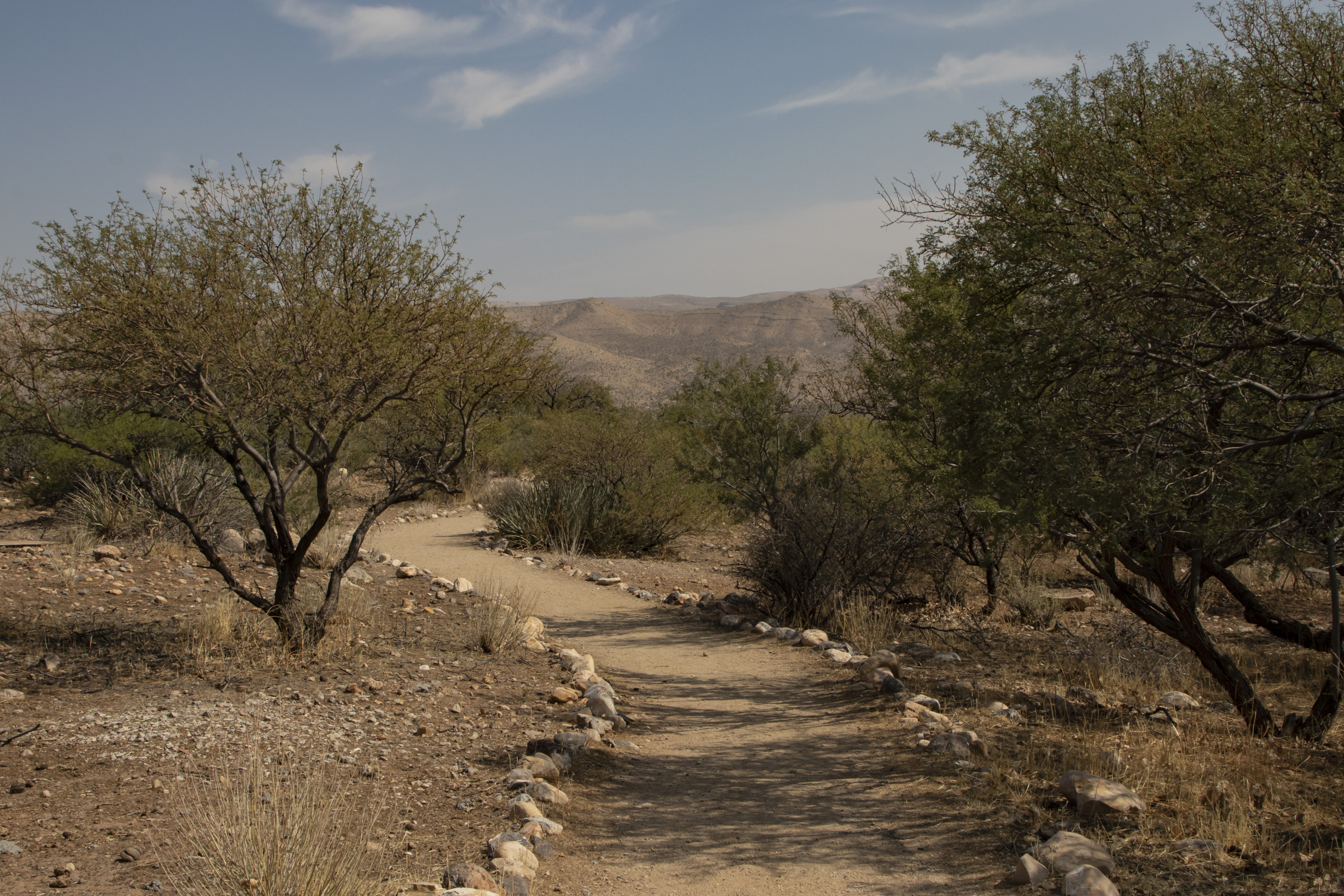
After the ranger tour, we walked along the Ash Grove Trail.
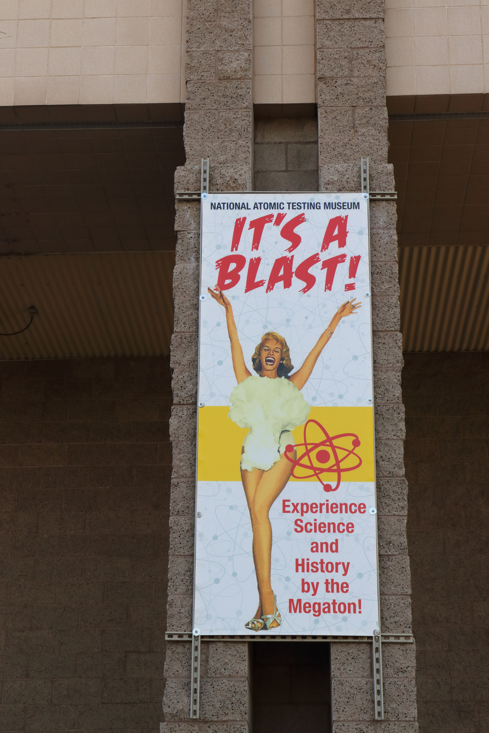
The temperatures that afternoon were in the 90s, so we headed indoors to the National Atomic Testing Museum.
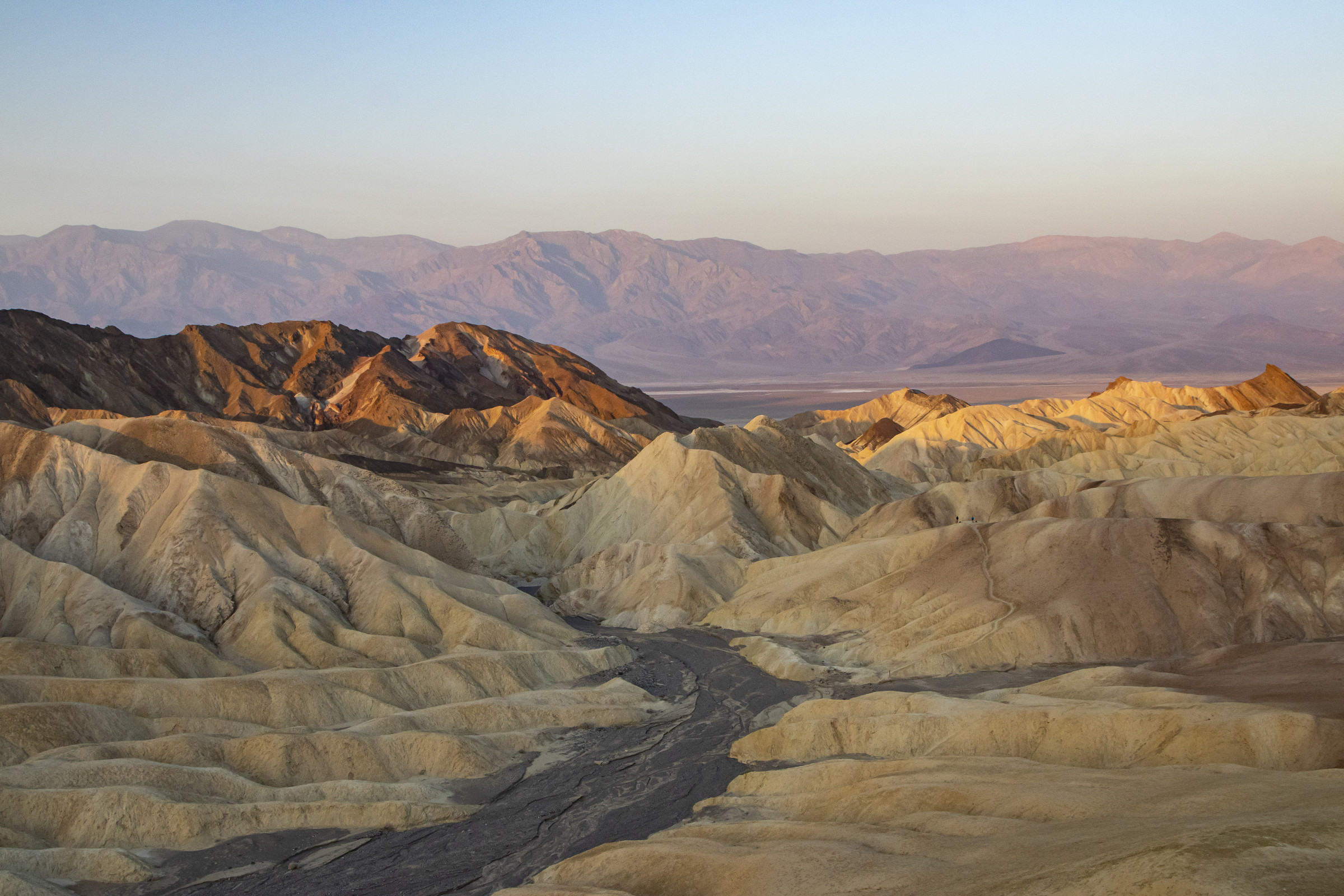
Day 9. Death Valley had never been on my “bucket list” until I saw a photo of Zabriskie Point on a Microsoft screen saver. Knowing it would be the hottest day of the trip, we arrived at Zabriskie Point well before dawn.
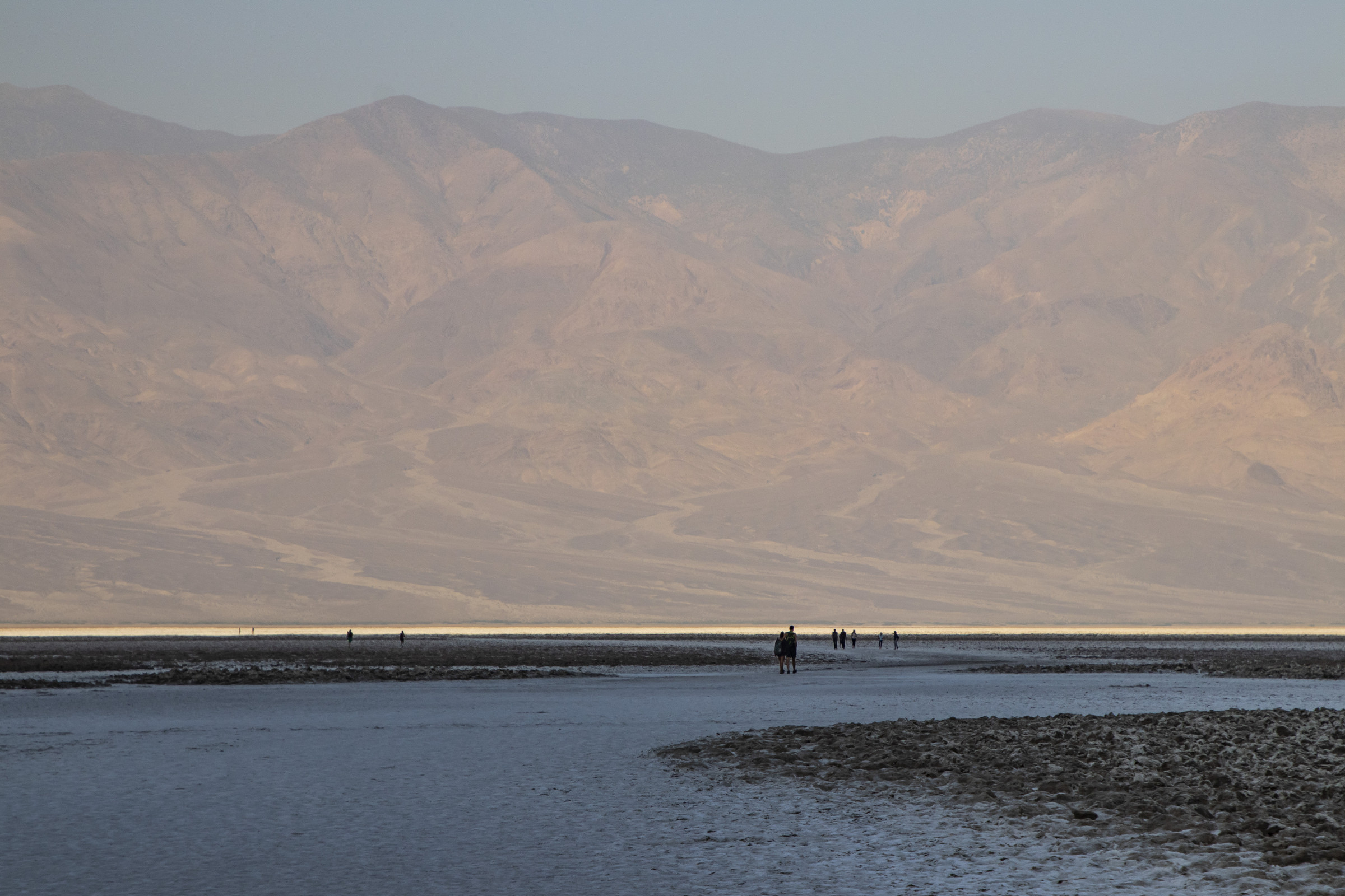
From there, we drove to Badwater Basin, the lowest point in North America, at 282 feet below sea level.
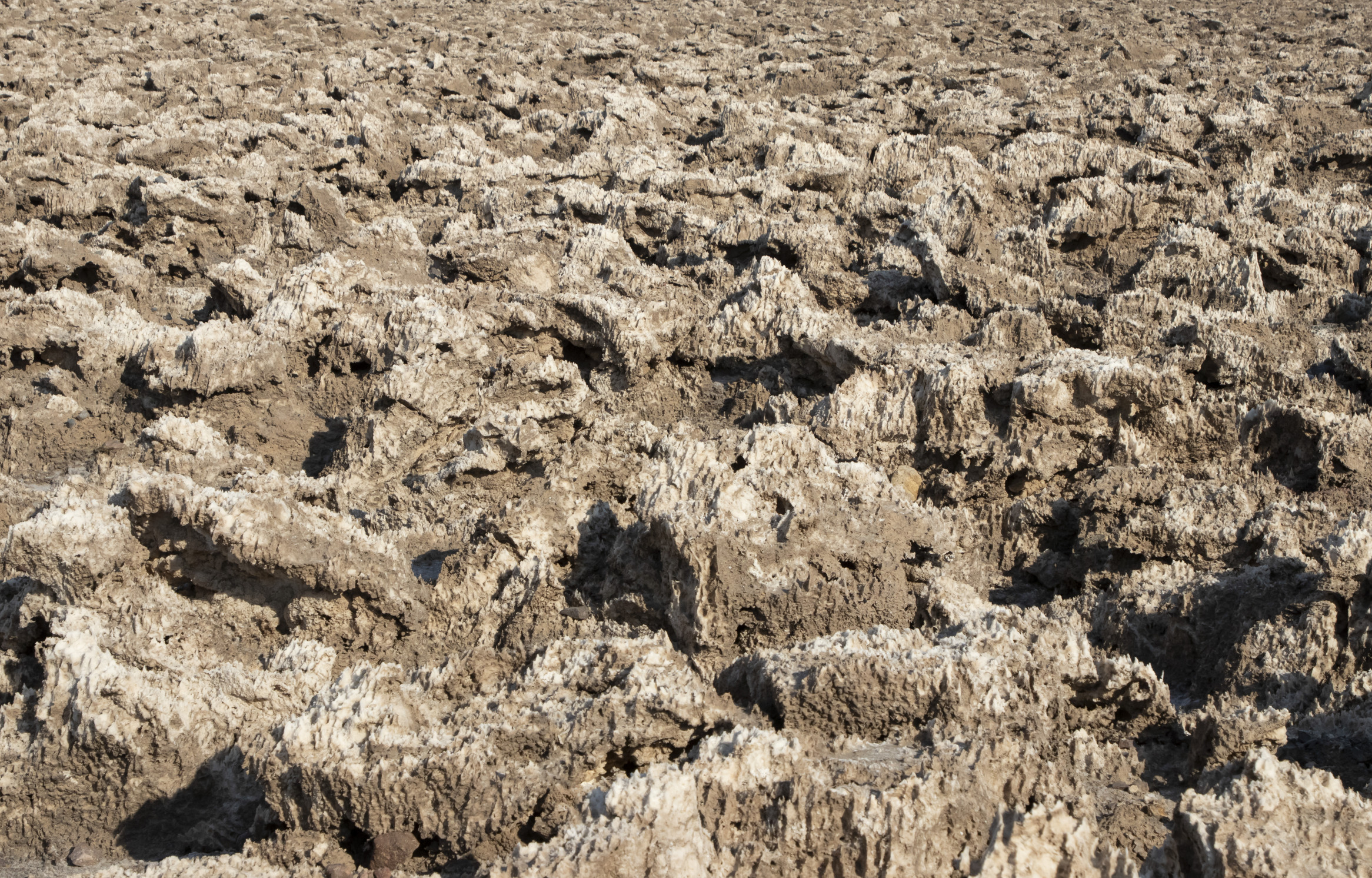
Like Badwater Basin, Devils Golf Course features unique salt formations.
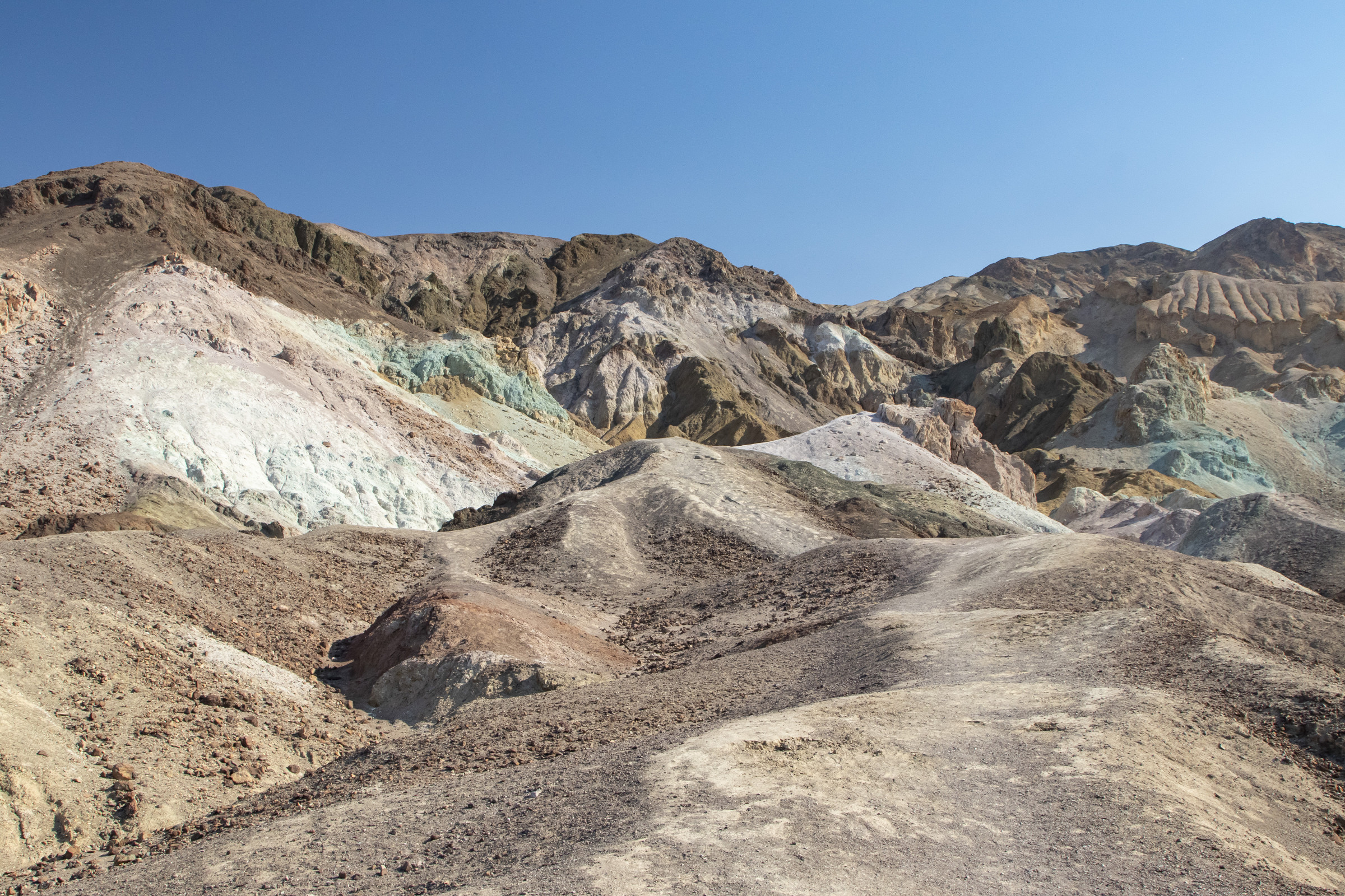
We drove along Artist’s Drive to Artist’s Palatte, a canyon of rock of various colors, a result of oxidation of different metals.
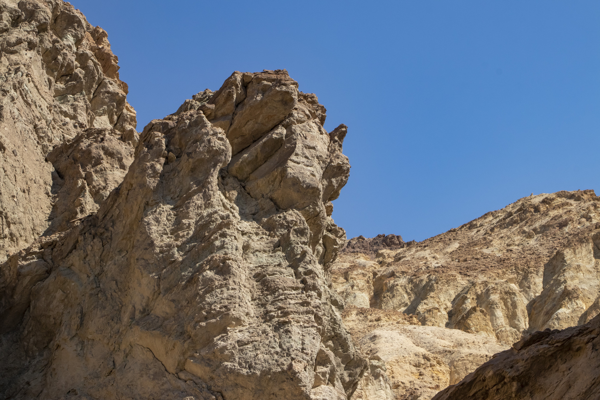
At Golden Canyon, we were greeted by a sign warning against hiking after 10am. It was around that time, so we walked only a short distance in the shade.
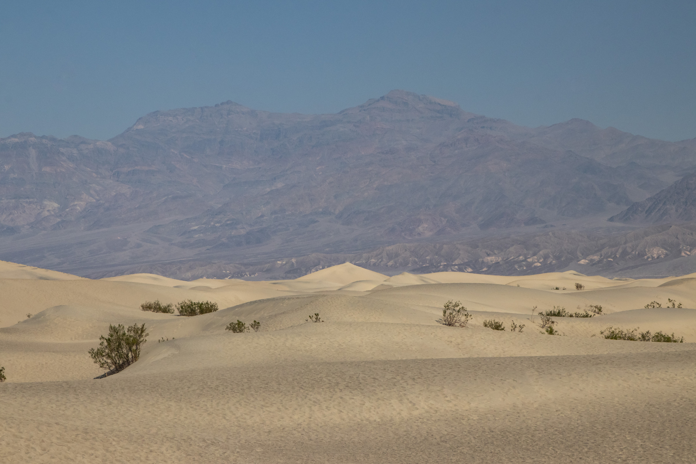
Finally, we stopped at Mesquite Flat Sand Dunes. It was simply too hot to spend much time there, so we headed back to Las Vegas.
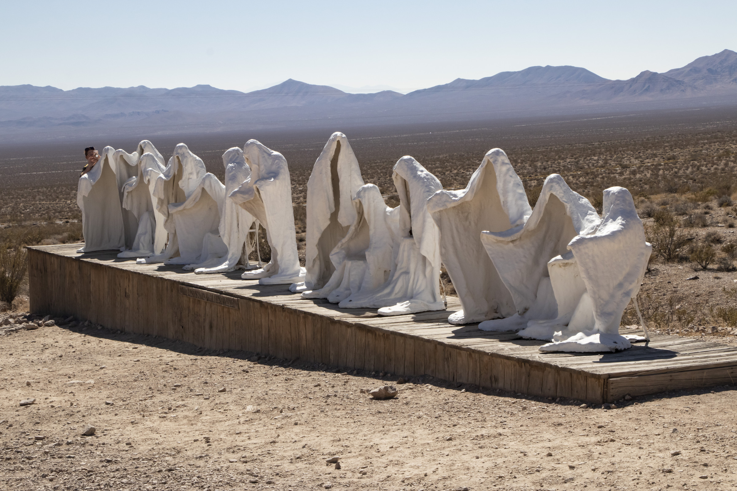
On our return trip, we stopped at Rhyolite, a ghost town in Nevada just outside of Death Valley. Founded after gold was discovered there in 1904, the town boomed then collapsed following the panic of 1907. It was abandoned less than 10 years later.
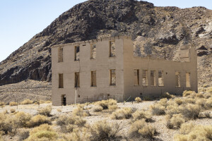
This ghost town actually has ghosts! In addition to the ruins of the town, there is also an open air art exhibit.
A sign at Spring Mountain Ranch warned of wild burros. We were disappointed, though not surprised, that we didn’t actually see a wild burro. But on our way back to our hotel, we spotted a lone wild burro then a pack of them along the side of the road.
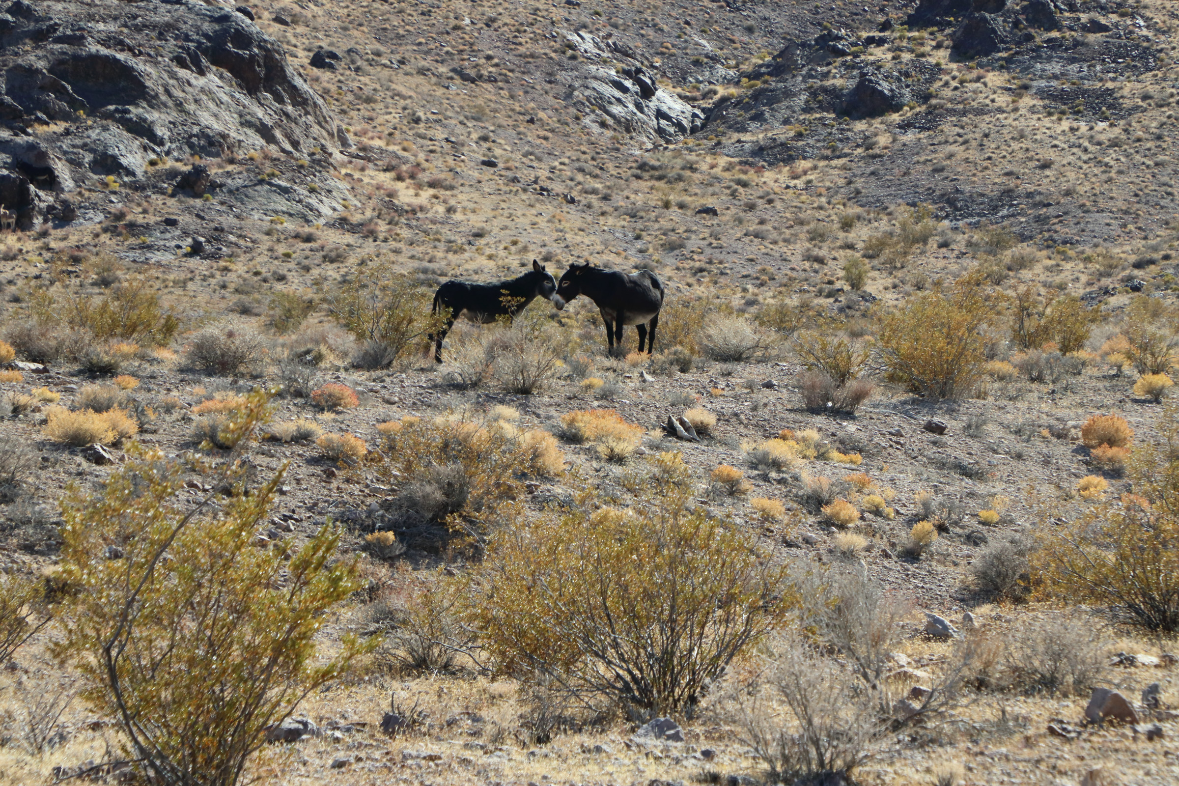
So in the end and in the very last hours of our trip, we saw the burros!
Photos and text (c) 2020 J. Atwater